- Niaqornat
-
Niaqornat Location within Greenland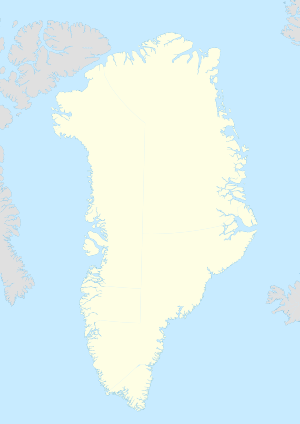
 Niaqornat
Coordinates: 70°47′20″N 53°39′50″W / 70.78889°N 53.66389°WCoordinates: 70°47′20″N 53°39′50″W / 70.78889°N 53.66389°W State  Kingdom of Denmark
Constituent country  Greenland
Municipality Qaasuitsup Government[1] - Mayor Karl Kristian Kruse Population (2010) - Total 58 Time zone UTC-03 Postal code 3961 Uummannaq Niaqornat is a settlement in the Qaasuitsup municipality in northwestern Greenland. Niaqornat means “the head-shaped” in Greenlandic. The settlement is located on the northern coast of the Nuussuaq Peninsula, with a wide view over Uummannaq Fjord.[2] It had 58 inhabitants in 2010.[3]
Contents
Economy
 Aerial view of the central expanse of Uummannaq Fjord, with Salleq Island, Appat Island, and Perlerfiup Nunaa in the background
Fishing
Fishing is the mainstay of the economy, with stocks of Atlantic cod, Greenland halibut and Greenland shark. A variety of mammal species are exploited: ringed seal, bearded seal, harp seal, hooded seal, and walrus. There is a seasonal catch of narwhal and beluga – on rare occasions pilot whales are caught. Capelin and fin whales have been observed at Niaqornat as late as in November in recent years. Like other settlements in northwestern Greenland, Niaqornat experiences the effects of global warming.
Hunting
During spring a few polar bears are shot. The catch includes reindeer/caribou, Arctic hare, ptarmigan and various sea birds. Niaqornat represents a traditional hunting culture where both dog sleds and small dinghies are used during the exploitation of the marine resources. The settlement is well situated for studies of narwhal, beluga, polar bear as well as other marine resources such as the ringed seal. Niaqornat is an example of a well functioning small settlement in which the inhabitants still live from exploitation of the local living resources and it represents a continuation in modern times of the Greenlandic hunting culture.
 Air Greenland Bell 212 helicopter shuttling passengers between Niaqornat and Uummannaq
Infrastructure
The settlement is able to communicate with the rest of the world via satellite and telephone and access to the internet. The settlement is in possession a 3 million liter water tank that supplies the settlement with fresh water from a lake in the mountain. There is also a community house where the inhabitants have access to a modern laundry and bath. The inhabitants have formed a local organisation that will work for attracting more tourists – especially from cruise ships. In 2007, the Greenland Institute of Natural Resources – which has its main office further south, in Nuuk, the capital of Greenland – established a field station in Niaqornat. In November 2007 there were 9 pupils in the local school.
Transport
Main article: Niaqornat HeliportAir Greenland serves the village as part of government contract, with mostly cargo helicopter flights from Niaqornat Heliport to the local hub in Uummannaq.[4] There are no direct flights to Qaarsut Airport located in Qaarsut, a village 37 km southwest of Niaqornat on the same shore of Nuussuaq Peninsula. All passengers must therefore transfer in Uummannaq Heliport.
Population
The population of Niaqornat has dropped by nearly a third relative to the 1990 levels, and by nearly a quarter relative to the 2000 levels, reflecting a general trend in the region.[5]
 Niaqornat population growth dynamics in the last two decades. Source: Statistics Greenland[5]
References
- ^ phototeam-nature.com
- ^ Nuussuaq, Saga Map, Tage Schjøtt, 1992
- ^ Statistics Greenland (Danish)
- ^ "Booking system". Air Greenland. http://book.airgreenland.com/. Retrieved 6 July 2010.
- ^ a b Statistics Greenland
External links
- arktiskebilleder.dk Historical images from Niaqornat.
Categories:- Populated places in Greenland
- Populated places of Arctic Greenland
- Uummannaq Fjord


Wikimedia Foundation. 2010.