- Qeqertarsuaq
Infobox Settlement
name =Qeqertarsuaq
official_name =
other_name =
native_name =
nickname =
settlement_type =
total_type =
motto =
imagesize =
image_caption =
flag_size =
image_
seal_size =
image_shield =
shield_size =
image_blank_emblem =
blank_emblem_type =
blank_emblem_size =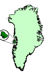
mapsize =
map_caption = Qeqertarsuatsiaq, Greenland
mapsize1 =
map_caption1 =
image_dot_
dot_mapsize =
dot_map_caption =
dot_x = |dot_y =
pushpin_
pushpin_label_position =
pushpin_map_caption =
pushpin_mapsize =
subdivision_type = Country
subdivision_name =Kingdom of Denmark
subdivision_type1 = Province
subdivision_name1 = Greenland
subdivision_type2 =
subdivision_name2 =
seat_type =
seat =
parts_type =
parts_style =
parts =
p1 =
p2 =
government_footnotes =
government_type =
leader_title =
leader_name =
leader_title1 =
leader_name1 =
established_title =
established_date =
area_magnitude =
unit_pref =
area_footnotes =
area_total_km2 =9700
area_land_km2 =
area_water_km2 =
area_total_sq_mi =
area_land_sq_mi =
area_water_sq_mi =
area_water_percent =
elevation_footnotes =
elevation_m =
elevation_ft =
elevation_max_m =
elevation_max_ft =
elevation_min_m =
elevation_min_ft =
population_as_of =
population_footnotes =
population_note =
population_total =
population_density_km2 =
population_density_sq_mi =
timezone =
utc_offset =
timezone_DST =
utc_offset_DST =
coor_type =
latd=69 |latm=14 |lats=37 |latNS=N
longd=53 |longm=33 |longs=11 |longEW=W
postal_code_type =
postal_code =
area_code =
website =
footnotes =Qeqertarsuaq ( _da. Godhavn) is a
port and a town on the south coast of Qeqertarsuaq (Disko) Island, an island on the west coast ofGreenland . Founded in 1773, it is home to a campus of theUniversity of Copenhagen . Qeqertarsuaq is Greenlandic for: 'Large Island.' It is also the name of several other islands on Greenland, for exampleQeqertarsuaq (Upernavik) inUpernavik municipality, orQeqertarsuaq (Herbert Island) inQaanaaq (Thule ) municipality.Geography
The
Municipality of Qeqertarsuaq is one of only two Greenlandic municipalities that do not occupy a portion of the main island of Greenland (the other one isAasiaat ). It consists of the island ofQeqertarsuatsiaq (Disko Island ) and its satellite islands (mainlyHareø convert|11|km|mi|0|abbr=on northwest ofQeqertarsuatsiaq , andQeqertaq on the southwest coast, at the mouth of Disko Fjord), with a total area of convert|9700|km2|sqmi|-1|abbr=on. As of January 1, 2005, the municipality had a population of 1,032. Of those, 978 lived in the town, and the remaining 54 in the village ofKangerluk (Diskofjord).Attractions
Many of the flat
basalt icmountain s found all over the island are covered with perpetual snow. The greatest area is called Sermersuaq (The Grand Glacier). Sermersuaq is situated rather far from thecoast which is why it is difficult to reach in summer. Lyngmarksbræen (The Lyngmark Glacier) is a lot smaller than Sermersuaq, but is close to town and can be reached on a few hours’ walk. The glacier covers almost 10 km.As something quite unique inGreenland , it is possible to ride adog sled at Qeqertarsuaq under the midnight sun in summer. It takes place on the inland ice at a height of around convert|700|m|ft|-1|abbr=on in the Lyngmarksfjeld behind the town. One can wander to the top of the Lyngmarksfjeld where efforts are rewarded by a fantastic view of Disco Bay and the gigantic icebergs at Ilulissat almost convert|100|km|mi|0|spell=us away.History
The town of Qeqertarsuaq was founded by whaler
Svend Sandgreen in 1773.Whaling has been of great importance to the town over the past two centuries. Hunting and fishing are still the primary occupations for the island's inhabitants. Around 1,000 of these inhabitants live in the main town and more than 50 in the Kangerluk settlement, a few hours by boat to the north-west. This is where researchers found a 'galloping' glacier in 1999 that moves up to convert|100|m|ft|-1|spell=us a day.Traces of settling between five to six thousand years ago have been found at Qeqertarsuaq. The settlers were
paleo-Eskimos wandering south.The first whalers came to Qeqertarsuaq during the 18th century; here they found a suitable anchoring place, which became the basis of the colony.
In 1773, the colony of Godhavn (the Good Port) was established, serving as the most northern point in the enforcement of the Danish rights to whaling in the region.
In 1862, a new law on municipalities was passed and the so-called Directions were introduced in Greenland. The primary task of the Direction was the administration of the means set apart for social purposes: support for widows, children unprovided for and others in need. The Direction also functioned as an inferior court in case of, for instance, theft. The Direction also took active part in the fight against the spreading of distemper, in the founding of a
kayak school for boys and a sewing school for girls.The Councils of Northern and Southern Greenland were summoned to a meeting in Godhavn on the 3rd of May, 1940. One of the consequences of the meeting is the fact that all the administration of Greenland, until then divided between Godhavn and Godthåb, now was concentrated in Godthåb so that the era of Godhavn being the governmental seat of Northern Greenland was over. The Chief Administrative Office was abolished in 1950 at the establishment of the
National Council of Greenland . This also was the beginning of the development of Qeqertarsuaq into a ’normal’ society based onhunting andfishing and into the modern town of today.Notable current/former residents
*
Rasmus Lerdorf , creator of the computer programming languagePHP , which is used byMediaWiki to generate the page you are reading now. [ [http://www.oracle.com/technology/pub/articles/php_experts/rasmus_php.html Do you PHP?] by Rasmus Lerdorf]ee also
"Qeqertarsuaq" may also refer to a tiny settlement in Qaanaaq municipality, see
Qeqertarsuaq (Qaanaaq) .References
External links
* [http://www.qeqertarsuaq.gl qeqertarsuaq.gl] Town home page
* [http://www.greenland.com/content/english/tourist/towns_regions/north_greenland/qeqertarsuaq/map_of_qeqertarsuaq greenland.com] Map of Qeqertarsuaq area

Wikimedia Foundation. 2010.