- Ittoqqortoormiit
Infobox Settlement
name = Ittoqqortoormiit
official_name =
other_name = Scoresbysund
native_name =
nickname =
settlement_type = Town
total_type =
motto =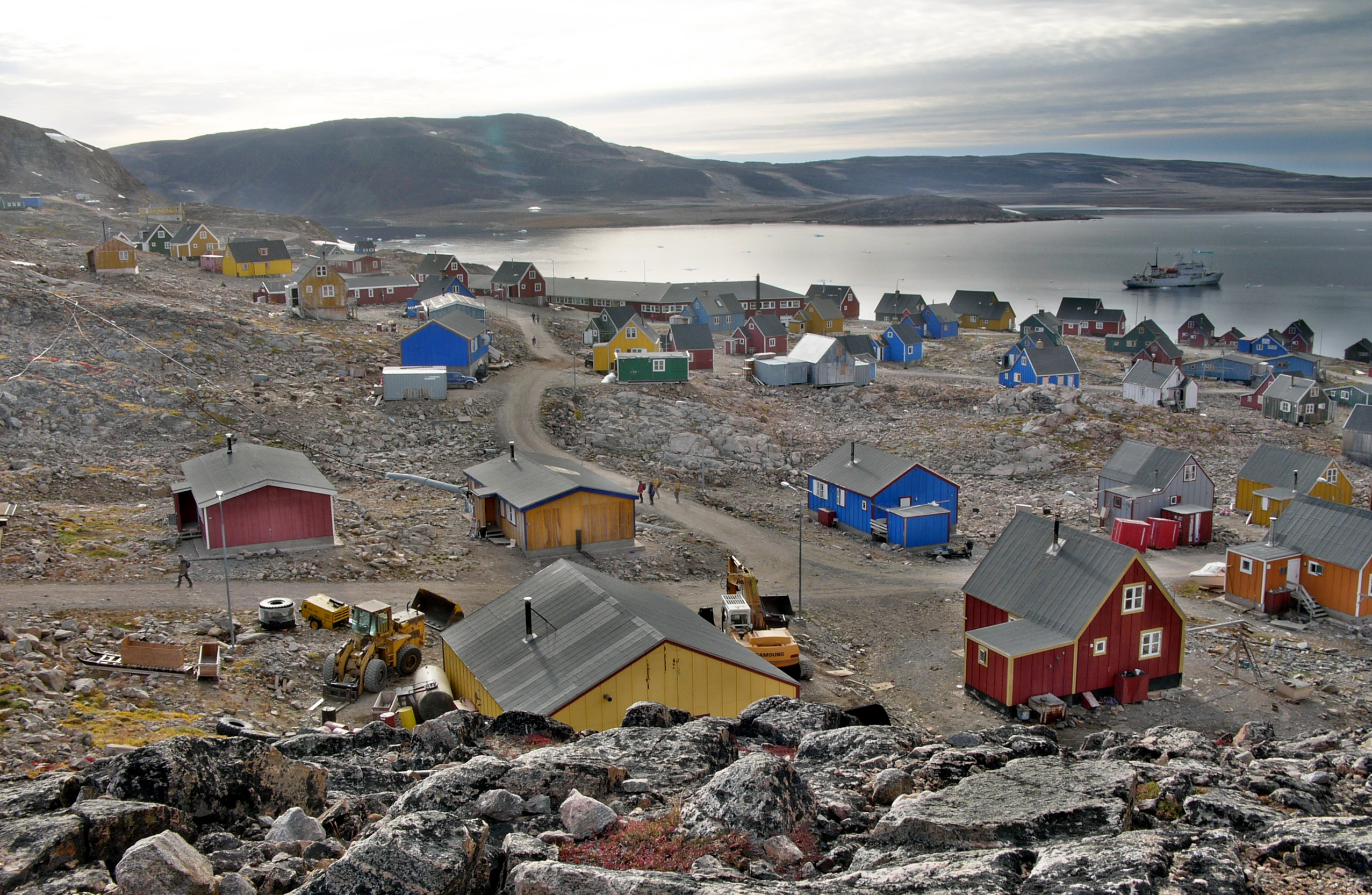
imagesize = 300px
image_caption =
flag_size =
image_
seal_size =
image_shield =
shield_size =
image_blank_emblem =
blank_emblem_type =
blank_emblem_size =
mapsize = 100px
map_caption = Location of the Ittoqqortoormiit municipality in Greenland
mapsize1 =
map_caption1 =
image_dot_
dot_mapsize =
dot_map_caption =
dot_x = |dot_y =
pushpin_
pushpin_label_position =
pushpin_map_caption =Location of Ittoqqortoormiit town within Greenland
pushpin_mapsize =300
subdivision_type = Country
subdivision_name =Kingdom of Denmark
subdivision_type1 = Province
subdivision_name1 =
subdivision_type2 = Municipality
subdivision_name2 =Ittoqqortoormiit
seat_type =
seat =
parts_type =
parts_style =
parts =
p1 =
p2 =
government_footnotes =
government_type =
leader_title =
leader_name =
leader_title1 =
leader_name1 =
established_title =
established_date =
area_magnitude =
unit_pref =
area_footnotes =
area_total_km2 = 235000
area_land_km2 =
area_water_km2 =
area_total_sq_mi =
area_land_sq_mi =
area_water_sq_mi =
area_water_percent =
elevation_footnotes =
elevation_m =
elevation_ft =
elevation_max_m =
elevation_max_ft =
elevation_min_m =
elevation_min_ft =
population_as_of = 2005
population_footnotes =
population_note =
population_total =537
population_density_km2 =
population_density_sq_mi =
timezone =
utc_offset =
timezone_DST =
utc_offset_DST =
coor_type =
latd=70|latm=29|lats= 8|latNS=N
longd=21|longm=58|longs=1 |longEW=W
postal_code_type =
postal_code =
area_code =
website =
footnotes =Ittoqqortoormiit (IPA2|itoqɔʁtɔʁmit, _da. Scoresbysund) is a town in East Greenland. The town is located at approximately coord|70|31|N|22|00|W near the mouth of "Kangertittivaq" ( _da.
Scoresby Sund ). It is one of the most remote of Greenland's towns, only reachable by plane toConstable Pynt airport (two weekly departures from Iceland), and then with helicopter or by boat a few months a year.Ittoqqortoormiit is also the administrative center of the Municipality of Ittoqqortoormiit which encompasses an area of 235,000 km² (91,000 sq mi) along the
Denmark Strait and theGreenland Sea . Before the creation of theNortheast Greenland National Park in 1974, the municipality was much bigger (935,000 km²), formally encompassing the largely uninhabited area to the north up to the border withAvannaa (North Greenland). From January 1, 2009, the municipality will be part of the new municipality ofSermersooq .Population is 537 (as of 2005). The place is known for its wildlife which includes
polar bear s, muskoxen, and seals. Besides the main town of Ittoqqortoormiit, only one more populated village remains within the municipality,Itterajivit , 14 km to the west across "Rosenvinge Bugt", with a population of only 9 (as of 2005).The Danish name Scoresbysund derives from the name of the Arctic explorer and whaler
William Scoresby , who was the first to map the area in 1822. The Greenlandic name "Ittoqqortoormiit" means "Big House".History
Ittoqqortoormiit was founded in 1925 by
Ejnar Mikkelsen and some 70Inuit settlers on the ship "Gustav Holm", 400 km south of the last Inuit settlement in Northeast Greenland (Eskimonæs at Dødemandsbugten on the south coast of Clavering Ø, 27 km southwest of laterDaneborg , 1823).The settlement was encouraged by the colonial power
Norway which at the time had a growing interest in Northeast Greenland. At the same time, thecolonization was intended to improve declining living conditions inTasiilaq , from where the settlers were more or less voluntarily transferred. The settlers soon prospered on the good hunting conditions of the new area, which was rich in seals,walrus es,narwhal s,polar bear s andarctic fox es.Before that, however, the area itself had been home to a dense population of
Inuit in the past, as testified by ruins and other archeological remains.Economy
Local hunters have for generations lived from whale and
polar bear hunting, and it remains up to the present a significant cultural-economical factor in the area. Flesh and byproducts play a direct part in the economy of the hunting families. Income is gained by trading these products, but these options are seasonal and variable. Ittoqqortoormiit lies near large populations ofshrimp andGreenland halibut , but the presence ofsea ice prevents exploiting these resources year-round, and as a result fishing has never been extensively developed in the municipality. Tourism, on the other hand, is growing in importance.References
* "Greenland and the Arctic". By Etain O'Carroll and Mark Elliott. Lonely Planet 2005. ISBN 1-74059-095-3.
* [http://www.statgreen.gl/dk/aarbog/Greenland%20in%20figures%202005.pdf "Greenland in Figures 2005"] Statistics Greenland. 3rd Edition, May 2005. ISSN 1604-7397
* Information pages on www.ittoqqortoormiit.gl http://www.ittoqqortoormiit.gl/uksider/english.htm]External links
* [http://www.ittoqqortoormiit.gl/ website of the municipality of Ittoqqortoormiit]

Wikimedia Foundation. 2010.