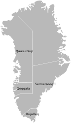
- Narsarmijit
-
Narsarmijit Location within Greenland Coordinates: 60°00′17″N 44°39′55″W / 60.00472°N 44.66528°WCoordinates: 60°00′17″N 44°39′55″W / 60.00472°N 44.66528°W State  Kingdom of Denmark
Constituent country  Greenland
Municipality Kujalleq Government[1] – Mayor Augo Simonsen Population (2010) – Total 97 Time zone UTC-03 Postal code 3922 Nanortalik Narsarmijit (sometimes spelled Narsamiit, also known as Narsaq Kujalleq, or in Danish: Frederiksdal) is a settlement in the Kujalleq municipality in southern Greenland. Its population is 97 as of 2010.[2] Presently the settlement is experiencing a loss of population, a slow but steady regression since the late 1950s.
Contents
Geography
Narsarmijit is the southernmost settlement in the country, located approximately 50 km north of Cape Farewell, the southern cape of Greenland.[3]
History
The present-day village was founded in 1824 by Moravian missionaries. The settlement was named Frederiksdal after Frederick VI of Denmark.
Until December 31, 2008, the settlement belonged to the Nanortalik municipality. Since January 1, 2009, the settlement has been part of the Kujalleq municipality, when the former municipalities of Qaqortoq, Narsaq, and Nanortalik ceased to exist as administrative entities.
Sheep farming
In 1906 pastor Jens Chemnitz founded the first modern day sheep farm in Narsarmijit. This marked the beginning of the present day sheep farming industry. There are still farms in the wider Narsarmijit area.
Transport
Main article: Narsarmijit HeliportThe village is served by the Narsarmijit Heliport. Air Greenland district helicopters link the settlement with Nanortalik, and further to Qaqortoq and Narsarsuaq.[4]
Population
Most towns and settlements in southern Greenland exhibit negative growth patterns over the last two decades, with many settlements rapidly depopulating. The population of Narsarmijit has decreased nearly a half relative to the 1990 levels, by nearly a quarter relative to the 2000 levels.[5]
 Narsarmijit population growth dynamics in the last two decades. Source: Statistics Greenland[5]
References
- ^ Kujalleq Municipality (Danish)
- ^ Statistics Greenland
- ^ "Greenland and the Arctic". By Etain O'Carroll and Mark Elliott. Lonely Planet 2005. ISBN 1-74059-095-3.
- ^ "Booking system". Air Greenland. http://book.airgreenland.com/. Retrieved 6 July 2010.
- ^ a b Statistics Greenland
Categories:- Populated places in Greenland
- History of the Greenland work of the Moravian Church
- Populated places established in 1824
Wikimedia Foundation. 2010.


