- Nicaragua Canal
-
- This article documents the historical inter-oceanic canal, not to be confused with the current Ecocanal project under construction. For the current dry-canal project, see Ecocanal.
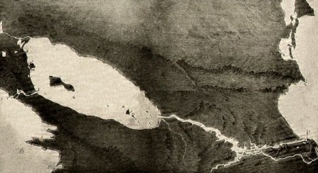
 Artist's conception of the proposed canal, 1899
The Inter-Oceanic Nicaragua Canal was a proposed waterway through Nicaragua to connect the Caribbean Sea and Atlantic Ocean with the Pacific Ocean. Such a canal would follow rivers up to Lake Nicaragua and then be constructed to cut through the isthmus of Rivas to reach the Pacific.
Such construction of a canal along the route using the San Juan River was proposed in the early colonial era. Louis Napoleon wrote an article about its feasibility in the early 19th century. Plans by the United States to build such a canal were abandoned in the early 20th century, after it purchased the French interests in the Panama Canal at a reasonable cost.
Speculation on a new canal continues, however; the steady increase in world shipping, together with the possibility of establishing shorter shipping routes, may make this an economically viable project. Alternatively, a railway, or a combined railway and oil pipeline, could be built to link ports on the Atlantic and Pacific coasts. Nicaragua has let contracts to Korean developers to construct a deepwater port and facilities at Monkey Point on the Atlantic coast to improve capacity there.
Contents
Route
Several possible routes have been proposed for a canal in Nicaragua, all making use of Lake Nicaragua, the second largest lake in Latin America. Three routes have been discussed to carry traffic from the Atlantic up to the lake, which is at an elevation of 32 m (105 ft) above sea level:
- from Bluefields, up the Rio Escondido and then an artificial canal to the lake
- from Punta Gorda, up the Rio Punta Gorda and then an artificial canal to the lake
- from San Juan de Nicaragua, up the San Juan River — with improvements and new locks — to the lake
An artificial canal would then be cut across the narrow isthmus of Rivas (its lowest point is 56 m (184 ft) above sea level) to reach the Pacific Ocean at San Juan del Sur.
History
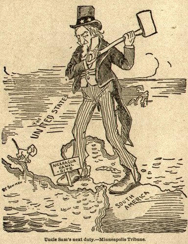
 1895 cartoon advocating U.S. action to build the Nicaragua Canal
The idea of building a canal through Central America is a very old one. The colonial administration of New Spain conducted preliminary surveys. The routes usually suggested ran across Nicaragua, Panama, or the Isthmus of Tehuantepec in Mexico.
In 1825 the newly established Federal Republic of Central America considered the canal. That year the Central American federal government hired surveyors to chart the route and contacted the government of the United States to seek financing and the engineering technology needed for building the canal, to the great advantage of both nations. A survey from the 1830s stated that the canal would be 278 km (172.7 mi) long and would generally follow the San Juan River from the Atlantic to Lake Nicaragua, then go through a series of locks and tunnels from the lake to the Pacific.
While officials in Washington, D.C. thought the project had merit, and Secretary of State Henry Clay formally presented it to the Congress of the United States in 1826, the plan was not approved. The US was worried about the poverty and political instability of Nicaragua, as well as the rival strategic and economic interests of the British government, which controlled both British Honduras (later Belize) and the Mosquito Coast.
On August 26, 1849, the Nicaraguan government signed a contract with the U.S. businessman Cornelius Vanderbilt. It granted his Accessory Transit Company the exclusive right to build a canal within 12 years and gave the same company sole administration of a temporary trade route in which the overland crossing through the Rivas isthmus was done by train and stagecoach. The temporary route operated successfully, quickly becoming one of the main avenues of trade between New York City and San Francisco. Civil war in Nicaragua and an invasion by filibuster William Walker intervened to prevent the canal from being completed.
Continued interest in the route was an important factor in the negotiation of the Clayton-Bulwer Treaty of 1850. The canal idea was discussed seriously by businessmen and governments throughout the 19th century.[1] In 1897, the United States' Nicaraguan Canal Commission proposed this idea, as did the subsequent Isthmian Canal Commission in 1899. However, the commission also recommended that the French work on the Panama Canal should be taken over if it could be purchased for no more than $40,000,000. Since the French effort was in disarray, the U.S. was able to make the purchase at its price.
In the late 19th century, the United States government negotiated with President José Santos Zelaya to lease the land to build a canal through Nicaragua. Luis Felipe Corea, the Nicaraguan minister in Washington, wrote to US Secretary of State John Hay expressing the Zelaya government's support for such a canal. The US signed the Sánchez-Merry Treaty with Nicaragua in case the negotiations for a canal through Colombia fell through, although the treaty was later rejected by John Hay. Before Corea completed a draft of the Nicaragua proposal, Congress was considering the Spooner Act, to authorize the Panama Canal. In addition to the promise of earlier completion of the Panama canal, opponents of the Nicaraguan canal criticized the risk of Momotombo for volcanic activity. They favored construction of a canal through the isthmus of Panama.[2]
According to Stephen Kinzer's 2006 book Overthrow, in 1898 the chief of the French Canal Syndicate (a group that owned large swathes of land across Panama), Philippe Bunau Varilla, hired William Nelson Cromwell to lobby the U.S. Congress for the Panama Canal. In 1902, taking advantage of a year with increased volcanic activity in the Caribbean, Cromwell planted a story in the New York Sun reporting that the Momotombo volcano had erupted and caused a series of seismic shocks. This caused concern about its possible effects on a Nicaraguan canal. Cromwell arranged for leaflets with the stamps featuring the Momotombo volcano to be sent to every Senator, as "proof" of the volcanic activity in Nicaragua. An eruption in Saint-Pierre, Martinique, which killed 30,000 people, persuaded most of the U.S. Congress to vote in favour of Panama, leaving only eight votes in favour of Nicaragua. The decision to build the Panama Canal passed by four votes. William Nelson Cromwell was paid $800,000 for his lobbying efforts.[3]
At the start of the 20th century, Nicaraguan president José Santos Zelaya tried to arrange for Germany and Japan to finance the canal. Having settled on the Panama route, the US opposed this proposal.
After the Panama Canal
 The relative locations of the Nicaragua and Panama Canals
Since the Panama Canal opened in 1914, the Nicaragua route has been reconsidered. Its construction would shorten the water distance between New York and San Francisco by nearly 800 kilometers (500 mi). Under the Bryan-Chamorro Treaty of 1916, the United States paid Nicaragua US$3 million for an option in perpetuity and free of taxation, including 99-year leases of the Corn Islands and a site for a naval base on the Gulf of Fonseca. From 1930 to 1931 a US Army Corp of Engineers survey team of 300 men, surveyed the route of any future canal, called the Forty-Niners route because it followed closely the route that miners took in the 1840s California Gold Rush.[4] But Costa Rica protested that Costa Rican rights to the San Juan River had been infringed, and El Salvador maintained that the proposed naval base would affect both it and Honduras. Both protests were upheld by the Central American Court of Justice in rulings that were not recognized by either Nicaragua or the U.S. Both nations repealed the Bryan-Chamorro Treaty on 14 July 1970.
Present day
In 2004, the Nicaraguan government again proposed a canal through the country—large enough to handle post-Panamax ships of up to 250,000 tons, as compared to the approximately 65,000 tons that the Panama Canal can accommodate. The estimated cost of this scheme may be as much as US$25 billion, 25 times Nicaragua's annual budget. Former President Enrique Bolaños has sought foreign investors to support the project. The scheme has met with strong opposition from environmentalists, who protest the damage that would be done to the rivers and jungle.
In addition to the governmental waterway canal proposal, private proposals have been based on a land bridge across Nicaragua. The Intermodal System for Global Transport (SIT Global), involving Nicaraguan and Canadian investors, proposes a combined railway, oil pipeline, and fibre optic cable; a competing group, the Inter-Ocean Canal of Nicaragua, proposes building a railway linking two ports on either coast. It is possible that these schemes could exist in parallel to the proposed canal.[5]
On October 2, 2006, President Enrique Bolaños, at a summit for Defense ministers of the Western Hemisphere, officially announced that Nicaragua intended to proceed with the project.[6][7] Bolaños said that there was sufficient demand for two canals within the Central American isthmus. Bolaños proclaimed that the project would cost an estimated US$18 billion and would take approximately 12 years to construct. It could take one of six possible routes at approximately 280 km, reduce the transit time from New York to California by one day and a total of 800 km, would considerably reduce transit costs from Europe to China and Japan, and have capacity for ships of up to 250,000 tons.
The construction of the canal would more than double Nicaragua's GDP based on the canal alone (exclusive of other investments which were estimated in Nicaragua as a result of the canal's construction). Some sources suggest that construction of the canal would enable Nicaragua to become one of the wealthiest countries in Central America, and one of the wealthiest countries in Latin America in per capita terms.[8] The government let a request for proposals on such development. Supporters believe that all Central America would benefit from the construction of the canal. If a Nicaraguan canal were built, "it would bring an economic effervescence never seen before in Central America," Bolaños said.[9]
In 2009, Russian President Dimitry Medvedev suggested that Russia would be interested in pursuing the construction of the inter-oceanic waterway canal. However, no progress has been made as the ecocanal project has advanced.[10][11] Khalifa bin Zayed bin Sultan Al Nahyan of the United Arab Emirates has also expressed interest in sponsoring an inter-oceanic canal project.[12]
References
- ^ Colquhoun, Archibald Ross (1895). The key of the Pacific: the Nicaragua canal. Westminster, England: Archibald Constable and Company. http://www.archive.org/stream/keypacificnicar02colqgoog#page/n6/mode/2up.
- ^ "CAMPAIGN IN AMERICA AGAINST THE NICARAGUA CANAL...". Brigham Young University. pp. CHAPTER VII. http://net.lib.byu.edu/~rdh7/wwi/comment/Panama/Panama02.htm.
- ^ Kinzer, Stephen, Overthrow, Henry Holt and Company (2006), p. 58-59, ISBN 0-8050-8240-9
- ^ "On The Trail Of The Forty-Niners", January 1932, Popular Mechanics map of surveyed route bottom of page 55
- ^ NICARAGUA: Plan for Inter-Ocean Canal Reborn, Inter Press Service, Retrieved March 7, 2006.
- ^ "Rival to Panama Canal Planned". The L.A. Times. http://www.latimes.com/business/la-fi-canal30sep30,1,7948157.story?coll=la-headlines-business. Retrieved 2006-10-04.[dead link]
- ^ Vidal, John (2006-10-05). "$20bn and 10 years to build – a giant rival for Panama canal: Nicaragua plans vast channel for largest ships; Opponents cite green issues and lack of demand". London: The Guardian. http://www.guardian.co.uk/international/story/0,,1886781,00.html. Retrieved 2006-10-04.
- ^ "Nicaragua Hopes to Rival Panama Canal", Mindfully Website
- ^ Rival to Panama Canal Planned. Articles.latimes.com (2006-09-30). Retrieved on 2011-11-13.
- ^ "Russia Reconsiders Plans for Nicaraguan Channel". Centralamericadata.com (2010-01-18). Retrieved on 2011-11-13.
- ^ "Russia May Build Long-Planned Nicaragua Canal". Novinite.com (2008-12-18). Retrieved on 2011-11-13.
- ^ "Emirates Interested in Interoceanic Nicaragua Canal". Centralamericadata.com (2009-10-06). Retrieved on 2011-11-13.
See also
References
- Mellander, Gustavo A.(1971) The United States in Panamanian Politics: The Intriguing Formative Years, Daville,Ill.: Interstate Publishers. OCLC 138568.
- Mellander, Gustavo A.; Nelly Maldonado Mellander (1999). Charles Edward Magoon: The Panama Years, Río Piedras, Puerto Rico: Editorial Plaza Mayor. ISBN 1-56328-155-4. OCLC 42970390.
External links
Coordinates: 12°01′00″N 86°27′00″W / 12.01667°N 86.45000°W
Categories:- Proposed canals
- Canals in Nicaragua
- Banana Wars
- Transport in Nicaragua

Wikimedia Foundation. 2010.