- Cwmfelinfach
-
Cwmfelinfach OS grid reference ST185916 Principal area Caerphilly Ceremonial county Gwent Country Wales Sovereign state United Kingdom Post town NEWPORT Postcode district NP11 Dialling code 01495 Police Gwent Fire South Wales Ambulance Welsh EU Parliament Wales UK Parliament Islwyn List of places: UK • Wales • Caerphilly Cwmfelinfach is a small village located in the Sirhowy valley of south-east Wales. It is part of the district of Caerphilly within the historic boundaries of Monmouthshire. Located north of Wattsville and about 5 miles north of the nearest town Risca and south of Blackwood.
Cwmfelinfach was home to a coal mining community during the early to mid 20th century. The colliery, known as "Nine Mile Point", opened about 1905 and closed in 1964. Nine Mile Point Colliery was the site of the first ever 'sit in' of miners. During 1935 there was a "stay down strike" involving 164 colliers. They were protesting over the use of "Scab" miners (men not members of the Federation unlike the rest of the "Points" workforce) and their ordeal only ended after the company promised no non-federation men would be employed at the colliery, the stay-down strike lasted for 177 hours. Miners from other collieries in the area, some taking similar action, supported their action.
Cwmfelinfach can be translated from the Welsh language as "valley of the little mill". The village was a small hamlet (place) until the late 19th century — therefore the majority of housing is traditional terraced from early 20th century. A map of 1885 showns the Melin (mill) and the Welsh Calvinistic Methodist chapel Babel Chapel. [1] The grave of Islwyn the 19th century Welsh-language poet can be found here. [2]
To the east the valley is bordered by the hills of Pen-y-Trwyn (1,028 ft / 313 m). To the west is Mynydd y Grug (1,132 ft / 345 m).
Coordinates: 51°37′02″N 3°10′43″W / 51.61730°N 3.17854°W
External links
- Monumental Inscriptions for Y Babel
- www.geograph.co.uk : photos of Cwmfelinfach and surrounding area
- Welsh Coal Mines website - check out the histories of the local pits
Notes
Caerphilly County Borough Caerphilly County Borough Council Principal settlements Aberbargoed · Abercarn · Bargoed · Bedwas · Blackwood · Caerphilly · Crumlin · Gelligaer · Newbridge · Rhymney · Risca · Senghenydd · Ystrad Mynach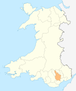
Towns and villages Abertridwr, Caerphilly · Abertysswg · Argoed · Blaen-carno · Bont Pren · Britannia · Brithdir · Bryn · Bryncenydd · Bute Town · Caledfryn · Castle Park · Cefn Fforest · Cefn Hengoed · Cefn Mably · Chapel of Ease · Churchill Park · Croespenmaen · Crosskeys · Cwmbargoed · Cwmcarn · Cwmgelli · Cwmfelinfach · Cwmsyfiog · Cwmnantygwynt · Darran Valley · Deri · Draethen · Eglwysilan · Elliotstown · Energleyn · Fernlea · Fleur de Lys · Fochriw · Gellihaf · Gelligroes · Gilfach · Gilfach Estate · Glan-y-nant · Graig-y-Rhacca · Groesfaen · Hafodyrynys · Hendredenny · Hengoed · Hollybush · Lansbury Park · Llanbradach · Llanfabon · Llanfach · Llechryd · Llwyn Gwyn · Machen · Maesycwmmer · Manmoel · Markham · Mornington Meadows · Mynyddislwyn · Nelson · New Tredegar · Oakdale · Ochrwyth · Pantside · Pantyresk · Penallta · Pengam · Penllwyn · Penmaen · Penpedairheol · Pentwyn (near Fochriw) · Pentwyn (near Penyrheol) · Pentwyn (near Trinant) · Pentwynmawr · Penybryn · Penyfan · Penyrheol · Phillipstown · Pontllanfraith · Pontlottyn · Pontymister · Pontywaun · Princetown · Pwllypant · Rhymney Bridge · Rudry · Ruperra · Springfield · Tirphil · Tir-y-berth · Trecenydd · Tredomen · Treowen · Trethomas · Trinant · Troedrhiwfwch · Ty Sign · Van · Waterloo · Watford · Wattsville · West End · Wernddu · Woodfieldside · Wyllie · YnysdduCategories:- Villages in Caerphilly county borough
- Gwent geography stubs

Wikimedia Foundation. 2010.