- Mornington Meadows
-
Mornington Meadows (Welsh: Dolydd Trefore) is a residential area of the town of Caerphilly, south Wales. The name comes from the pastoral land and hay meadows which once covered this area. It borders Lansbury Park to the north and pastoral land to the South. It is within the community council of Van, Caerphilly and the electoral ward of St. James. The estate was constructed in the 1970s. All residential roads within the estate are linked into a circular internal ring road - Pen Y Cae. The estate only has one exit road for vehicles but a considerable number for pedestrians. Despite Mornington Meadows having an english name all of the roads in the estate have Welsh names.
Coordinates: 51°35′04″N 3°12′12″W / 51.58444°N 3.20333°W
Caerphilly County Borough Principal settlements Aberbargoed · Abercarn · Bargoed · Bedwas · Blackwood · Caerphilly · Crumlin · Gelligaer · Newbridge · Rhymney · Risca · Senghenydd · Ystrad Mynach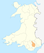
Towns and villages Abertridwr, Caerphilly · Abertysswg · Argoed · Blaen-carno · Bont Pren · Britannia · Brithdir · Bryn · Bryncenydd · Bute Town · Caledfryn · Castle Park · Cefn Fforest · Cefn Hengoed · Cefn Mably · Chapel of Ease · Churchill Park · Croespenmaen · Crosskeys · Cwmbargoed · Cwmcarn · Cwmgelli · Cwmfelinfach · Cwmsyfiog · Cwmnantygwynt · Darran Valley · Deri · Draethen · Eglwysilan · Elliotstown · Energleyn · Fernlea · Fleur de Lys · Fochriw · Gellihaf · Gelligroes · Gilfach · Gilfach Estate · Glan-y-nant · Graig-y-Rhacca · Groesfaen · Hafodyrynys · Hendredenny · Hengoed · Hollybush · Lansbury Park · Llanbradach · Llanfabon · Llanfach · Llechryd · Llwyn Gwyn · Machen · Maesycwmmer · Manmoel · Markham · Mornington Meadows · Mynyddislwyn · Nelson · New Tredegar · Oakdale · Ochrwyth · Pantside · Pantyresk · Penallta · Pengam · Penllwyn · Penmaen · Penpedairheol · Pentwyn (near Fochriw) · Pentwyn (near Penyrheol) · Pentwyn (near Trinant) · Pentwynmawr · Penybryn · Penyfan · Penyrheol · Phillipstown · Pontllanfraith · Pontlottyn · Pontymister · Pontywaun · Princetown · Pwllypant · Rhymney Bridge · Rudry · Ruperra · Springfield · Tirphil · Tir-y-berth · Trecenydd · Tredomen · Treowen · Trethomas · Trinant · Troedrhiwfwch · Ty Sign · Van · Waterloo · Watford · Wattsville · West End · Wernddu · Woodfieldside · Wyllie · YnysdduCategories:- Caerphilly
- Gwent geography stubs

Wikimedia Foundation. 2010.