- Oil City Pennsylvania Railroad Bridge
-
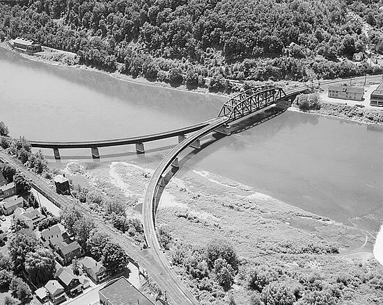
Oil City Pennsylvania Railroad Bridge 
Carries Western New York and Pennsylvania Railroad Crosses Allegheny River Locale Cranberry Township and Oil City, Pennsylvania Design Truss bridge Opened 1902 The Oil City Pennsylvania Railroad Bridge is a truss bridge that carries the Western New York and Pennsylvania Railroad across the Allegheny River between Cranberry Township and Oil City, Pennsylvania. The bridge was originally built to serve the Pennsylvania Railroad as part of its Buffalo Line. WNY&P is the fourth owner of the structure. After the breakup of the Pennsy, Conrail took ownership of the line. The breakup of these company saw Norfolk Southern assigned the rights; the WNY&P took ownership in 2006 as they extended their trackage from Meadville, Pennsylvania to Oil City. Because the bridge once served as a major junction point for several Pennsylvania Railroad lines, it features a unique approach structure.
See also
References
Bridges of the Allegheny River Upstream
Hunter Station Bridge
 US 62
US 62Oil City Pennsylvania Railroad Bridge Downstream
Veterans Memorial BridgeCategories:- Railroad bridges in Pennsylvania
- Bridges over the Allegheny River
- Bridges completed in 1902
- United States railway bridge stubs
- Pennsylvania building and structure stubs
Wikimedia Foundation. 2010.