- North Carolina Highway 181
-
NC 181
Route information Maintained by NCDOT Length: 36.2 mi[1] (58.3 km) Existed: 1928 – present Major junctions South end: 

 US 64 / US 70 / NC 18 in Morganton
 NC 183 near Jonas Ridge
 US 221 in Pineola
North end:  NC 194 in Newland
Location Counties: Burke, Avery Highway system ←  NC 180
NC 182  →
→North Carolina Highway 181 is a primary state highway in the U.S. state of North Carolina. It runs north–south from Morganton to Newland.
Contents
Route description
The route serves as the main road from Morganton to Northern Burke County then on towards Newland in Avery County. The first 12 miles of the road appears as a regular back road highway, going by homes and shrubbery farms. At Brown Mountain Beach Road, the sharp bend of the highway starts the climb up through the Pisgah National Forest to Jonas Ridge. This section of the highway (13 miles) features multiple curves (some tight with speed warnings), multiple passing lanes (five up, two down, one turnoff down), and mostly undeveloped wooded lands. Before Jonas Ridge is the Brown Mountain Overlook, where stories of phantom lights on the mountain can be seen from the location. After Jonas Ridge, the highway goes parallel with the Blue Ridge Park for a mile before passing over it. In Pineola, the highway overlaps with US 221 for almost three miles before splitting in Linville. The last section of the highway goes by several hills and mountains covered by Frasier furs before entering the Newland city limits and ending at Pineola Street.
One unique feature of the highway is the use of mile markers, which only appear between before Brown Mountain Beach Road and Jonas Ridge (mile markers 12-25). An oddity for a two-lane surface road in the state; however, the reason why they exist is simply to assist police and rescue crews to better locate accidents or lost hikers along the winding section of the highway.
Majority of the route shares with either NC Bike Route 2 (Mountains to Sea) or NC Bike Route 6 (Piedmont Spur). Because it mostly overlaps with a state bike route, the road has wider paved shoulders compared to other roads in the area. Because of these extra features, it is not uncommon to find several bikes and motorcycles riding along the highway on any given nice day.
Scenic byway
Pisgah Loop Scenic Byway is a 47-mile (76 km) loop byway, not recommended for recreational vehicles and bus, as well as four-wheel drive required for unpaved portions. NC 181 makes up the eastern section of the byway (17.5 miles (28.2 km)), it is noted for its history as the same route the Kirk's Raiders used to make a successful attack on Confederate Army Camp Vance, outside Morganton, during the Civil War. It is also noted for scenic views of the surrounding mountains and access to various trails along the route. Other roads and highways that make-up the loop are: NC 183, Old NC Highway 105 (S.R. 1238, the entire road is unpaved), NC 126, and Fish Hatchery Road (S.R. 1254 & 1240).[2]
Junction list
County Location Mile[1] Destinations Notes Burke Morganton 0 

US 64 Bus. west / US 70 Bus. / NC 18 southNC 181 begins at the intersection of Meeting and Green Streets
West end of US 64 Business overlap, south end of NC 18 overlap0.2
US 64 Bus. east / NC 18 north (Avery Avenue)East end of US 64 Business overlap, north end of NC 18 overlap 1.1 US 64 (US 64 Bypass) – Lenoir1.7  NC 126 west – Lake James
9 Fish Hatchery Road begin of Pisgah Loop Scenic Byway overlap 12.4 Brown Mountain Beach Road East end of NC Bike 2, west end of NC Bike 6, enter Pisgah National Forest
Intersection marks the start of a 13 mile ascent26.5 NC 183 west – Linville Falls, Linville GorgeWest end of NC Bike 2, end of Pisgah Loop Scenic Byway overlap Avery Pineola 28.2 Blue Ridge Parkway 30 US 221 south (Linville Falls Highway) – Crossnore, MarionSouth end of US 221 overlap Linville 32.8  US 221 north to NC 105 (Newland Highway) – Banner Elk, Boone, Linville
North end of US 221 overlap
Also goes to Blowing Rock, Grandfather Mountain, and area ski resortsNewland 36.2 NC 194 (Pineola Street) – Elk Park, CrossnoreNC 181 ends 1.000 mi = 1.609 km; 1.000 km = 0.621 mi
Concurrency terminus • Closed/Former • Incomplete access • UnopenedHistory
Established in 1928, NC 181 begins as a new primary routing between Morganton and Pineola, then west to NC 194 near Crossnore. A year later, it was extended southwest to end at NC 19 (now Old US 221 Road). In 1930, NC 181 was rerouted north of Pineola to its current northern terminus in Newland; this decommissioned NC 175 and NC 176 and re-branded the old route briefly as NC 691 and later US 221. In 1934, NC 181 was extended further southwest to US 176 in Tryon. In 1940, NC 181 southern terminus moved back to Morganton, it's southwesterly route replaced by US 64 Alternate (later US 64 and US 64 Business) and NC 108. Sometime between 1969 and 1982, NC 181 was split onto one-way streets in downtown Morganton (Green and Sterling streets); its current southern terminus ends at the begin of NC 181 on Meeting street.[3]
In 1989 and 1990, NC 181 was rerouted to bypass the communities of Montezuma (to the north), and a year later at Linville (to the west).[3]
Alternate names
The highway is known as both NC 181 and Beatrice Cobb Highway; but it also has lesser known names that it uses along the route.
- Meeting Street - road name, location of begin and end of NC 181 in Morganton.
- Green Street - road name, used only in Morganton city limits.
- Sterling Street - road name, used as south-bound route through downtown Morganton.
- Linville Falls Highway - road name, used when overlap with U.S. Route 221.
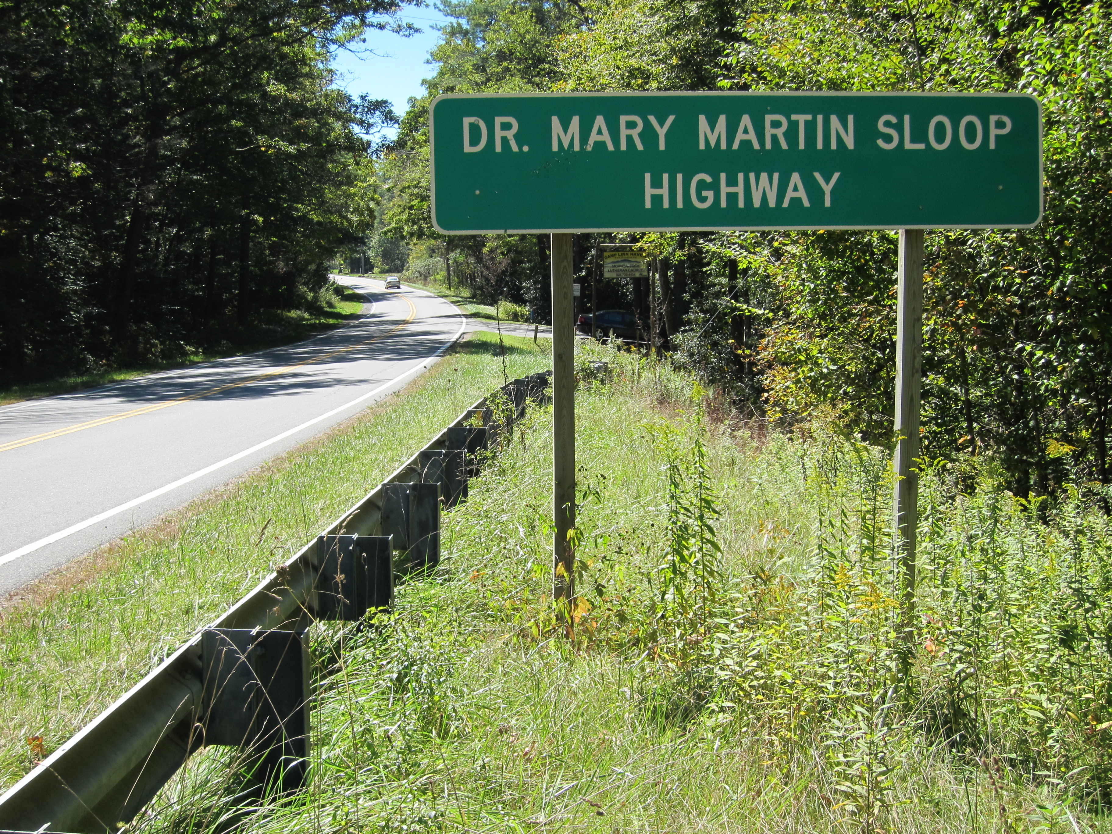
- Dr. Mary Martin Sloop Highway - official name of highway, between Pineola and Linville.
- Linville Bypass - name of road that goes around Linville.
- Newland Highway - road name, between Linville and Newland.
- S B Lacey Jr Highway - official North Carolina name of NC 181, between Linville and Newland.[4]
- Linville Avenue - road name, used only in Newland city limits.
Beatrice Cobb Highway
Beatrice Cobb (1888-1951) started her career early as a teacher and writer. In 1916, she became editor and publisher of the Morganton Herald; in 1922 she was chosen secretary of the North Carolina Press Association by her peers. Eventually her journalism clout in the state became also political clout; she was a Democratic National Committeewoman and an adviser on allocations to federal agencies in the state during the New Deal era. She has received numerous awards during her career and an honorary doctorate from the University of North Carolina.[5] The highway, between Morganton and Pineola, is officially named in her honor.[4]
Photo gallery
-
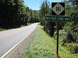
Beatrice Cobb Highway sign, near Jonas Ridge (2010-10-02).
-
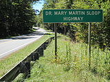
Dr. Mary Martin Sloop Highway sign, located south of Linville (2010-10-02).
-

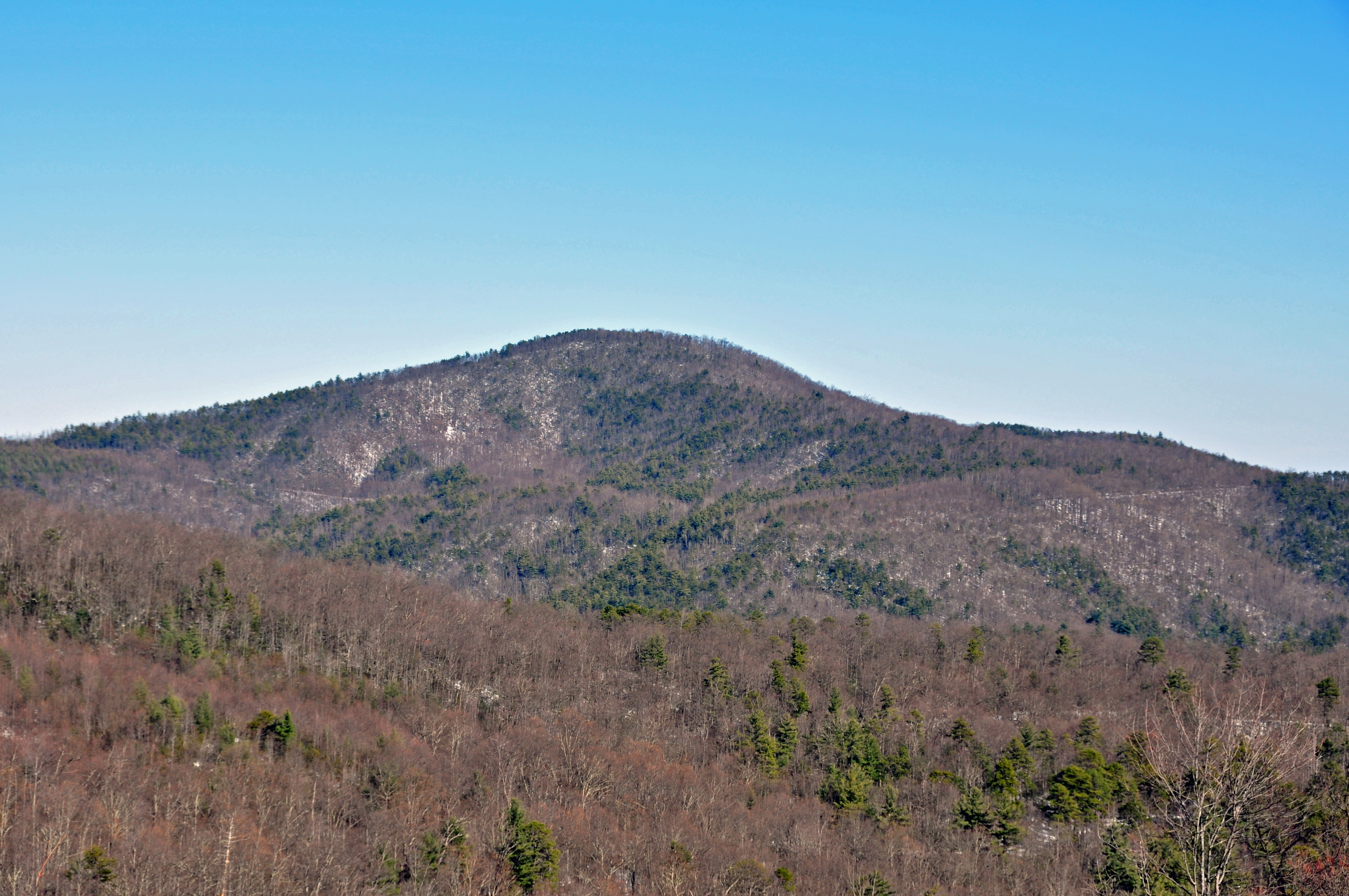
Chestnut Mountain, from the Brown Mountain Overlook (2009-12-27).
-
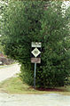
Original Beatrice Cobb Highway sign, in Pineola (2001-03-18).
See also
- Blue Ridge Parkway
- Brown Mountain
- Chestnut Mountain
- Linville Falls
- Linville Gorge Wilderness
- Linville River
- Grandfather Mountain
- North Carolina Bicycle Route 2
- North Carolina Bicycle Route 6
References
- ^ a b Google, Inc. Google Maps – NC 181 (Map). Google, Inc. http://maps.google.com/maps?f=d&source=s_d&saddr=S+Green+St%2FKnightdale+Bypass+E&daddr=36.06784,-81.88463+to:Pineola+St&hl=en&geocode=FZZuIQId2pAh-w%3BFQBaJgIdKooe-yk7Oxi_o5RQiDGsgIeFtafLYg%3BFbKdJgIdqN8d-w&mra=dpe&mrcr=0&mrsp=1&sz=13&via=1&sll=36.064642,-81.840591&sspn=0.103656,0.222988&ie=UTF8&ll=35.926869,-81.756134&spn=0.415347,0.891953&z=11. Retrieved 2011-02-01.
- ^ "NCDOT: Scenic Byways". http://www.ncdot.org/travel/scenic/. Retrieved 2011-01-06.
- ^ a b NCRoads - NC 181
- ^ a b "North Carolina Memorial Highways and other Named Facilities". http://www.ncdot.org/doh/preconstruct/traffic/TEPPL/Topics/N-01/Sorted%20by%20County.pdf. Retrieved 2011-03-06.
- ^ "Beatrice Cobb". http://www.ncpress.com/ncpf/ncnie/About_Newspapers/NC_Newspaper_History/RoyParker%206.pdf. Retrieved 2010-10-01.
External links
Categories:- State highways in North Carolina
- Transportation in Burke County, North Carolina
- Transportation in Avery County, North Carolina


Wikimedia Foundation. 2010.