- North Carolina Highway 183
-
NC 183
Route information Maintained by NCDOT Length: 4.5 mi[1] (7.2 km) Existed: ca. 1930 – present Major junctions West end:  US 221 in Linville Falls
East end:  NC 181 near Jonas Ridge
Location Counties: Burke, McDowell Highway system ←  NC 182
NC 184  →
→North Carolina Highway 183 is a primary state highway in the U.S. state of North Carolina. It runs from US 221, in the community of Linville Falls, to NC 181, near the community of Jonas Ridge.
Contents
Route description
The route serves mainly as a connector between Linville Falls and the rest of Burke County; it also serves as an alternate route to the Blue Ridge Parkway, which parallels the route. The route also has access to the Linville Falls and Gorge Wilderness Area. Part of the route is shared with NC Bike Route 2.
NC 183, though begins and ends in Burke county, crosses through McDowell county twice in two short successions in Linville Falls. Nearly halfway along the highway, a spur road from the Blue Ridge Parkway does a fly-over above the highway (no access).
NC 183, with continuation via NC 181, can be considered an alternate route of U.S. Route 221, by-passing Crossnore.
Scenic byway
Pisgah Loop Scenic Byway is a 47-mile (76 km) loop byway, not recommended for recreational vehicles and bus with four-wheel drive required for unpaved portions. NC 183 makes up the northern section of the byway (3.8 miles (6.1 km)), it is noted for its close proximity to the Blue Ridge Parkway, the Linville River, and a rare montane (mountain wetland). Other roads and highways that make-up the loop are: Old NC Highway 105 (S.R. 1238, the entire road is unpaved), NC 126, Fish Hatchery Road (S.R. 1254 & 1240), and NC 181.[2]
Junction list
County Location Mile[1] Destinations Notes Burke Linville Falls 0 US 221 (Linville Falls Highway) – Linville, Blowing Rock, Boone, MarionNC 183 begins 0.7 Old NC 105 Road – Linville Gorge Unpaved road, begin of Pisgah Loop Scenic Byway overlap 3.6 Parkway Road West end of NC Bike 2 overlap; unsigned access to the Blue Ridge Parkway 4.5 NC 181 (Beatrice Cobb Highway) – Pineola, Linville, Newland, MorgantonEast end of NC Bike 2 overlap, end of Pisgah Loop Scenic Byway overlap; NC 183 ends History
NC 183 was established in 1930 as a new primary route connecting NC 105 (today Old NC Highway 105) to NC 181. In 1954, after NC 105 was decommissioned, NC 183 was extended over part of the old highway, allowing it to reach U.S. Route 221. The highway has not changed since.[3][4]
Photo gallery
-
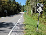
First NC 183 West sign, near Jonas Ridge (2010-10-02).
See also
- Blue Ridge Parkway
- Linville Falls
- Linville Gorge Wilderness
- Linville River
- North Carolina Bicycle Route 2
References
- ^ a b Google, Inc. Google Maps – NC 183 (Map). Cartography by Google, Inc. http://maps.google.com/maps?f=d&source=s_d&saddr=N+Carolina+183+S&daddr=N+Carolina+183+S&hl=en&geocode=FQmwJAIdC6gd-w%3BFRISJQIdOF4e-w&mra=me&mrcr=0&mrsp=1,0&sz=18&sll=35.983602,-81.895212&sspn=0.003243,0.006968&ie=UTF8&ll=35.966753,-81.913376&spn=0.051892,0.111494&z=14. Retrieved 2011-02-01.
- ^ "NCDOT: Scenic Byways". http://www.ncdot.org/travel/scenic/. Retrieved 2011-01-06.
- ^ "NCRoads.com: N.C. 183". http://members.cox.net/ncroads/nc183.html. Retrieved 2011-01-06.
- ^ "NC State Hwy 183 Ends". http://www.state-ends.com/ncends/state/183.html. Retrieved 2011-01-06.
Categories:- State highways in North Carolina
- Transportation in Burke County, North Carolina
- Transportation in McDowell County, North Carolina
-


Wikimedia Foundation. 2010.