- North Carolina Highway 184
-
NC 184
Route information Maintained by NCDOT Length: 8 mi[1] (13 km) Existed: ca. 1956 – present Major junctions South end:  NC 105 near Sugar Mountain
 NC 194 in Banner Elk
North end: Beech Mountain Location Counties: Avery, Watauga Highway system ←  NC 183
NC 186  →
→NC 184 is a primary state highway in the U.S. state of North Carolina. It runs from NC 105 at Tynecastle (near the village of Sugar Mountain) to the town of Beech Mountain.
Contents
Route description
The route serves mainly as a spur from NC 105 to Banner Elk (Tynecastle Highway/Shawneehaw Avenue). In the mid-1980s, it was extended as the main route to Beech Mountain from Banner Elk (Beech Mountain Parkway). The route also connects two ski resorts, Ski Beech and Ski Sugar, and crosses the Eastern Continental Divide (unmarked). After Banner Elk, the highway continues another 5 miles up and over Beech Mountain, ending just past the entrance to Ski Beech on the left and the Holland Realty sign on the right.
The final part of the highway from the stoplight in Banner Elk to the Town Hall on Beech Mountain served as a major finish in the Tour DuPont Bike Race during the 1990's. Lance Armstrong also made his return to biking after cancer on 184 up Beech Mountain.
Junction list
County Location Mile[2] Destinations Notes Avery Sugar Mountain 0 NC 105 – Boone, LinvilleNC 184 begins Banner Elk 3.8 NC 194 north (Main Street) – Valle CrucisEnd north NC 194 overlap 4 NC 194 south (Main Street) – Elk ParkEnd south NC 194 overlap
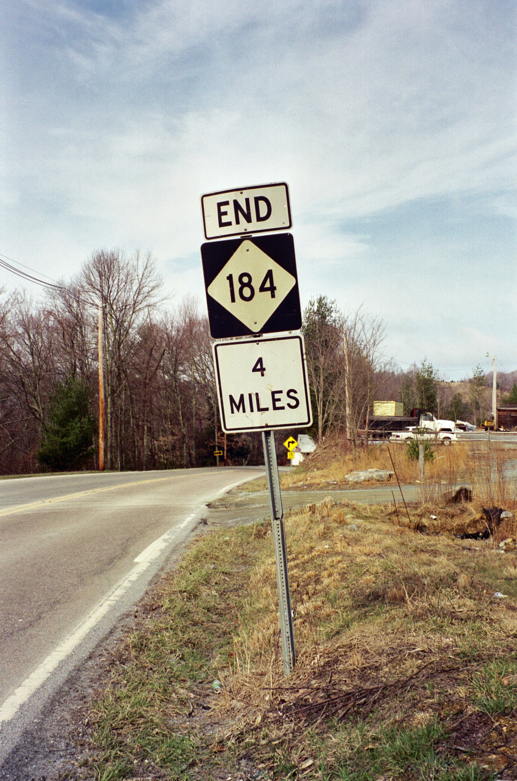
After split, sign declaring NC 184 ends in 4 milesHistory
- 1937 - NC 184 first appeared on state highway maps as a spur from NC 18 to Boiling Springs.[1]
- 1940 - NC 184 is decommissioned, replaced by NC 150.[1]
- 1956 - NC 184 reappears as a new connector between NC 105 to NC 194 in Banner Elk.[1]
- Mid-1980's - Highway was extended to Beech Mountain.[1]
Photo gallery
-
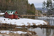
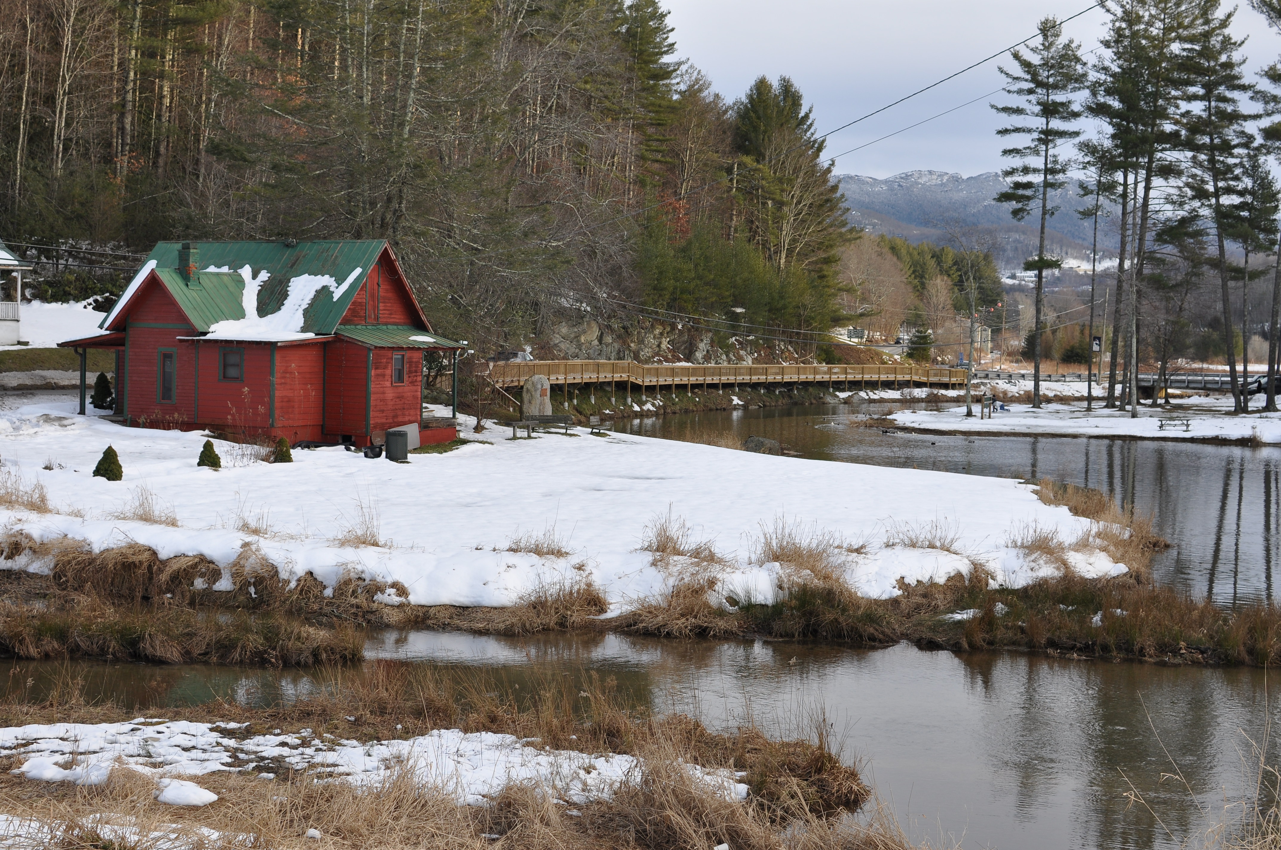
Mill Pond and NC 184 along its bank, in Banner Elk (2009-12-26).
-
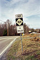
End NC 184 in 4 miles sign, in Banner Elk (2001-03-18).
See also
- Beech Mountain
- Elk River
- Land of Oz
- Lees-McRae College
- Peak Mountain
- Shawneehaw Creek
- Sugar Mountain
References
- ^ a b c d e NCRoads - NC 184
- ^ "Google Maps". http://maps.google.com/. Retrieved 2010-10-02.
External links
Categories:- Transportation in Avery County, North Carolina
- Transportation in Watauga County, North Carolina
- State highways in North Carolina

Wikimedia Foundation. 2010.