- North Carolina Highway 105
-
NC 105
Route information Maintained by NCDOT Length: 17.7 mi[1] (28.5 km) Existed: ca. 1956 – present Major junctions South end:  US 221 in Linville
 NC 184 near Sugar Mountain
 US 221 / US 321 in Boone
North end: 
 US 221 / US 421 / NC 194 in Boone
Location Counties: Avery, Watauga Highway system ←  NC 104
NC 106  →
→NC 105 is a primary state highway in the U.S. state of North Carolina. It runs from US 221 in Linville to US 221/US 421/NC 194 in Boone.
Contents
Route description
Majority of the route was originally the ETWN "Tweetsie" Railroad connecting Linville to Boone before a major flood in 1940 washed away the tracks. In 1956, the state converted the old route into a state highway. Unlike other roads in the area, it was less curvy, less steep, and made the most direct route to Boone compared to US 221 and NC 194. The highway also doubles as a truck route for US 221, US 321, and US 421.
The first four miles of the highway is 2-lane and goes by Grandfather (village) and two golf clubs: Grandfather Golf & Country Club and Linville Ridge. At the Tynecastle intersection, it crosses the Eastern Continental Divide and begins to descend into a valley area. On this section of the highway, the south-bound traffic has a passing lane and Trucks are required to drive 45 mph. Once the descent ends, the town of Seven Devils and Ski Hawknest is located on left. Between Seven Devils and Broadstone Road is the unincorporated community of Foscoe. Some of the best views of Grandfather Mountain can be seen at this section of the highway; it is also notorious for traffic back-ups by travelers trying to stop and visit shops on either side of the road. A brief south-bound passing lane is available near Hound Ears, however drivers typically do not go fast enough to take advantage of the passing zone or slower traffic will stay left causing passers to pass on right. Between Broadstone Road and NC 105 Bypass, the highway ascends towards Boone, the north-bound traffic expands to two lanes; probably the least scenic section of the road thanks to a quarry and asphalt factory along road. In Boone, the highway becomes a full four-lane highway for the rest of the route and connects to two major roads: Blowing Rock Road and East King Street.
Junction list
County Location Mile[1] Destinations Notes Avery Linville 0  US 221 to NC 181 (Newland Highway) – Blowing Rock, Grandfather Mountain, Marion, Newland
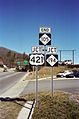
NC 105 begins, south end of US 221 Truck overlap Sugar Mountain 4 NC 184 north (Tynecastle Highway) – Banner ElkAlso goes to Beech Mountain, Lees-McRae College, and area ski resorts Watauga 12 Broadstone Road – Valle Crucis Boone 15 NC 105 Bypass North end of US 321 & 421 Truck Overlap
Road typically confused as part of bannered highway because of name; south bound traffic must be on left-lane to stay on highway17 US 221 south / US 321 (Blowing Rock Road) – ASU, Blowing Rock, LenoirSouth end of US 221 overlap, north end of US 221 Truck overlap, south end of US 321 Truck overlap 17.7 US 221 north / US 421 / NC 194 (East King Street)NC 105 ends, north end of US 221 overlap, south end of US 421 Truck overlap
Also goes to Todd, West Jefferson, and WilkesboroHistory
- 1926 - NC 105 appears as a primary route from Nebo to Linville Falls.[2]
- 1929 - Highway was extended slightly south to the US 70/NC 10 alignment.[2]
- 1935 - NC 105 was rerouted from Longtown[3] to Morganton. The old route to Nebo was re-branded as NC 105-A.[2]
- 1940 - Highway was restored back to its original route to Nebo, eliminating NC 105-A. The route from Longtown to Morganton becomes NC 126.[2]
- 1954 - NC 105 is decommissioned. NC 126 extends over it from Longtown to Nebo; NC 183 extends on a small section in Linville Falls. Rest of the highway becomes Old NC 105 Road.[2]
- 1956 - NC 105 is resurrected as a new primary route from Linville to Boone (ending at Blowing Rock Road; unknown when it was later extended to East King Street).[2]
- Early 1990's - Passing lanes were added along the route: Northbound passing lane for a mile before Boone town limits, Southbound passing lane at Hounds Ear, and another Southbound passing lane from Seven Devils to just after the Avery/Watauga county line.
Alternate names
Though the highway is commonly known as "105" in the area, they highway does have other known names.
- Linville Avenue - road name, within the unincorporated community of Linville.
- Linville Highway - less common alternate name.
- W Ralph Winkler Highway - official name of highway, from the Avery/Watauga county line to Blowing Rock Road.
- NC 105 Extension - road name, from Blowing Rock Road to East King Street.
Photo gallery
-
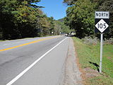
First sign on NC 105 North in Linville (2010-10-02).
-

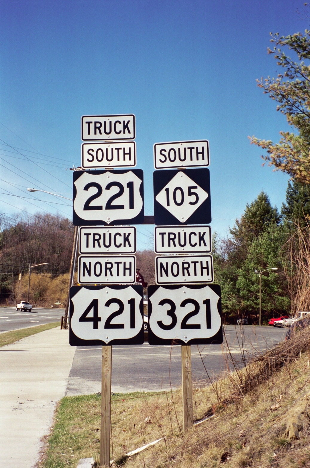
NC 105 with overlapping 221, 321, and 421 Truck routes in Boone (2001-03-19).
-
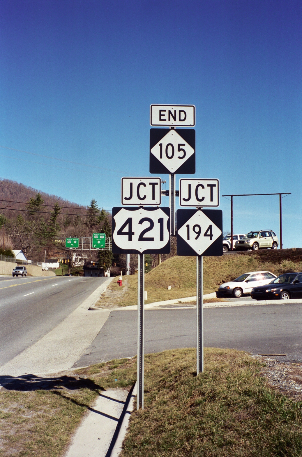
Final sign of NC 105, as it ends on East King Street in Boone (2001-03-19).
See also
- East Tennessee and Western North Carolina Railroad
- Flattop Mountain
- Grandfather Mountain
- Linville River
- Peak Mountain
- Watauga River
References
- ^ a b Google, Inc. Google Maps – NC 105 (Map). Cartography by Google, Inc. http://maps.google.com/maps?f=d&source=s_d&saddr=N+Carolina+105+N&daddr=N+Carolina+105+N%2FUS-221+N&hl=en&geocode=FahmJgIdmMEe-w%3BFXieKAIdbtQh-w&mra=me&mrcr=0&mrsp=1,0&sz=17&sll=36.214917,-81.66746&sspn=0.006466,0.013937&ie=UTF8&ll=36.146747,-81.727982&spn=0.207095,0.445976&z=12. Retrieved 2011-02-01.
- ^ a b c d e f NCRoads - NC 105
- ^ "Longtown". Geographic Names Information System, U.S. Geological Survey. http://geonames.usgs.gov/pls/gnispublic/f?p=gnispq:3:::NO::P3_FID:1006285. Retrieved 2010-10-02.
External links
Categories:- State highways in North Carolina
- Transportation in Avery County, North Carolina
- Transportation in Watauga County, North Carolina


Wikimedia Foundation. 2010.