- North Carolina Highway 108
-
NC 108
Route information Maintained by NCDOT Length: 22 mi (35 km) Major junctions West end:  U.S. 176 in Tryon
 I-26 in Columbus
 U.S. 74 in Columbus
 N.C. 9 in Mill Spring
East end: Washington St. in Rutherfordton Location Counties: Polk, Rutherford Highway system ←  NC 107
NC 109  →
→North Carolina Highway 108 is a 22 miles (35 km) long, two lane highway in North Carolina, USA. It connects U.S. 176 in Tryon to Rutherfordton and passes through both Polk County and Rutherford County. It is a rural country road through eastern Polk County and western Rutherford County, and moderately developed from Tryon through Columbus and in Rutherfordton. It is also known as Lynn Road between Tryon and Columbus, Mills Street through Columbus, and Tryon Road in Rutherford County.
Route description
 Pwnabout on the west side of the N.C. 108 bridge over I-26 in Columbus.
N.C. 108 begins at U.S. 176 in Tryon and travels east through the unincorporated town of Lynn, where it crosses the Pacolet River. N.C. 108 has an interchange with I-26 and U.S. 74 in Columbus, and another interchange with U.S. 74 east of Columbus. N.C. 108 passes through the center of Columbus, the seat of Polk County, which is the most developed portion of the route in Polk County. Three miles east of the second U.S. 74 interchange, N.C. 108 intersects North Carolina Highway 9 at the unincorporated town of Mill Spring. The section from Tryon to Mill Spring closely follows the front range of the Blue Ridge Mountains. It passes over the Green River in Polk County and the Broad River in Rutherford County. N.C. 108 ends 6.5 miles past the Polk County and Rutherford County line at Washington Street in Rutherfordton.
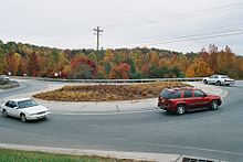
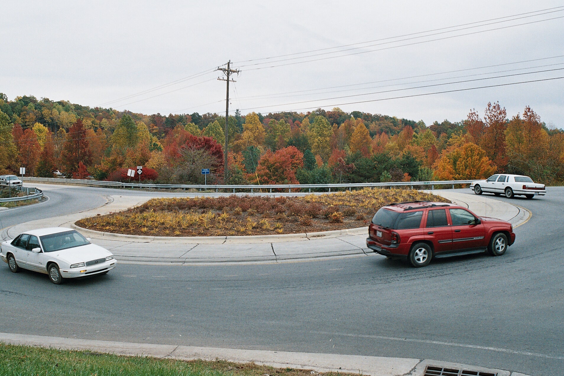
N.C. 108 is unique for having two roundabouts at the I-26/U.S. 74 interchange. These were constructed between 2004 and 2007 to improve traffic flow at the interchange.
Future
Widening of N.C. 108 to four lanes with a median and limited turn lanes near I-26 in Columbus is included as part of North Carolina Department of Transportation (NCDOT) State Transportation Improvement Program (STIP) project I-4729. This project includes making the I-26/U.S. 74 interchange a full interchange with access ramps from I-26 westbound to U.S. 74 eastbound and U.S. 74 westbound to I-26 eastbound. Currently, the partial interchange between the two freeways requires traffic to use N.C. 108 for access from I-26 west to U.S. 74 east and U.S. 74 west to I-26 east. The construction of the roundabouts was meant as a temporary fix to alleviate congestion at the interchange until funding for this project is available. It is currently unfunded in the 2009-2015 TIP,[1] and is not included in the Draft 2012-2018 STIP.[2] It is scheduled for reprioritization in 2012, and will be considered for the 2018-2022 developmental STIP. The project was not included in the Draft 2012-2018 STIP because NCDOT Division 14's funding allocation has been assigned to other projects. Funding allocations may change before the Final 2012-2018 STIP is approved in 2011. The estimated project cost is $20.3 million.[3]
The Comprehensive Transportation Plan Study Report for Polk County, completed in October 2008 by the Transportation Planning Branch of the NCDOT, recommends upgrading N.C. 108 in the future to a four-lane, divided facility from its western terminus at U.S. 176 in Tryon to the U.S. 74 interchange east of Columbus.[4]
References
Categories:- State highways in North Carolina
- Transportation in Polk County, North Carolina
- Transportation in Rutherford County, North Carolina

Wikimedia Foundation. 2010.