- Chartham
-
Coordinates: 51°15′18″N 1°01′14″E / 51.255°N 1.0205°E
Chartham 
 Chartham
Chartham shown within KentPopulation 3,351 [1] OS grid reference TR108549 Parish Chartham District City of Canterbury Shire county Kent Region South East Country England Sovereign state United Kingdom Post town CANTERBURY Postcode district CT4 7 Dialling code 01227 Police Kent Fire Kent Ambulance South East Coast EU Parliament South East England UK Parliament Canterbury List of places: UK • England • Kent Chartham is a village and civil parish in Kent, 4 miles (6 km) west of Canterbury.
It is located on the Great Stour river which provided power for the paper mills up until some point before 1955. The name literally means ‘Village on rough ground’, and the word "Chart" is also found in other villages in Kent with this meaning. Paper making has been a major occupation for the last 625 years. The Paper Mill in Chartham dates from the late eighteenth century and specialises in the production of tracing paper. In the summer, many caravans park up outside the Paper Mill in their annual Caravan Paper convention.
The village is served by Chartham railway station.
The church of St Mary the Virgin is located next to the village green and is remarkable for containing the oldest peal of bells in Kent. It was built in approximately 1294 and features a number of impressive brasses, including that of Sir Robert de Setvans (d 1306). The church is also notable for the stonework of its chancel windows, which exhibit an unusual form of tracery. In the North East and East Kent volume in the Buildings of England series, Newman[2] wrote 'The windows are the locus classicus of so-called Kentish tracery, i.e. with split cusps'.
The village is continuous with the smaller Shalmsford Street to the west, and was until recently the location of St Augustine's Mental Hospital, formerly known as the East Kent Lunatic Asylum. The site on which St Augustine's stood has now become a housing estate. The northern, upper, part of the village is known as Chartham Hatch. The civil parish area also includes Mystole and the village is part of the Kent Downs Area of Outstanding Natural Beauty.
References
- ^ National Statistics Census 2001
- ^ John Newman, North East & East Kent, Penguin Books 1969; 1983. ISBN 0-300-09613-5
External links
 Media related to Chartham at Wikimedia Commons
Towns and villages in the Canterbury district of Kent, England 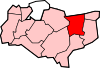 Adisham • Barham • Bekesbourne • Beltinge • Bishopsbourne • Blean • Boyden Gate • Bramling • Bridge • Broad Oak • Broomfield • Chartham • Chartham Hatch • Chestfield • Chislet • Eddington • Fordwich • Grays • Hackington • Harbledown • Hawthorn • Herne • Herne Bay • Hersden • Hillborough • Hoath • Ickham • Kingston • Littlebourne • Lower Hardres • Marshside • Nackington • Patrixbourne • Petham • Pett Bottom • Reculver • Rough Common • Stuppington • Sturry • Swalecliffe • Tankerton • Thanington Without • Tyler Hill • Upper Harbledown • Upper Hardres • Upstreet • Waltham • Westbere • Whitstable • Wickhambreaux • Wincheap • Womenswold • Woolage Green • Woolage Village • Yorkletts
The city of Canterbury • List of places in Kent Categories:- Canterbury
- Villages in Kent
- Kent geography stubs


Wikimedia Foundation. 2010.