- Nackington
-
Coordinates: 51°15′00″N 1°04′59″E / 51.25°N 1.083°E
Nackington 
 Nackington
Nackington shown within KentDistrict City of Canterbury Shire county Kent Region South East Country England Sovereign state United Kingdom Police Kent Fire Kent Ambulance South East Coast EU Parliament South East England List of places: UK • England • Kent Nackington is a village near Canterbury in Kent, England.
External links
 Media related to Nackington at Wikimedia Commons
Towns and villages in the Canterbury district of Kent, England 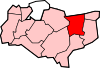 Adisham • Barham • Bekesbourne • Beltinge • Bishopsbourne • Blean • Boyden Gate • Bramling • Bridge • Broad Oak • Broomfield • Chartham • Chartham Hatch • Chestfield • Chislet • Eddington • Fordwich • Grays • Hackington • Harbledown • Hawthorn • Herne • Herne Bay • Hersden • Hillborough • Hoath • Ickham • Kingston • Littlebourne • Lower Hardres • Marshside • Nackington • Patrixbourne • Petham • Pett Bottom • Reculver • Rough Common • Stuppington • Sturry • Swalecliffe • Tankerton • Thanington Without • Tyler Hill • Upper Harbledown • Upper Hardres • Upstreet • Waltham • Westbere • Whitstable • Wickhambreaux • Wincheap • Womenswold • Woolage Green • Woolage Village • YorklettsThe city of Canterbury • List of places in KentCategories:
- Kent geography stubs
- Villages in Kent


Wikimedia Foundation. 2010.