- Chartham Hatch
-
Coordinates: 51°15′18″N 1°01′14″E / 51.255°N 1.0205°E
Chartham Hatch 
 Chartham Hatch
Chartham Hatch shown within KentPopulation 3,351 [1] (Parish) OS grid reference TR108549 Parish Chartham District City of Canterbury Shire county Kent Region South East Country England Sovereign state United Kingdom Post town CANTERBURY Postcode district CT4 7 Dialling code 01227 Police Kent Fire Kent Ambulance South East Coast EU Parliament South East England UK Parliament Canterbury List of places: UK • England • Kent Chartham Hatch is a small hamlet of around 200 houses in Kent, England, situated around 5 miles South-West of Canterbury. The area has orchards of apples and pears. A Village Hall, formerly the village's school, is in the centre of the village.
Source
- Chartham Hatch - Village School to Village Hall
External links
References
- ^ National Statistics Census 2001
Towns and villages in the Canterbury district of Kent, England 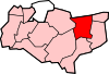 Adisham • Barham • Bekesbourne • Beltinge • Bishopsbourne • Blean • Boyden Gate • Bramling • Bridge • Broad Oak • Broomfield • Chartham • Chartham Hatch • Chestfield • Chislet • Eddington • Fordwich • Grays • Hackington • Harbledown • Hawthorn • Herne • Herne Bay • Hersden • Hillborough • Hoath • Ickham • Kingston • Littlebourne • Lower Hardres • Marshside • Nackington • Patrixbourne • Petham • Pett Bottom • Reculver • Rough Common • Stuppington • Sturry • Swalecliffe • Tankerton • Thanington Without • Tyler Hill • Upper Harbledown • Upper Hardres • Upstreet • Waltham • Westbere • Whitstable • Wickhambreaux • Wincheap • Womenswold • Woolage Green • Woolage Village • Yorkletts
The city of Canterbury • List of places in Kent Categories:- Kent geography stubs
- Hamlets in Kent


Wikimedia Foundation. 2010.