- Tonghae Satellite Launching Ground
-
"Musudan" redirects here. For the missile, see BM25 Musudan.
Coordinates: 40°51′N 129°40′E / 40.85°N 129.667°E
Tonghae Satellite Launching Ground 
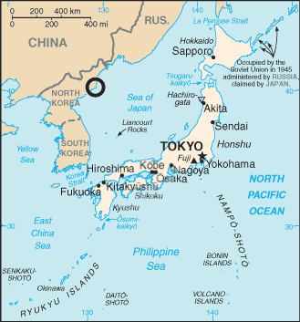
Circle locates North Korea Tonghae Satellite Launching Ground (previously Musudan-ri) within the Sea of JapanKorean name Chosŏn'gŭl 무수단리 Hancha 舞水端里 McCune–Reischauer Musudan-ri Revised Romanization Musudan-ri The Tonghae Satellite Launching Ground, also known as Musudan-ri,[1] is a rocket launching site in North Korea. It lies in southern North Hamgyong province, near the northern tip of the East Korea Bay. The area was formerly known as Taep'o-dong (대포동) during the period when Korean was occupied by Japan, thus the Taepodong rockets take their name.
Since 1984 military rockets of the types Hwasong, Rodong and Taepodong-1 were launched from Musudan-ri. In 1998, North Korean media reported the successful launch of the Kwangmyŏngsŏng-1 satellite by a Baekdusan-1 SLV from Musudan-ri. North Korea claimed their first satellite was successfully placed into orbit, but no independent sources have confirmed this. A second failed satellite launch attempt apparently occurred in 2006.
 Satellite view of launch pad
The facilities at Musudan-ri are modest, consisting of a launch pad at 40°51.342′N 129°39.948′E / 40.8557°N 129.6658°E, an engine test stand at 40°51.138′N 129°40.788′E / 40.8523°N 129.6798°E, a missile assembly/checkout building at 40°51.348′N 129°39.552′E / 40.8558°N 129.6592°E, and a missile control building at 40°51.78′N 129°39.624′E / 40.863°N 129.6604°E and a Ground Tracking Facility (coordinates obtained from Google Earth in June, 2006.).
According to senior North Korean officials, the site launched an Unha-2 SLV carrying an experimental communications satellite named Kwangmyŏngsŏng-2 at 0230 GMT on 5 April 2009. It passed over Japan as it headed towards Low Earth orbit to unload the experimental satellite. However, the United States, South Korea and Japan have maintained it was a test launch of a Taepodong-2 ICBM class missile capable of carrying nuclear warheads. South Korea and the United States claim three components of the rocket fell into the Pacific Ocean, and that no new satellite could be detected in space. North Korea maintained though that the satellite was successfully put in orbit. Concerns that the payload could reach areas of the non-coterminous United States (namely Alaska and the Hawaiian Islands) as well as proliferation of the technology have led the United States and the European Union to demand strong action from the United Nations.
See also
- Tongch'ang-dong Space Launch Center
- Korean People's Army
- List of Korea-related topics
- Geography of North Korea
References
External links
- http://www.astronautix.com/sites/musudan.htm
- GlobalSecurity.org Background on Musudan-ri
- The Meaning of the North Korean Missile Launch. (2009 launch) Posted by GlobalSecurity.org on 2009-04-05
Spaceports Asia and the
Middle EastEurope  FKA: Kapustin Yar · Plesetsk ·
  SSC: Esrange
North America  CAF / CSA: Fort Churchill ·
  NASA: KSC · Wallops · DoD: Cape Canaveral (ER) · Vandenberg (WR) · Private: Corn Ranch · Jacksonville · Kodiak · Mid-Atlantic Regional Spaceport · Mojave · Oklahoma · Spaceport America
South America  FAB / AEB: Barreira do Inferno · Alcântara ·
  Private: Spaceport Curaçao ·
  ESA / CNES: Guiana/Kourou
Pacific Categories:- Rocket launch sites
- North Hamgyong
- Military of North Korea
- Nuclear program of North Korea
- Space program of North Korea
Wikimedia Foundation. 2010.