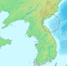
Korea Bay — Map showing Korea Bay. North Korean name Chosŏn gŭl … Wikipedia
Korea, North — Introduction Korea, North Background: Following World War II, Korea was split with the northern half coming under Communist domination and the southern portion becoming Western oriented. KIM Chong il has ruled North Korea since his father and the … Universalium
Korea, North — <p></p> <p></p> Introduction ::Korea, North <p></p> Background: <p></p> An independent kingdom for much of its long history, Korea was occupied by Japan beginning in 1905 following the Russo… … The World Factbook
East China Sea — Not to be confused with South China Sea. For other uses, see East Sea (Chinese mythology). Coordinates: 30°N 125°E / 30°N 125°E … Wikipedia
East China Sea — a part of the N Pacific, bounded by China, Japan, the Ryukyus, and Taiwan. 480,000 sq. mi. (1,243,200 sq. km). Also called Dong Hai. * * * ▪ sea, Pacific Ocean Introduction Chinese (Wade Giles) Tung Hai or (Pinyin) Dong Hai arm of the… … Universalium
East Turkestan Islamic Movement — This article is about an Islamist based organization. For the nationalist movement, see East Turkestan independence movement. East Turkestan Islamic Movement Flag of Jihad Dates of operation 1997 present Leader … Wikipedia
East Coast Main Line — ECML redirects here. For the European Conference on Machine Learning, see ECML PKDD. East Coast Main Line An InterCity 225 on the East Coast Main Line Overview Type … Wikipedia
Geography of South Korea — Coordinates: 36°30′N 127°30′E / 36.50°N 127.5°E / 36.50; 127.5 … Wikipedia
North Korea — Democratic People s Republic of Korea 조선민주주의인민공화국 朝鮮民主主義人民共和國 Chosŏn Minjujuŭi Inmin Konghwaguk[1] … Wikipedia
Geography of North Korea — Coordinates: 40°00′N 127°00′E / 40°N 127°E / 40; 127 … Wikipedia