- Matatiele Local Municipality
-
Matatiele — Local municipality — Location in the Eastern Cape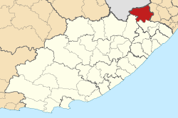
Coordinates: 32°10′S 28°35′E / 32.167°S 28.583°ECoordinates: 32°10′S 28°35′E / 32.167°S 28.583°E Country South Africa Province Eastern Cape District Alfred Nzo District Seat Matatiele Area - Total 1,417 km2 (547.1 sq mi) Population (2007)[1] - Total 258,758 - Density 182.6/km2 (473/sq mi) - Households 54,208 Racial makeup[2] (2007) - Black African 98.66% - White 0.50% - Coloured 0.73% - Indian or Asian 0.10% Time zone SAST (UTC+2) Municipal code EC441 Matatiele Local Municipality is an administrative area in the Alfred Nzo District of Eastern Cape in South Africa.
The name is derived from the Sesotho language and it means "the ducks have flown", in an apparent reference to the abundance of waterflow that even today inhabit the surrounding pools and marshes.[3]
References
- ^ "Community Survey, 2007: Basic Results Municipalities" (PDF). Statistics South Africa. http://www.statssa.gov.za/Publications/P03011/P030112007.pdf. Retrieved 2009-10-20.
- ^ "Community Survey 2007 interactive data". Statistics South Africa. http://www.statssa.gov.za/community_new/content.asp?link=interactivedata.asp. Retrieved 19 October 2009.
- ^ South African Languages - Place names
Province of Eastern Cape, South Africa Provincial Capital: Bhisho Metropolitan
MunicipalitiesBuffalo City · Nelson Mandela BayDistrict
and Local
MunicipalitiesCamdeboo · Blue Crane Route · Ikwezi · Makana · Ndlambe · Sunday's River Valley · Baviaans · Kouga · Kou-KammaInxuba Yethemba · Tsolwana · Inkwanca · Lukhanji · Intsika · Emalahleni · Engcobo · SakhisizweElundini · Senqu · Maletswai · GariepMbizana · Ntabankulu · Matatiele · UmzimvubuCategories:- Local Municipalities of Alfred Nzo

Wikimedia Foundation. 2010.