- Matadero Creek
-
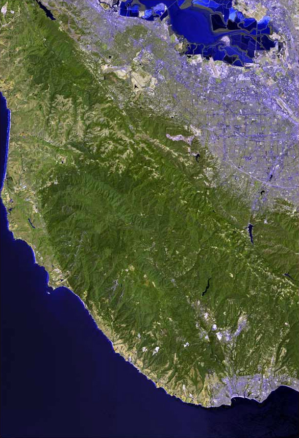
Matadero Creek Arroyo del Matadero,[1] Madera Creek[2][3][4] stream Country United States State California Region Santa Clara County Tributaries - left Arastradero Creek, Santa Rita Creek via the "Stanford Channel" - right Deer Creek Source Foothills of the Santa Cruz Mountains - location Los Altos Hills, California - elevation 640 ft (195 m) - coordinates 37°22′01″N 122°09′04″W / 37.36694°N 122.15111°W [5] Mouth Palo Alto Flood Basin, then Mayfield Slough, then southwest San Francisco Bay - location Palo Alto, California - elevation 0 ft (0 m) [5] - coordinates 37°25′27″N 122°08′01″W / 37.42417°N 122.13361°W [5] Matadero Creek is a stream originating in the foothills of the Santa Cruz Mountains in Santa Clara County, California, United States. The creek flows in a northeasterly direction for 8 miles (13 km) until it enters the Palo Alto Flood Basin, then the Mayfield Slough and then southwest San Francisco Bay. Matadero Creek begins in the city of Los Altos Hills, then traverses the Stanford University lands and Palo Alto before culminating in the Bay.
Contents
History
Matadero Creek was originally called Arroyo del Matadero on maps from the 1830s and 1840s, and matadero means slaughtering place in Spanish.[1] On the Palo Alto Topo Map of 1899, it was referred to as Madera Creek, a name which suggests its prior value as a source of timber (madera in Spanish).[2][5]
Watershed
 Deer Creek just east of Arastradero Road in a concrete trapezoidal channel which does not allow the creek's water to replenish the groundwater table Aug. 29, 2010
 Concretization of Matadero Creek's banks (in back of shot) accelerates stream flows, causing severe channel incision which is now threatening Page Mill Road below the Arastradero Road intersection Jan. 2011
Matadero Creek's mainstem begins at elevation 640 feet just north of Altamount Road and west of Black Mountain Road in Los Altos Hills. The creek has two significant tributaries, Arastradero Creek and Deer Creek. Arastradero Creek is protected by the Arastradero Preserve.[6] Arastradero Creek begins at elevation 800 feet just south of the terminus of Alexis Drive in Palo Alto, and heads briefly west then north around the Los Altos Hills Country Club where it is dammed to form small two small water bodies (Sobey Pond and Arastradero Lake), then joins Matadero Creek where Arastradero Road intersects Page Mill Road.[7] Deer Creek begins at elevation 680 feet just north of Altamount Road and west of Taafe Road in Los Altos Hills, then flows northerly passing under Interstate 280 at the La Barranca Road underpass, where it turns west and parallels Purissima Road, crosses Arastradero Road and Deer Creek Road, before joining the Matadero Creek mainstem just south of Foothill Expressway and east of Page Mill Road.[8]
The Santa Rita Creek tributary, which drains the faculty housing area of Stanford, was artificially connected to Matadero Creek by the "Stanford Channel".[9] Historically Santa Rita Creek terminated in the marshlands in historic Mayfield.[2]
The Matadero Creek watershed drains 14 square miles (36 km2), of which 11 square miles (28 km2) are mountainous land, and 3 square miles (7.8 km2) are gently sloping valley floor. Downstream of Foothill Expressway Matadero Creek has been greatly modified for flood protection. From Highway 101 to El Camino Real the creek flows through a concrete trapezoidal channel. In 1990, the concrete trapezoidal channel was extended from the CalTrain tracks to El Camino Real. Historically Barron Creek was a tributary to Matadero Creek[2] but subsequently Barron Creek was connected to Adobe Creek north of U. S. Highway 101. However, during large storm events flow may be diverted to Matadero Creek from Barron Creek via the Barron Diversion Channel.[10]
Habitat and Wildlife
Steelhead trout (Oncorhynchus mykiss) were supported by Matadero Creek historically, and at least as recently as the late 1980s. In 1905 John Otterbein Snyder collected O. mykiss (then called Salmo irideus) in “Madera Creek”, today's Matadero Creek.[11] A California Department of Fish and Game (CDFG) field note from 1945 documents a fisherman’s sighting of steelhead adults in Matadero Creek two years prior (1942/43 season). According to CDFG, steelhead were caught by local fishermen during 1985, 1986 and 1987 in Mayfield Slough at the confluence of Matadero and Adobe Creeks. At least six steelhead were noted passing the tidal gates at Mayfield Slough in the Palo Alto Flood Basin in April 1987. Also, 1986 CDFG correspondence identifies Matadero Creek as an anadromous steelhead trout stream with winter spawning runs. However in February 1997, Leidy electrofished Matadero Creek at three sites between Laguna Street and the third downstream bridge crossing on Old Matadero Creek Road and no O. mykiss were found.[12]
Regarding whether steelhead trout could have accessed Matadero Creek historically, since it appears to have terminated in an alluvial fan prior to reaching Bay marshlands,[2] Snyder wrote in 1905 about a historical connection that formed when some willows deflected San Francisquito Creek to Matadero Creek, allowing Sacramento suckers (Catostomus occidentalis) to ascend the latter creek, where they had not been seen before despite eight years of monitoring.[11] It is also possible that very high flows would have connected the historical Matadero Creek to the Bay's tidal marshes in flood years. At the present, of course, Matadero Creek has been lengthened to connect to Adobe Creek in Mayfield Slough in the Palo Alto Flood Basin.
In June, 1980 local residents spotted a milky substance in the creek that was determined to be wheelchair cleaning solvent dumped into the waters by the Veterans Administration Medical Center. The large population of resident Pacific Tree Frogs (Pseudacris regilla regilla) near the creek was nearly extirpated. In the 1970's the "nightly tree frog chorus along Matadero Creek was almost deafening in the mating season and loud during all the warmer months", according to Barron Park historian, Douglas Graham. Despite several efforts to re-introduce tree frogs from neighboring Barron Creek and Lake Lagunita, at the present time they have only recovered to 5%-10% of their original numbers.[13]
The Palo Alto Flood Basin
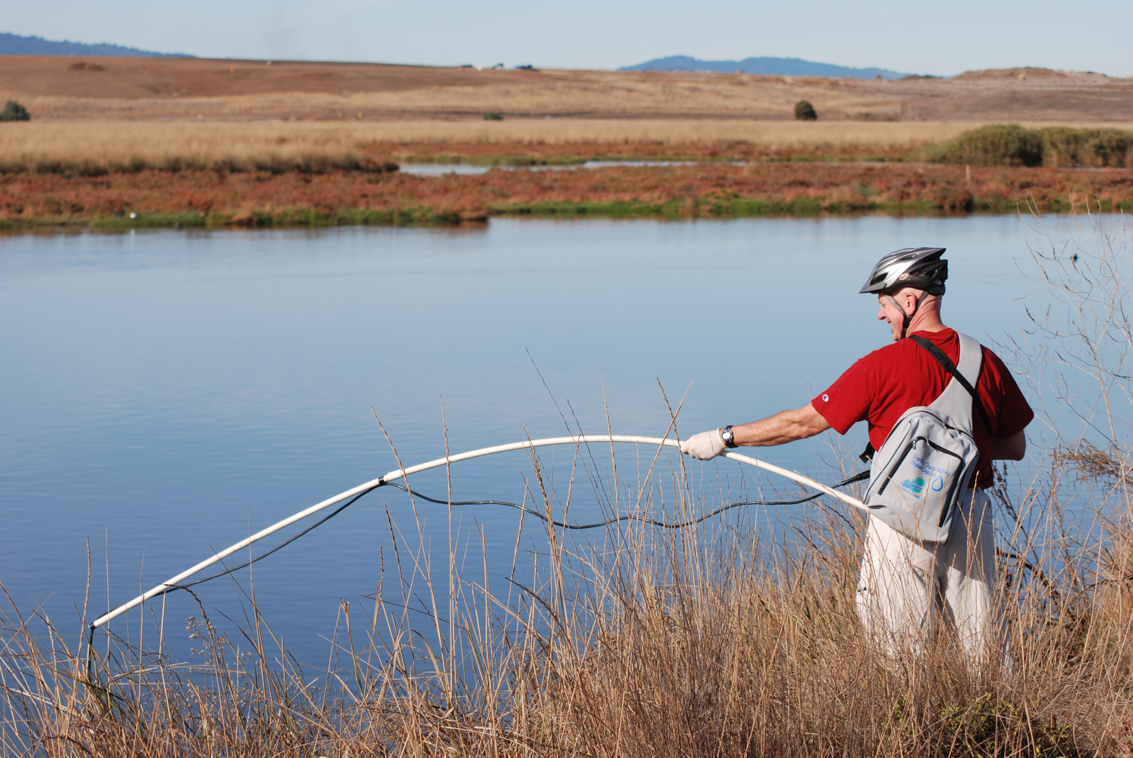
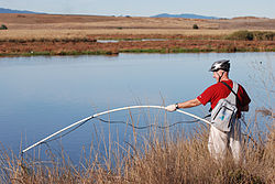 Jim McCarthy, Adobe and Matadero Creek Streamkeeper, was honored by the Santa Clara County Creeks Coalition for his work to restore the creek. Here he measures temperature, dissolved oxygen, salinity, copper levels, and turpidity 2010.
The Palo Alto Flood Basin was constructed in 1956 in order to prevent a repeat of the floods of 1955, when a high tide prevented the escape of heavy runoff from Matadero, Adobe, and Barron Creeks into the San Francisco Bay. The trapped runoff waters overflowed upstream creek banks and caused severe flooding in Palo Alto. In order to control the flow of water into the flood basin, a tidegate was placed at the confluence of Adobe Creek, Matadero Creek, and the San Francisco Bay, so that the flood basin could be maintained at approximately 2 feet below sea level, creating room to absorb floodwaters. The tidegate consists of several weirs and one operator-controlled sluice gate that enables tidal flows into the basin in order to improve water quality and for mosquito control. Three agencies oversee the tidegates: Santa Clara Valley Water District, City of Palo Alto, and Santa Clara County Vector Control. Because the trash grate and weirs separate the mouth of the flood basin from the San Francisco Bay estuary, large fish cannot swim freely between the Bay and the basin, unless the sluice gate is open. In addition, the tidegates are set to reduce tidal inflows into the basin, so that the basin is mostly freshwater. After a rainstorm the tidegate is kept closed, however this is precisely when steelhead trout in-migrations should occur.[14]
From November 16 to 20, 2002, approximately 100 Striped bass (Morone saxatilis), 5 Bat rays (Myliobatis californica) and 2 Leopard sharks (Triakis semifasciata) were found dead in the Flood Control Basin in both Adobe and Matadero Creeks within one mile of the tidegate. The fishkill was attributed to the first large rainstorm washing a large amount of leaf litter into the basin, leading to eutrophication and low dissolved oxygen. This is supported by the fact that the dead fish were all large (requiring more oxygen) at 2 to 4 feet long and the mouths and gills of the bass were fully extended open.[14]
See also
- List of watercourses in the San Francisco Bay Area
- Palo Alto, California
- Rancho Rincon de San Francisquito
References
- ^ a b Durham, David L. (1998). Durham's Place Names of California's San Francisco Bay Area: Includes Marin, San Francisco, San Mateo, Contra Costa, Alameda, Solano & Santa Clara counties. Word Dancer Press, Sanger, California. p. 103. ISBN 78-1884995149. http://books.google.com/books?id=3MkxoL0X7xYC&pg=PA103&lpg=PA103&dq=durham+place+names+matadero&source=bl&ots=fK9PhNlYVp&sig=_bmbc6XmOk8mR0ol8piRWuvDecY&hl=en&ei=imhVS5-TOIGysgOb45z1Bw&sa=X&oi=book_result&ct=result&resnum=1&ved=0CAcQ6AEwAA#v=onepage&q=&f=false. Retrieved Jan. 19, 2010.
- ^ a b c d e "Palo Alto Creeks Topo, 1899". Oakland Museum. http://museumca.org/creeks/1460-TopoPaloAlto-Big1899.html. Retrieved 2010-11-07.
- ^ William S. Cooper (January, 1926). "Vegetational Development Upon Alluvial Fans in the Vicinity of Palo Alto, California". Ecology: 1–30. JSTOR 1929116.
- ^ Gudde, Erwin G. (1949). California Place Names: A Geographical Dictionary. Berkeley, California: University of California Press. p. 224. http://books.google.com/books?id=Kqwt5RlMVBoC&pg=PA224&lpg=PA224&dq=erwin+gudde+place+names+matadero&source=bl&ots=3ssdmhfWkV&sig=y5Tdpol88jH8I-GJ8lyM69Yw4sg&hl=en&ei=HmhVS7GjBYb-tAP87LH1Bw&sa=X&oi=book_result&ct=result&resnum=1&ved=0CAcQ6AEwAA#v=snippet&q=matadero%20creek&f=false. Retrieved Jan. 19, 2010.
- ^ a b c d U.S. Geological Survey Geographic Names Information System: Matadero Creek
- ^ "Arastradero Preserve". City of Palo Alto. http://www.cityofpaloalto.org/civica/filebank/blobdload.asp?BlobID=6049. Retrieved 2010-08-21.
- ^ U.S. Geological Survey Geographic Names Information System: Arastradero Creek
- ^ U.S. Geological Survey Geographic Names Information System: Deer Creek
- ^ "Matadero Creek Watershed Map". Oakland Museum Watershed Maps. http://museumca.org/creeks/1450-OMMataderoBig.html. Retrieved 2010-11-07.
- ^ "Matadero Watershed, Santa Clara Valley Urban Runoff Pollution Prevention Program". http://www.scvurppp-w2k.com/ws_matadero.shtml. Retrieved Jan. 19, 2010.
- ^ a b John Otterbein Snyder, United States Bureau of Fisheries (1905). Notes on the fishes of the streams flowing into San Francisco Bay, California in Report of the Commissioner of Fisheries to the Secretary of Commerce and Labor for the fiscal year ending June 30, 1904. 30. General Printing Office. pp. 330–332, 337. http://books.google.com/books?id=P7tWAAAAMAAJ&pg=PA327&lpg=PA327&dq=Notes+on+the+fishes+of+the+streams+flowing+into+San+Francisco+Bay,+California&source=bl&ots=c7o8HilV6Z&sig=5WwfvEixY0YCJ_HFbGgzS_J52xM&hl=en&ei=CsrDTLmwHZKosAO97YXmCA&sa=X&oi=book_result&ct=result&resnum=3&ved=0CCMQ6AEwAg#v=onepage&q=madera&f=false. Retrieved 2011-01-16.
- ^ Leidy, R.A., G.S. Becker, B.N. Harvey (2005). "Historical distribution and current status of steelhead/rainbow trout (Oncorhynchus mykiss) in streams of the San Francisco Estuary, California.". Center for Ecosystem Management and Restoration, Oakland, CA.. http://www.cemar.org/pdf/santaclara.pdf. Retrieved 2011-01-16.
- ^ Douglas Graham (Summer 2008). "The Creeks of Barron Park - Part One". http://www.bpaonline.org/bp-news/pdfs/Summer08.pdf. Retrieved 2011-11-20.
- ^ a b Research Results Regarding the Fish Die-Off at Palo Alto Flood Control Basin (Report). City of Palo Alto Public Works Department Environmental Compliance Division. 2002-11.
External links
- U.S. Geological Survey Geographic Names Information System: Matadero Creek - Geographic Names Information System
- Matadero Creek Watershed map hosted by Oakland Museum
- Santa Clara County Creeks Coalition
Santa Cruz Mountains Peaks Black Mountain · Loma Prieta · Long Ridge · Montara Mountain · Mount Bielawski · Mount Thayer · Mount Umunhum · San Bruno Mountain · Santa Teresa Hills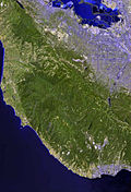
Rivers and creeks Adobe Creek · Bean Creek · Branciforte Creek · Butano Creek · Carbonera Creek · Guadalupe River · Little Boulder Creek · Loch Lomond · Los Alamitos Creek · Los Gatos Creek · Naples Creek · Permanente Creek · Pescadero Creek · Peters Creek · Pilarcitos Creek · San Bruno Creek · San Francisquito Creek · San Lorenzo River · San Pedro Creek · San Vicente Creek · Stevens Creek · Tip Toe Falls · Uvas Creek · Waddell Creek · Waterman Creek · Zayante CreekParks Hiking trails Other Categories:- Rivers of Santa Clara County, California


Wikimedia Foundation. 2010.