- Marmelópolis
-
Marmelópolis — Municipality — Marmelópolis Nickname(s): Marmelópolis Location in the State of Minas Gerais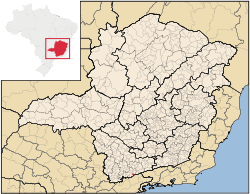 Location in the State of Minas Gerais
 Marmelópolis
Coordinates: 22°26′56″S 45°09′54″W / 22.44889°S 45.165°WCoordinates: 22°26′56″S 45°09′54″W / 22.44889°S 45.165°W Country  Brazil
Region Southeast State  Minas Gerais
Founded December 31, 1962 Area – Total 107.861 km2 (41.6 sq mi) Elevation 1,277 m (4,190 ft) Population (2009) – Total 3,156 – Density 32.9/km2 (85.2/sq mi) Time zone BST (UTC-3) – Summer (DST) BDT (UTC-2) Postal Code 37516-000 Marmelópolis is a town and municipality in the state of Minas Gerais in the Southeast region of Brazil.[1][2][3][4]
Contents
Geography
It lies on the boundary of the state of São Paulo at 1277 meters elevation and is the future of eco-tourism, having an area of 108,1 km² in the municipality.
The physical area is made up for the most part of mountainous terrain of The Mantiqueira Mountains. The name Mantiqueira derives from a [Tupi-Guarani] word meaning "mountains that cry", denoting the large number of springs and streams found there. Part of Marins peak is located in Marmelópolis. This is a beautiful landscape with a peaceful mood on it.
Marmelópolis occupies a highly strategic geographical location, due to its proximity to São Paulo (260 km), Belo Horizonte (460 km) and Rio de Janeiro (420 km), whose connections are made with good highways.
Climate
The climate is characterized by dry winters and mild summers. The winter is from April to September and has an average temperature of 15 °C and rainfall of 315 mm. The summer is from October to March and has an average temperature of 21 °C with rainfall of 1,430 mm. The annual rainfall is 1,745 mm. The average annual temperature is 17 °C with minimums of -6 °C and maximums of 31.7 °C.
See also
References
- ^ "Divisão Territorial do Brasil" (in Portuguese). Divisão Territorial do Brasil e Limites Territoriais, Instituto Brasileiro de Geografia e Estatística (IBGE). July 1, 2008. ftp://geoftp.ibge.gov.br/Organizacao/Divisao_Territorial/2008/DTB_2008.zip. Retrieved December 17, 2009.
- ^ "Estimativas da população para 1º de julho de 2009" (in Portuguese) (PDF). Estimativas de População, Instituto Brasileiro de Geografia e Estatística (IBGE). August 14, 2009. http://www.ibge.gov.br/home/estatistica/populacao/estimativa2009/POP2009_DOU.pdf. Retrieved December 17, 2009.
- ^ "Ranking decrescente do IDH-M dos municípios do Brasil" (in Portuguese). Atlas do Desenvolvimento Humano, Programa das Nações Unidas para o Desenvolvimento (PNUD). 2000. http://www.pnud.org.br/atlas/ranking/IDH-M%2091%2000%20Ranking%20decrescente%20(pelos%20dados%20de%202000).htm. Retrieved December 17, 2009.
- ^ "Produto Interno Bruto dos Municípios 2002-2005" (in Portuguese). Instituto Brasileiro de Geografia e Estatística (IBGE). December 19, 2007. http://www.ibge.gov.br/home/estatistica/economia/pibmunicipios/2005/tab01.pdf. Retrieved December 17, 2009.
 Municipalities of Minas GeraisCapital: Belo Horizonte
Mesoregion Campo das Vertentes BarbacenaLavrasCarrancas • Ijaci • Ingaí • Itumirim • Itutinga • Lavras • Luminárias • Nepomuceno • Ribeirão VermelhoSão João del Rei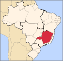
Mesoregion Central Mineira Bom DespachoCurveloTrês MariasMesoregion Jequitinhonha AlmenaraAlmenara • Bandeira • Divisópolis • Felisburgo • Jacinto • Jequitinhonha • Joaíma • Jordânia • Mata Verde • Monte Formoso • Palmópolis • Rio do Prado • Rubim • Salto da Divisa • Santa Maria do Salto • Santo Antônio do JacintoAraçuaíCapelinhaDiamantinaPedra AzulMesoregion Metropolitana de Belo Horizonte Belo HorizonteBelo Horizonte • Betim • Brumadinho • Caeté • Confins • Contagem • Esmeraldas • Ibirité • Igarapé • Juatuba • Lagoa Santa • Mário Campos • Mateus Leme • Nova Lima • Pedro Leopoldo • Raposos • Ribeirão das Neves • Rio Acima • Sabará • Santa Luzia • São Joaquim de Bicas • São José da Lapa • Sarzedo • VespasianoConceição do Mato DentroConselheiro LafaieteItabiraAlvinópolis • Barão de Cocais • Bela Vista de Minas • Bom Jesus do Amparo • Catas Altas • Dionísio • Ferros • Itabira • João Monlevade • Nova Era • Nova União • Rio Piracicaba • Santa Bárbara • Santa Maria de Itabira • São Domingos do Prata • São Gonçalo do Rio Abaixo • São José do Goiabal • Taquaraçu de MinasItaguaraBelo Vale • Bonfim • Crucilândia • Itaguara • Itatiaiuçu • Jeceaba • Moeda • Piedade dos Gerais • Rio MansoOuro PretoPará de MinasFlorestal • Onça de Pitangui • Pará de Minas • Pitangui • São José da VarginhaSete LagoasAraçaí • Baldim • Cachoeira da Prata • Caetanópolis • Capim Branco • Cordisburgo • Fortuna de Minas • Funilândia • Inhaúma • Jaboticatubas • Jequitibá • Maravilhas • Matozinhos • Papagaios • Paraopeba • Pequi • Prudente de Morais • Santana de Pirapama • Santana do Riacho • Sete LagoasMesoregion Noroeste de Minas ParacatuUnaíArinos • Bonfinópolis de Minas • Buritis • Cabeceira Grande • Dom Bosco • Formoso • Natalândia • Unaí • Uruana de MinasMesoregion Norte de Minas BocaiúvaGrão MogolJanaúbaCatuti • Espinosa • Gameleiras • Jaíba • Janaúba • Mamonas • Mato Verde • Monte Azul • Nova Porteirinha • Pai Pedro • Porteirinha • Riacho dos Machados • Serranópolis de MinasJanuáriaMontes ClarosBrasília de Minas • Campo Azul • Capitão Enéas • Claro dos Poções • Coração de Jesus • Francisco Sá • Glaucilândia • Ibiracatu • Japonvar • Juramento • Lontra • Luislândia • Mirabela • Montes Claros • Patis • Ponto Chique • São João da Lagoa • São João da Ponte • São João do Pacuí • Ubaí • Varzelândia • VerdelândiaPiraporaBuritizeiro • Ibiaí • Jequitaí • Lagoa dos Patos • Lassance • Pirapora • Riachinho • Santa Fé de Minas • São Romão • Várzea da PalmaSalinasMesoregion Oeste de Minas Campo BeloDivinópolisCarmo do Cajuru • Cláudio • Conceição do Pará • Divinópolis • Igaratinga • Itaúna • Nova Serrana • Perdigão • Santo Antônio do Monte • São Gonçalo do Pará • São Sebastião do OesteFormigaOliveiraBom Sucesso • Carmo da Mata • Carmópolis de Minas • Ibituruna • Oliveira • Passa Tempo • Piracema • Santo Antônio do Amparo • São Francisco de PaulaPiuiBambuí • Córrego Danta • Doresópolis • Iguatama • Medeiros • Piumhi • São Roque de Minas • Tapiraí • Vargem BonitaMesoregion Sudoeste de Minas AlfenasAlfenas • Alterosa • Areado • Carmo do Rio Claro • Carvalhópolis • Conceição da Aparecida • Divisa Nova • Fama • Machado • Paraguaçu • Poço Fundo • SerraniaAndrelândiaAiuruoca • Andrelândia • Arantina • Bocaina de Minas • Bom Jardim de Minas • Carvalhos • Cruzília • Liberdade • Minduri • Passa-Vinte • São Vicente de Minas • Seritinga • SerranosItajubáBrasópolis • Consolação • Cristina • Delfim Moreira • Dom Viçoso • Itajubá • Maria da Fé • Marmelópolis • Paraisópolis • Piranguçu • Piranguinho • Virgínia • Wenceslau BrazPassosAlpinópolis • Bom Jesus da Penha • Capetinga • Capitólio • Cássia • Claraval • Delfinópolis • Fortaleza de Minas • Ibiraci • Itaú de Minas • Passos • Pratápolis • São João Batista do Glória • São José da BarraPoços de CaldasAlbertina • Andradas • Bandeira do Sul • Botelhos • Caldas • Campestre • Ibitiúra de Minas • Inconfidentes • Jacutinga • Monte Sião • Ouro Fino • Poços de Caldas • Santa Rita de CaldasPouso AlegreBom Repouso • Borda da Mata • Bueno Brandão • Camanducaia • Cambuí • Congonhal • Córrego do Bom Jesus • Espírito Santo do Dourado • Estiva • Extrema • Gonçalves • Ipuiúna • Itapeva • Munhoz • Pouso Alegre • Sapucaí-Mirim • Senador Amaral • Senador José Bento • Tocos do Moji • ToledoSanta Rita do SapucaíCachoeira de Minas • Careaçu • Conceição das Pedras • Conceição dos Ouros • Cordislândia • Heliodora • Natércia • Pedralva • Santa Rita do Sapucaí • São Gonçalo do Sapucaí • São João da Mata • São José do Alegre • São Sebastião da Bela Vista • Silvianópolis • TurvolândiaSão LourencoAlagoa • Baependi • Cambuquira • Carmo de Minas • Caxambu • Conceição do Rio Verde • Itamonte • Itanhandu • Jesuânia • Lambari • Olímpio Noronha • Passa Quatro • Pouso Alto • São Lourenço • São Sebastião do Rio Verde • Soledade de MinasSão Sebastiao do ParaísoArceburgo • Cabo Verde • Guaranesia • Guaxupé • Itamogi • Jacuí • Juruaia • Monte Belo • Monte Santo de Minas • Muzambinho • Nova Resende • São Pedro da União • São Sebastião do Paraíso • São Tomás de AquinoVarginhaBoa Esperança • Campanha • Campo do Meio • Campos Gerais • Carmo da Cachoeira • Coqueiral • Elói Mendes • Guapé • Ilicínea • Monsenhor Paulo • Santana da Vargem • São Bento Abade • São Thomé das Letras • Três Corações • Três Pontas • VarginhaMesoregion Triângulo Mineiro/Alto Paranaiba AraxáAraxá • Campos Altos • Ibiá • Nova Ponte • Pedrinópolis • Perdizes • Pratinha • Sacramento • Santa Juliana • TapiraFrutalItuiutabaPatos de MinasPatrocínioUberabaUberlândiaAraguari • Araporã • Canápolis • Cascalho Rico • Centralina • Indianópolis • Monte Alegre de Minas • Prata • Tupaciguara • UberlândiaMesoregion Vale do Mucuri NanuqueTeófilo OtoniAtaléia • Catuji • Franciscópolis • Frei Gaspar • Itaipé • Ladainha • Malacacheta • Novo Oriente de Minas • Ouro Verde de Minas • Pavão • Poté • Setubinha • Teófilo OtoniMesoregion Vale do Rio Doce AimorésAimorés • Alvarenga • Conceição de Ipanema • Conselheiro Pena • Cuparaque • Goiabeira • Ipanema • Itueta • Mutum • Pocrane • Resplendor • Santa Rita do Itueto • TaparubaCaratingaBom Jesus do Galho • Bugre • Caratinga • Córrego Novo • Dom Cavati • Entre Folhas • Iapu • Imbé de Minas • Inhapim • Ipaba • Piedade de Caratinga • Pingo-d'Água • Santa Bárbara do Leste • Santa Rita de Minas • São Domingos das Dores • São João do Oriente • São Sebastião do Anta • Tarumirim • Ubaporanga • Vargem AlegreGovernador ValadaresAlpercata • Campanário • Capitão Andrade • Coroaci • Divino das Laranjeiras • Engenheiro Caldas • Fernandes Tourinho • Frei Inocêncio • Galiléia • Governador Valadares • Itambacuri • Itanhomi • Jampruca • Marilac • Mathias Lobato • Nacip Raydan • Nova Módica • Pescador • São Geraldo da Piedade • São Geraldo do Baixio • São José da Safira • São José do Divino • Sobrália • Tumiritinga • VirgolândiaGuanhãesBraúnas • Carmésia • Coluna • Divinolândia de Minas • Dores de Guanhães • Gonzaga • Guanhães • Materlândia • Paulistas • Sabinópolis • Santa Efigênia de Minas • São João Evangelista • Sardoá • Senhora do Porto • VirginópolisIpatingaAçucena • Antônio Dias • Belo Oriente • Coronel Fabriciano • Ipatinga • Jaguaraçu • Joanésia • Marliéria • Mesquita • Naque • Periquito • Santana do Paraíso • TimóteoMantenaCentral de Minas • Itabirinha de Mantena • Mantena • Mendes Pimentel • Nova Belém • São Félix de Minas • São João do ManteninhaPeçanhaÁgua Boa • Cantagalo • Frei Lagonegro • José Raydan • Peçanha • Santa Maria do Suaçuí • São José do Jacuri • São Pedro do Suaçuí • São Sebastião do MaranhãoCategories:- Municipalities of Brazil
- Populated places in Minas Gerais


Wikimedia Foundation. 2010.