Comercinho

Comercinho

For Comercinho in the state of Bahia see Comercinho, Bahia.

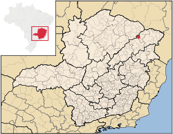
Location of Comercinho in the state of Minas Gerais

Comercinho is a municipality in the northeast of the Brazilian state of Minas Gerais. Its population in 2007 was 8,720 inhabitants in a total area of 657 km².

Comercinho belongs to the Pedra Azul statistical microregion. The elevation of the municipal seat is 614 meters. It became a municipality in 1942. This municipality is located to the southeast of Salinas on a dirt road that connects Santa Cruz de Salinas to Itinga. The closest population center with a hospital and banking facilities is Medina, a distance of about 36 km.

Neighboring municipalities are: Medina, Salinas, Santa Cruz de Salinas, Rubelita, and Itinga,

The main economic activities are cattle raising and farming. The GDP was R$27,441,000 (2005). There were no banking agencies in 2006. In the rural area there were 1,175 farms with around 3,100 people involved in the agricultural sector. There were 22 tractors, a ratio of one tractor for every 50 farms. The main crops were bananas, coffee, sugarcane, beans, manioc, and corn. In the health sector there were 3 health clinics. The score on the Municipal Human Development Index was 0.603. This ranked Comercinho 830 out of 853 municipalities in the state, with Poços de Caldas in first place with 0.841 and Setubinha in last place with 0.568. See Frigoletto for the complete list.

References

See also

Coordinates: 16°18′0″S 41°47′44″W / 16.3°S 41.79556°W / -16.3; -41.79556


Wikimedia Foundation. 2010.

Игры ⚽ Поможем написать курсовую

Look at other dictionaries:

  • Comercinho — Admin ASC 2 Code Orig. name Comercinho Country and Admin Code BR.15.3117009 BR …   World countries Adminstrative division ASC I-II

  • Муниципалитеты штата Минас-Жерайс — …   Википедия

  • Комерсинью — Муниципалитет Комерсинью Comercinho Страна БразилияБразилия …   Википедия

  • Salinas, Minas Gerais — Salinas is a municipality in the northeast of the Brazilian state of Minas Gerais. Its population in 2007 was 37,370 inhabitants in a total area of 1,897 km². Important facts and DistancesThe elevation is 471 meters. It became a municipality in… …   Wikipedia

  • Coronel Fabriciano —   Municipality   The Municipality of Coronel Fabriciano …   Wikipedia

  • Pedra Azul — Infobox City official name = Pedra Azul map caption = Location in Brazil pushpin subdivision type = Country subdivision type1 = Region subdivision type2 = State subdivision name = flagicon|BRA Brazil subdivision name1 = Southeast subdivision… …   Wikipedia

  • Liste der Gemeinden in Minas Gerais — Die untenstehenden Gemeinden liegen im brasilianischen Bundesstaat Minas Gerais. Die Zahl hinter den Namen ist die Bevölkerung im Gemeindegebiet in einer Schätzung des brasilianischen Bundesamtes für Statistik und Geographie (IBGE) für den… …   Deutsch Wikipedia

  • Liste Des Villes Du Minas Gerais — Sommaire 1 Municipalités 1.1 A B 1.2 C 1.3 D/H 1.4 I/L …   Wikipédia en Français

  • Liste des villes de Minas Gerais — Liste des villes du Minas Gerais Sommaire 1 Municipalités 1.1 A B 1.2 C 1.3 D/H 1.4 I/L …   Wikipédia en Français

  • Liste des villes du Minas Gerais — Sommaire 1 Municipalités 1.1 A B 1.2 C 1.3 D/H 1.4 I/L …   Wikipédia en Français

Share the article and excerpts

Direct link
Do a right-click on the link above
and select “Copy Link”