Miravânia

Miravânia
Location of Miravânia in the state of Minas Gerais

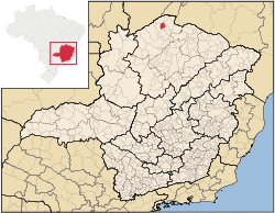
Miravânia is a municipality in the north of the state of Minas Gerais in Brazil. As of 2007 the population was 4,708 in an area of 603 km².

  • The elevation of the municipal seat is 632 meters.
  • It became a municipality in 1997
  • The postal code (CEP) is 39465-000
  • Statistical microregion: Januária

Miravânia is located on the left bank of the São Francisco River. It is connected by dirt road to São João das Missões by paved BR-135. The distance is 112 km. Neighboring municipalities are: Montalvânia, Manga, Cônego Marinho, and São João das Missões.

The economy is based on agriculture with emphasis on cattle raising. There were 10,000 head in 2006. The main agricultural crops were bananas, rice, corn, and manioc. The GDP was R$12,247,000 in 2005.

This municipality is extremely isolated from major population centers and suffers from drought and poor soils. It is one of the poorest in the state and in the country. Like many impoverished districts it fought for municipal autonomy to apply for government assistance programs.

  • Municipal Human Development Index: .644 (2000)
  • State ranking: 761 out of 853 municipalities as of 2000
  • National ranking: 3,857 out of 5,138 municipalities as of 2000

(For the complete list see Frigoletto)

  • Infant mortality rate: 46.15 (2003) The rate for Minas Gerais was 17.40; the rate for Brazil was 18.91.
  • Illiteracy rate: 31% (15 years old or older)(2003) The rate for Minas Gerais was 11.96; the rate for Brazil was 13.63
  • Health clinics: 2

References

See also

Coordinates: 14°44′58″S 44°23′56″W / 14.74944°S 44.39889°W / -14.74944; -44.39889


Wikimedia Foundation. 2010.

Игры ⚽ Нужно решить контрольную?

Look at other dictionaries:

  • Miravania — Admin ASC 2 Code Orig. name Miravânia Country and Admin Code BR.15.3142254 BR …   World countries Adminstrative division ASC I-II

  • Муниципалитеты штата Минас-Жерайс — …   Википедия

  • Миравания — Муниципалитет Миравания Miravânia Страна БразилияБразилия …   Википедия

  • Coronel Fabriciano —   Municipality   The Municipality of Coronel Fabriciano …   Wikipedia

  • Januária — Januária, known as The Queen of the Beautiful Waters is a city and municipality in northern Minas Gerais state, Brazil. It is located on the left bank of the São Francisco River. The population was 64,985 inhabitants (IBGE 2007)and the area of… …   Wikipedia

  • São João das Missões — is a municipality in the north of the Brazilian state of Minas Gerais. As of 2007 the population was 10,769 in a total area of 675 km². The elevation is 501 meters. It became a municipality in 1997. São João das Missões is part of the statistical …   Wikipedia

  • Cônego Marinho — Location of Cônego Marinho in the state of Minas Gerais Cônego Marinho is a municipality in the north of the state of Minas Gerais in Brazil. As of 2007 the population was 6,279 in an area of 1,618 km². The elevation of the municipal seat is 637… …   Wikipedia

  • Manga, Minas Gerais — Location of Manga in the state of Minas Gerais Manga is a municipality in the north of the state of Minas Gerais in Brazil. As of 2007 the population was 20,903 in an area of 1,968 km². The elevation of the municipal seat is 445 meters. It became …   Wikipedia

  • Liste der Gemeinden in Minas Gerais — Die untenstehenden Gemeinden liegen im brasilianischen Bundesstaat Minas Gerais. Die Zahl hinter den Namen ist die Bevölkerung im Gemeindegebiet in einer Schätzung des brasilianischen Bundesamtes für Statistik und Geographie (IBGE) für den… …   Deutsch Wikipedia

  • Liste Des Villes Du Minas Gerais — Sommaire 1 Municipalités 1.1 A B 1.2 C 1.3 D/H 1.4 I/L …   Wikipédia en Français

Share the article and excerpts

Direct link
Do a right-click on the link above
and select “Copy Link”