- Carmo do Rio Claro
Infobox City
official_name = Carmo do Rio Claro
nickname = Carmo
motto = Fluctuat, nec mergitur
imagesize =
image_caption =
image_
mapsize =
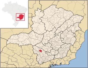
map_caption = Location in SouthweastMinas Gerais
pushpin_
subdivision_type = Country
subdivision_type1 = Region
subdivision_type2 = State
subdivision_name =Brazil
subdivision_name1 = Southeast
subdivision_name2 =Minas Gerais
leader_title =Mayor
leader_name = Angelo Leite Pereira
area_magnitude = 1 E8
area_total_km2 =1064.790
area_total_sq_mi =
area_land_km2 =
area_land_sq_mi =
area_water_km2 =
area_water_sq_mi =
area_water_percent =
area_urban_km2 =
area_urban_sq_mi =
area_metro_km2 =
area_metro_sq_mi =
population_as_of =2006
population_note =
population_total = 21.404
population_metro =
population_urban =
population_density_km2 = 20.1
population_density_sq_mi =
timezone =UTC-3
utc_offset = -3
timezone_DST =UTC-2
utc_offset_DST = -2
latd= 20
latm= 58
lats= 23
latNS= S
longd= 46
longm= 07
longs= 08
longEW= W
elevation_m = 785
elevation_ft =
website =
footnotes =Carmo do Rio Claro is a city and municipality located in the south-west of
Minas Gerais state,Brazil . The estimated population in2004 was 21,404 inhabitants. The total area of the municipality is 1,064.790 km² and the elevation is 785 meters. The distance to the state capital,Belo Horizonte is 374 km.The characteristic vegetation of the municipality is
cerrado but there is still some gallery forest along the rivers.The climate of the municipality is classified as subtropical mesothermic, characterized by dry winters and wet summers. The average temperature in winter is approximately 16°C and the average of the hottest month is about 27°C. The period between December and February is the rainiest. The driest months are from April to September
Carmo do Rio Claro is watered by the Furnas Dam.
Carmo do Rio Claro is part of the
Guaxupé diocese.History and Economy
Its believed that the initial core of the town occurred during the Bandeiras with José Barbosa de Arruda and Domingos Ferreira de Avelar, reminiscents of the Lourenço Castanho Bandeira's, known for having expulsed the natives
Cataguases from the region of Tamanduá (Itapecerica).Initially with the help of locals, José Joaquim Santana, built in his lands a small chapell in the place where today is the main church Igreja Matriz de Carmo do Rio Claro. The freguesia de Nossa Senhora do Carmo do Monte do Rio Claro was created in 1810, in the lands inside the Princess Campaign area, to be later, 1814, included to the
Jacuí municipality.The fertility of its lands propitiated the development of great farms, economic basis of the town, which in 1848 started to be part of
Passos .External links

Wikimedia Foundation. 2010.