- Dolgy Island
-
Coordinates: 69°15′00″N 59°04′01″E / 69.250°N 59.067°E
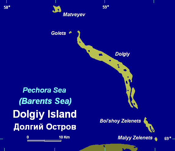
 Dolgy and its adjacent small islands
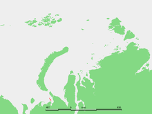 Location of Dolgy Island in the Pechora Sea
Dolgy Island (Russian: остров До́лгий) is an island in the Pechora Sea, east of the Khaypudyr Bay. Long and narrow, this island is 38 kilometres (24 mi) in length, with an average width of 2.8 kilometres (1.7 mi). It stretches roughly from north-west to south-east and there are smaller islands at both of its ends, Matveyev Island in the north and Bolshoy Zelenets and Maly Zelenets in the south, which are a prolongation of the same submarine structure.
Dolgy Island's southern tip is only 12 kilometres (7.5 mi) from the mainland. This island is administratively a part of Nenets Autonomous Okrug, an autonomous okrug of Arkhangelsk Oblast.
This island should not be confused with other islands called "Dolgy", one of which is located in the Barents Sea itself in the bay southeast of Khodovarikha and the other in Karelia. Dikson Island was also formerly called "Dolgy".
History
Stepan Malygin undertook a voyage starting from Dolgy Island in 1736-1737. There were two ships in this early expedition, the Pervy, under Malygin and the Vtoroy under the command of captain A. Skuratov. After entering the little-explored Kara Sea, they sailed to the mouth of the Ob River.
Malygin took careful observations of these hitherto almost unknown areas of the Russian Arctic coastline. With this knowledge he was able to draw the first somewhat accurate map of the Arctic shores between the Pechora River and the Ob River.
References
- Albert Hastings Markham, Arctic Exploration 1895
- Location
- Leonid Sverdlov, (Member of the Russian Geographic Society), Russian Naval Officers and Geographic Exploration in Northern Russia.
- C. Raymond Beazley, The Russian Expansion Towards Asia and the Arctic in the Middle Ages (to 1500). The American Historical Review
See also
- History of the Northern Sea Route
- Stepan Malygin
Islands of the Barents Sea Barentsøya · Berkha Island · Bear Island · Dolgy Island · Edgeøya · Gorbovy Island · Hopen · Kharlov Island · Kildin Island · Kolguyev · Kongsøya · Kvitøya · Lumbovskiy Island · Mezhdusharsky Island · Morzhovets Island · Nordaustlandet · Novaya Zemlya · Pankratyev Island · Pinyegin and Kazimov Islands · Prince Charles Forland · Sengeyskiy Island · Severny Island · Spitsbergen · Svenskøya · Vaygach Island · Wilhelmøya · Yuzhny IslandCategories:- Islands of Russia
- Nenets Autonomous Okrug
- Islands of the Barents Sea

Wikimedia Foundation. 2010.