- Culgaith
-
Coordinates: 54°39′00″N 2°36′00″W / 54.650°N 2.600°W
Culgaith 
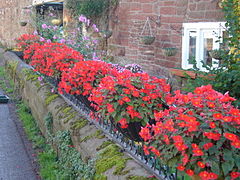
An old Cumbrian farmhouse in Culgaith
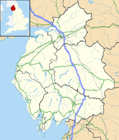
 Culgaith shown within Cumbria
Population 721 (2001) OS grid reference NY6129 Parish Culgaith District Eden Shire county Cumbria Region North West Country England Sovereign state United Kingdom Post town PENRITH Postcode district CA10 Dialling code 01768 Police Cumbria Fire Cumbria Ambulance North West EU Parliament North West England UK Parliament Penrith and the Border List of places: UK • England • Cumbria Culgaith is a village and civil parish in the Eden District of Cumbria, England. It is located on the River Eden between Temple Sowerby and Langwathby. Amenties include All Saints Church,[1] and its associated primary school,[2] as well as a pub and garden centre. The village had a railway station which closed in 1970.
Canadaian politician Matthew Kendal Richardson was born in Culgaith.[3]
References
External links
Ceremonial county of Cumbria Cumbria Portal Boroughs or districts City of Carlisle • Borough of Allerdale • Borough of Barrow-in-Furness • Borough of Copeland • District of Eden • District of South LakelandMajor settlements Alston • Ambleside • Appleby-in-Westmorland • Aspatria • Barrow-in-Furness • Bowness-on-Windermere • Brampton • Broughton-in-Furness • Carlisle • Cleator Moor • Cockermouth • Dalton-in-Furness • Egremont • Grange-over-Sands • Harrington • Kendal • Keswick • Kirkby Lonsdale • Kirkby Stephen • Longtown • Maryport • Millom • Penrith • Sedbergh • Silloth • Ulverston • Whitehaven • Wigton • Windermere • Workington
See also: List of civil parishes in CumbriaTopics Demography • Economy • Education • Geography • History • People • Places of interest • Settlements • Sport • Symbols and county emblems • TransportCategories:- Cumbria geography stubs
- Villages in Cumbria
- Civil parishes in Cumbria
- Eden, Cumbria
Wikimedia Foundation. 2010.

