- Unanderra
-
Unanderra- Moss Vale 
Mode Coach service Owner RailCorp Operator(s) CityRail Road Coach
3801 LimitedConnects Wollongong
Dapto
Bowral
BundanoonStations 9 Line colour Blue Key dates 1932 Rail line opened 1990s Passenger service replaced with coach service The Unanderra – Moss Vale railway line is a cross country railway line in New South Wales, Australia. The line branches from the Illawarra (South Coast) railway line at the town of Unanderra and winds west over the Illawarra escarpment to the Southern Highlands town of Moss Vale. The line is one of the most scenic in New South Wales, and for the first 20 km after leaving Unanderra has an almost continuous grade 1 in 30 providing spectacular view over the Illawarra coastline.[1]
Contents
Course
Unanderra - Moss Vale Line Line Legend
From Unanderra on the Illawarra (South Coast) Line 
Summit Tank 
Mount Murray Ocean View Ranelagh House Robertson Burrawang Calwalla 
to Moss Vale on the Main South line The length of the line is 57 kilometres, and is double track from Unanderra to Dombarton. The line is single track thereafter with several crossing loops. The double track section was built as part of the now abandoned Maldon to Dombarton railway line, and unfinished staunchions line this section as part of the proposed electrification.
The line connects the following current and former passenger stations:[2]
- Unanderra - junction with Illawarra line.
- Dombarton - end of double line (formerly the site of an unusual crossing arrangement[3])
- Summit Tank (platform only) (crossing loop)
- Mount Murray (closed) (crossing loop reopened 1980s)
- Ocean View (closed 1968)
- Ranelagh House (platform only)
- Robertson (platform) (crossing loop)
- Burrawang (closed 1975)
- Calwalla (closed 1976) (crossing loop reopened 1980s)
- Moss Vale - triangular junction with Main South line.
History
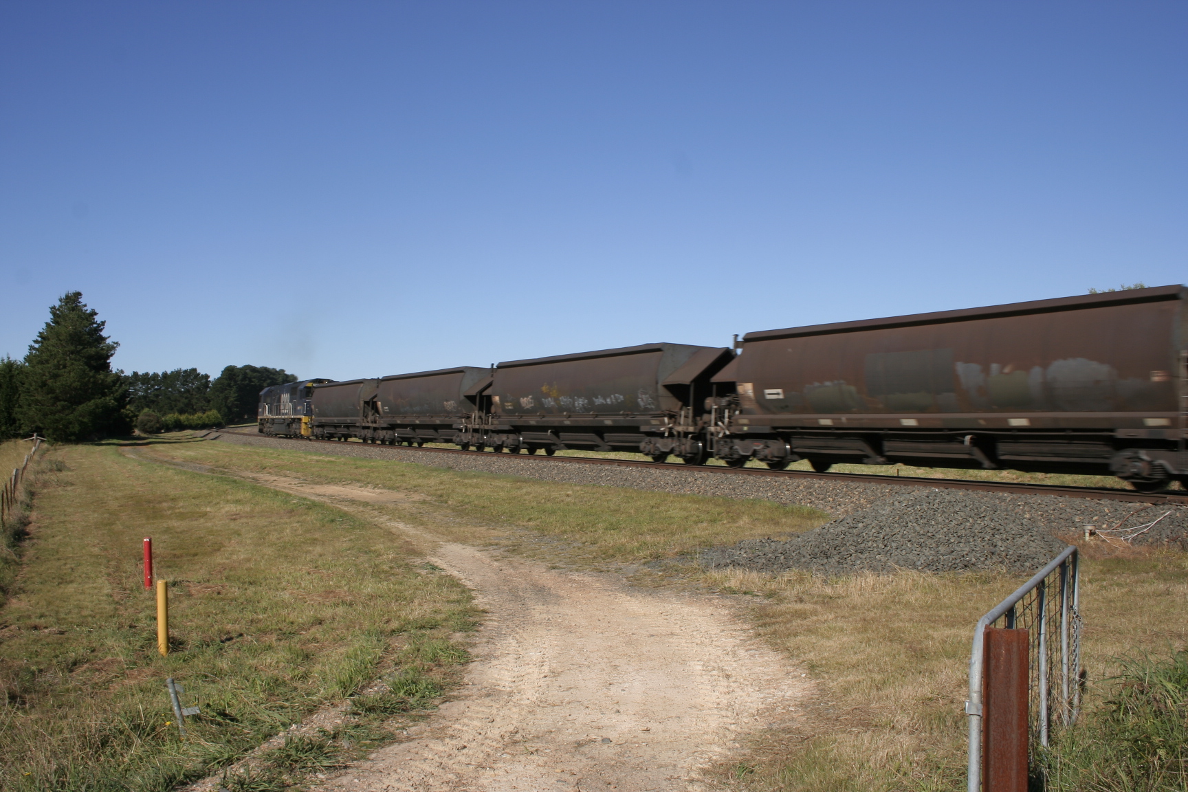
 Unanderra-Moss Vale line at Sheepwash Road
The line was first proposed in the 1880s by residents of Moss Vale and local industry keen for a connection to the port at Port Kembla. Construction began on 26 June 1925, and was completed on 20 August 1932.[4]
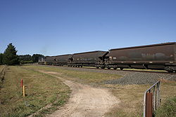
The line initially carried mainly limestone from the Marulan Quarry to Port Kembla Steelworks, but also vegetables from Robertson to Sydney and later, coal. Daily steam-hauled passenger trains operated from 1932, which were later replaced by diesel hauled trains, then rail-motors.
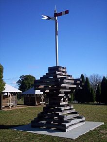 Memorial to workers on the Unanderra-Moss Vale railway (1927-32) in Robertson, New South Wales
A weekend excursion train operated until the early 1990s, prior to its replacement by the privately operated Cockatoo Run steam hauled weekend tourist train. This train, operated by 3801 Limited continues to operate to the present day but is hauled by a diesel electric locomotive. Limestone freight continues to be hauled, and the line remains a valuable freight link to the Wollongong area and a useful bypass line when engineering works close the Main South Line. Occasionally, when there is trackwork on the Southern Highlands Line, CountryLink XPT services from Melbourne may operate via this line, and continue to Central via the South Coast Line. [5]
Services
CityRail road coach service is now provided in lieu of the former rail service. The service stops at Wollongong, Dapto and Albion Park railway stations; bus stops on Hoddle Street in both Burrawang and Robertson; then at Bowral, Moss Vale, Exeter and Bundanoon railway stations.
Maldon-Dombarton Line
State Rail began construction of a line connecting Maldon, on the Southern Highlands line near Picton, with Dombarton near Port Kembla. The project would have created the longest tunnel in Australia: the 4-km Avon Tunnel. Part of the incomplete tunnel, as well approaches to a bridge over the Cordeaux River, are visible today.[6]
A pre-feasibility report into completing the line was conducted by the Commonwealth Government and found the project could be viable.[7] Following the report a full feasibility study was conducted.[8] The feasibility study has finished but has not yet been released. A spokesperson for NSW Infrastructure and Transport Minister Anthony Albanese said the study would be released when "properly considered".[9]
Deviation
A section of the line was deviated in the 1960s to avoid the site of a new lake built for water supply and power generation purposes.
References
- ^ Singh-Sidhu, Daniel; Dennis Rittson, John Crudine, Tony Gatt. "Dombarten-Moss Vale". Railpix Australia. http://railpix.railmedia.com.au/index.php?page=dombarton. Retrieved 2006-12-07.
- ^ Bozier, Rolfe; et al.. "Unanderra - Moss Vale Line". NSWrail.net. http://www.nswrail.net/lines/show.php?name=NSW:unanderra_moss_vale. Retrieved 2006-12-13.
- ^ Dombarton Crossing Station Australian Railway Historical Society Bulletin, August, 1943 pp15-16
- ^ The Unanderra to Moss Vale Line Jacobson, O.F. Australian Railway Historical Society Bulletin, February, 1972 pp25-48
- ^ Wollongong City Council. "Kembla Grange History". Wollongong City Council. Archived from the original on 2006-09-19. http://web.archive.org/web/20060919150337/http://www.wollongong.nsw.gov.au/library/localinfo/kemblagrange/history.html. Retrieved 2006-12-07.
- ^ Bozier, Rolfe; et al.. "Dombarton - Maldon Line". NSWrail.net. http://www.nswrail.net/lines/show.php?name=NSW:dombarton_maldon. Retrieved 2006-12-13.
- ^ "Maldon to Dombarton Freight Rail Line Pre-feasibility Study". Nation Building Program. http://www.nationbuildingprogram.gov.au/projects/ProjectDetails.aspx?Project_id=rail003. Retrieved 2009-10-16.
- ^ "Maldon to Dombarton Rail Link Feasibility Study". Nation Building Program. http://www.nationbuildingprogram.gov.au/projects/ProjectDetails.aspx?Project_id=RAIL016. Retrieved 2010-12-21.
- ^ Hasham, Nicole (26 September 2011). "Maldon-Dombarton study with Anthony Albanese". Illawarra Mercury. http://www.illawarramercury.com.au/news/local/news/general/maldondombarton-study-with-anthony-albanese/2303088.aspx. Retrieved 17 October 2011.
Railway Lines in New South Wales 
Main lines Broken Hill Line · Main North Line · Main South Line · Main West Line · North Coast Line · South Coast Line
Country branch lines Berrima Line • Binnaway-Werris Creek Line • Blayney-Demondrille Line • Boggabilla Branch • Bombala Line • Canberra Branch • Cobar Branch • Coonamble Branch • Grenfell Branch • Gwabegar Line • Hay Branch • Lake Cargelligo Branch • Medway Quarry Branch • Mungindi Line • Naradhan Branch • Newcastle branch • Oaklands Branch • Parkes to Narromine Line • Picton - Mittagong loop • Pokataroo Branch • Sandy Hollow - Gulgong Line • South Maitland Railway • Stockinbingal - Parkes Line • Temora to Roto Line • Tottenham Branch • Troy Junction - Merrygoen Line • Unanderra - Moss Vale Line • Walgett Branch • Warren Branch • Yanco - Griffith Line
Closed: Ballina line • Barraba line • Belmont line • Boorowa branch • Brewarrina Line • Burcher Branch • Camden Branch • Captains Flat Branch • Corowa Branch • Crookwell line • Dorrigo Line • Eugowra branch • Holbrook Branch • Kunama (Batlow) Branch • Kywong Branch • Merriwa line • Molong to Dubbo line • Morpeth line • Mount Hope line • Murwillumbah Branch • Newnes line • Oberon Line • Rand Branch • Rankins Springs Branch • Richmond Vale Railway • Taralga Branch • Tocumwal line • Toronto Line • Tumbarumba Line • Tumut Branch •Wallsend Branch • Westby Branch
Sydney lines Main Suburban Line • City Circle
Airport Line • Bankstown Line • Carlingford Line • Cumberland Line • Cronulla Line • Eastern Suburbs Line • East Hills Line • Epping to Chatswood Line • Illawarra Line • Inner West Line • North Shore Line • Northern Line • Olympic Park Line • Richmond Line • South Line • Western Line
Goods only: Metropolitan Goods Line • Southern Sydney Freight Line
Closed: Camden Line • Kurrajong Line • Rogans Hill Line • Ropes Creek Line • Royal National Park Line • Sandown Line
Interurban and regional passenger services Blue Mountains Line • Hunter Lines • Newcastle & Central Coast Line • South Coast Line • Southern Highlands Line
Proposed or under construction Tourist & heritage railways Glenreagh Mountain Railway • Lachlan Valley Railway • Richmond Vale Railway • Skitube • Zig Zag Railway
Categories:- Regional railway lines in New South Wales
- CityRail
- Wollongong
- Standard gauge railways in Australia

Wikimedia Foundation. 2010.