- Cobridge
-
Coordinates: 53°02′20″N 2°11′12″W / 53.038950°N 2.1866649°W
Cobridge 
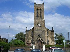
Christ church
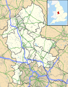
 Cobridge shown within Staffordshire
OS grid reference SJ875490 Shire county Staffordshire Region West Midlands Country England Sovereign state United Kingdom Post town STOKE-ON-TRENT Postcode district ST1 Dialling code 01782 Police Staffordshire Fire Staffordshire Ambulance West Midlands EU Parliament West Midlands List of places: UK • England • Staffordshire Not to be confused with Corbridge.Cobridge is an area of Stoke-on-Trent in the county of Staffordshire, England. Cobridge has a Holdcroft (car dealer) centre on Sneyd Street,[1] a community centre[2] and a C of E church called Christ Church on Emery Street[3][4] which is Grade II listed.[5] Cobridge once had a railway station on the Potteries Loop Line.[6] Cobridge was marked on the 1775 Yates map as 'Cow Bridge' and was recorded in Ward records (1843) as Cobridge Gate.[7] There was once a school in Cobridge.[8]
See also
- Athletic Ground (Cobridge)
References
- ^ Holdcraft Honda, Cobridge at Holdcroft Motors
- ^ "Map - Directions | Cobridge Community Centre | Community Centres, Stoke-On-Trent". Yell.com. http://www.yell.com/b/Cobridge+Community+Centre-Community+Centres-Stoke_On_Trent-ST63DQ-2069879/index.html. Retrieved 2011-07-08.
- ^ A Church Near You. "Christ Church, Cobridge - Staffordshire | Diocese of Lichfield". Achurchnearyou.com. http://www.achurchnearyou.com/christ-church-cobridge/. Retrieved 2011-07-08.
- ^ "Christ Church, Cobridge:: OS grid SJ8748 :: Geograph Britain and Ireland - photograph every grid square!". Geograph.org.uk. 2006-07-27. http://www.geograph.org.uk/photo/209848. Retrieved 2011-07-08.
- ^ Good Stuff IT Services (1993-03-15). "Christ Church - Stoke On Trent - Staffordshire - England". British Listed Buildings. http://www.britishlistedbuildings.co.uk/en-384380-christ-church-stoke-on-trent. Retrieved 2011-07-08.
- ^ "Latest News and Information on Cobridge Railway Station". Eastgrinsteadliving.info. http://www.eastgrinsteadliving.info/products/Cobridge-Railway-Station.html. Retrieved 2011-07-08.
- ^ "Cobridge - Stoke-on-Trent Districts". Thepotteries.org. 2008-01-28. http://www.thepotteries.org/location/districts/cobridge.htm. Retrieved 2011-07-08.
- ^ "Cobridge - Stoke-on-Trent Districts". Thepotteries.org. http://www.thepotteries.org/location/districts/cobridge1.htm. Retrieved 2011-07-08.
External links
- Cobridge Station at thepotteries.org
- History of Cobridge, in Stoke on Trent and Staffordshire | Map and description at A Vision of Britain through Time
- Images for SJ8748 at Geograph Britain and Ireland
- Cobridge - 'the changing face of Cobridge' at thepotteries.org
- Cobridge streets at thepotteries.org
- Cobridge, Staffordshire at the FamilySearch Research Wiki
- Christ Church, Cobridge at Hanley Team Ministry
Categories:- Areas of Stoke-on-Trent
- Geography of Staffordshire
- Staffordshire geography stubs
Wikimedia Foundation. 2010.

