- Chojolom
-

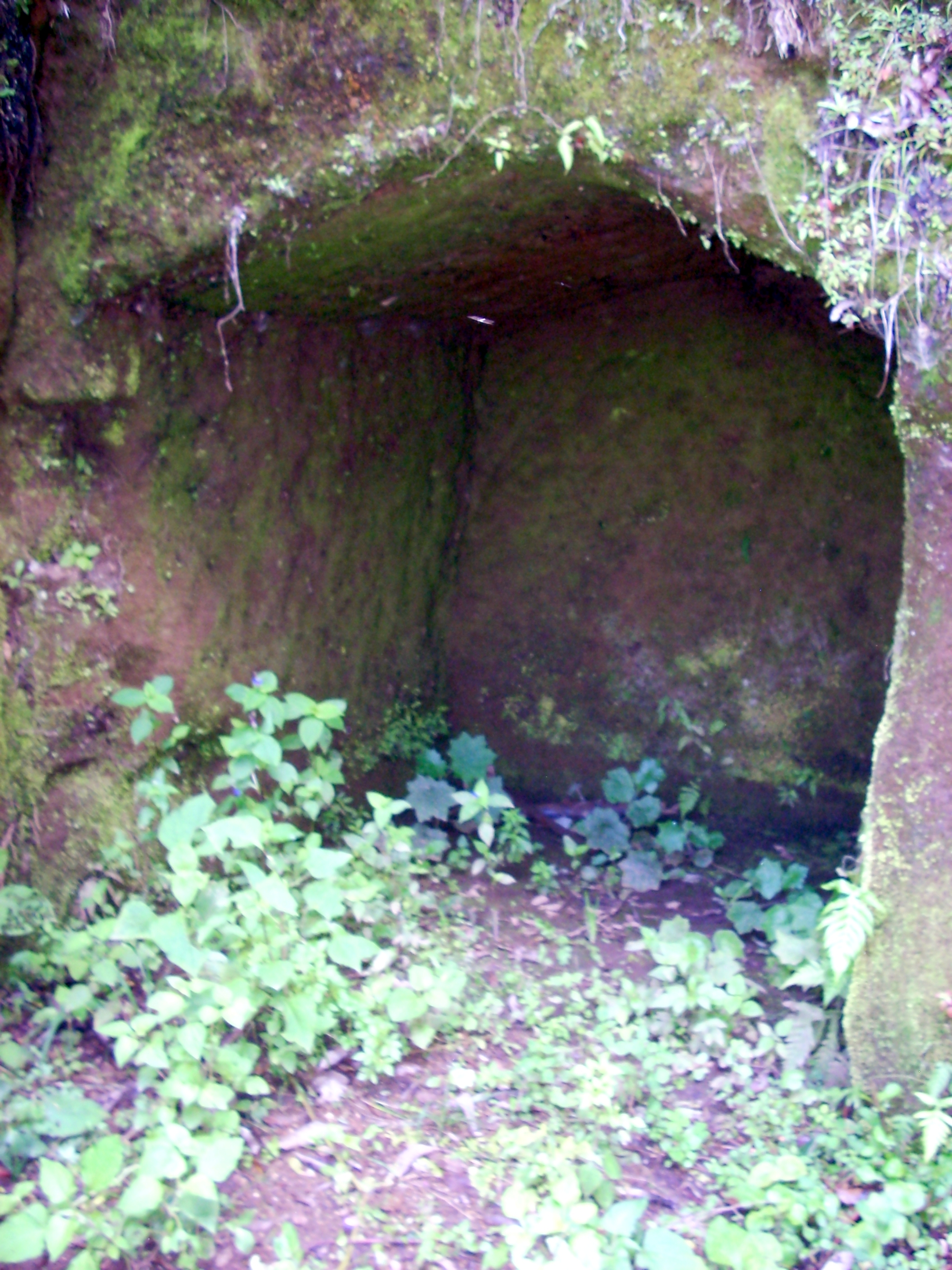
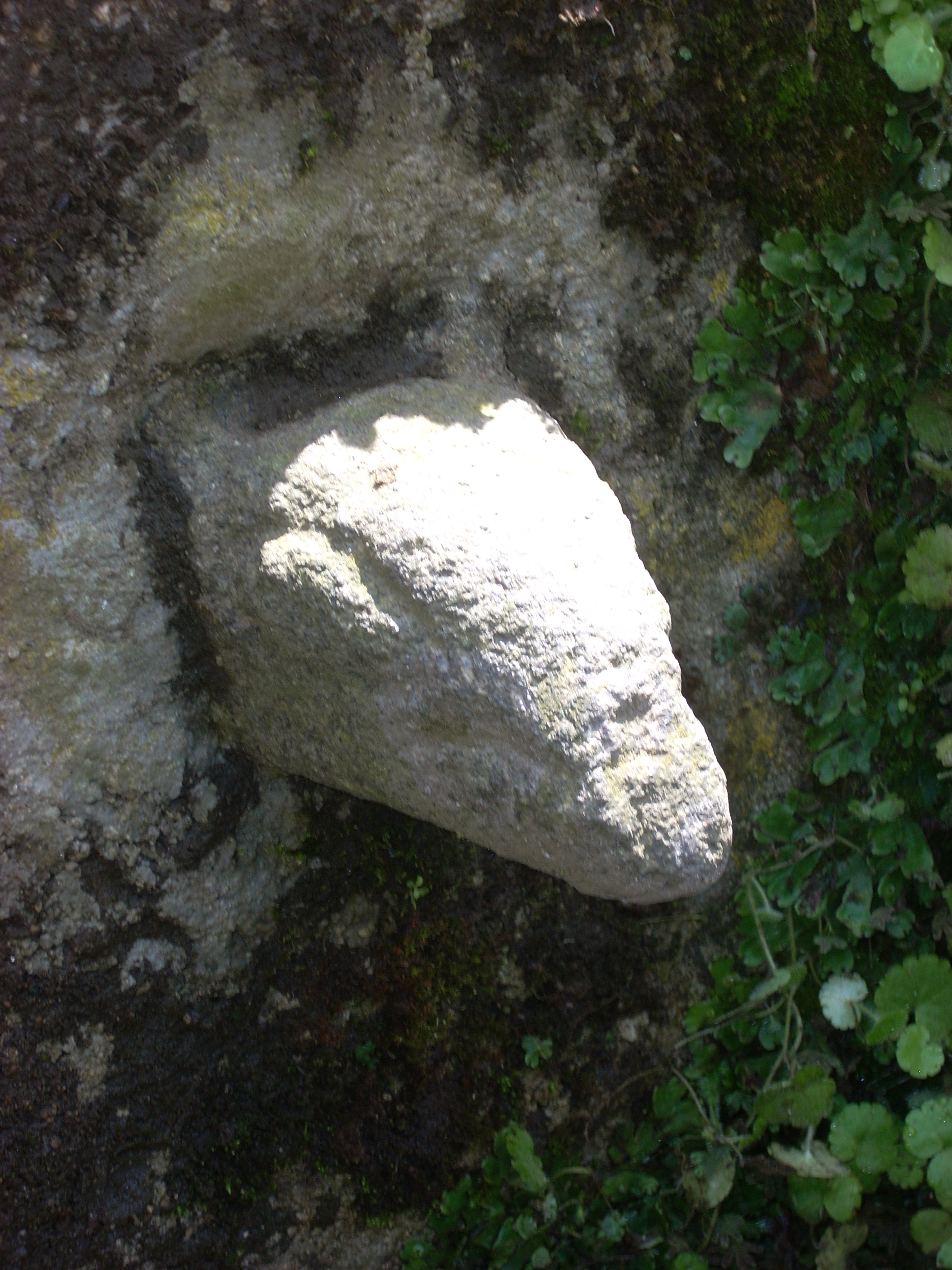
 Artificial cave where one of the stone heads was found
Chojolom is a small Maya archaeological site in the western highlands of Guatemala. The site features a number of sculpted stones that are presumed to belong to the K'iche Maya culture of the Postclassic Period (approximately AD 900–1520).[2] Chojolom is situated on a hill in the municipality of Cantel, in the department of Quetzaltenango.[3] The municipality is inhabited by K'iche' Maya to this day, who make up 93.8% of the local population.[4] Cantel is located 10 kilometres (6.2 mi) from the modern city of Quetzaltenango at Kilometer 217 on the CA2 Highway.[5] Chojolom is believed to have been a ritual site.[6]
Chojolom means "by the head" in the K'iche' Maya language, deriving from the root word jolom ("head").[7] Local historian Mariano Cornejo has speculated that the depositing of the stone heads and the naming of the hill may be linked.[8]
Contents
Sculptures
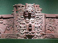
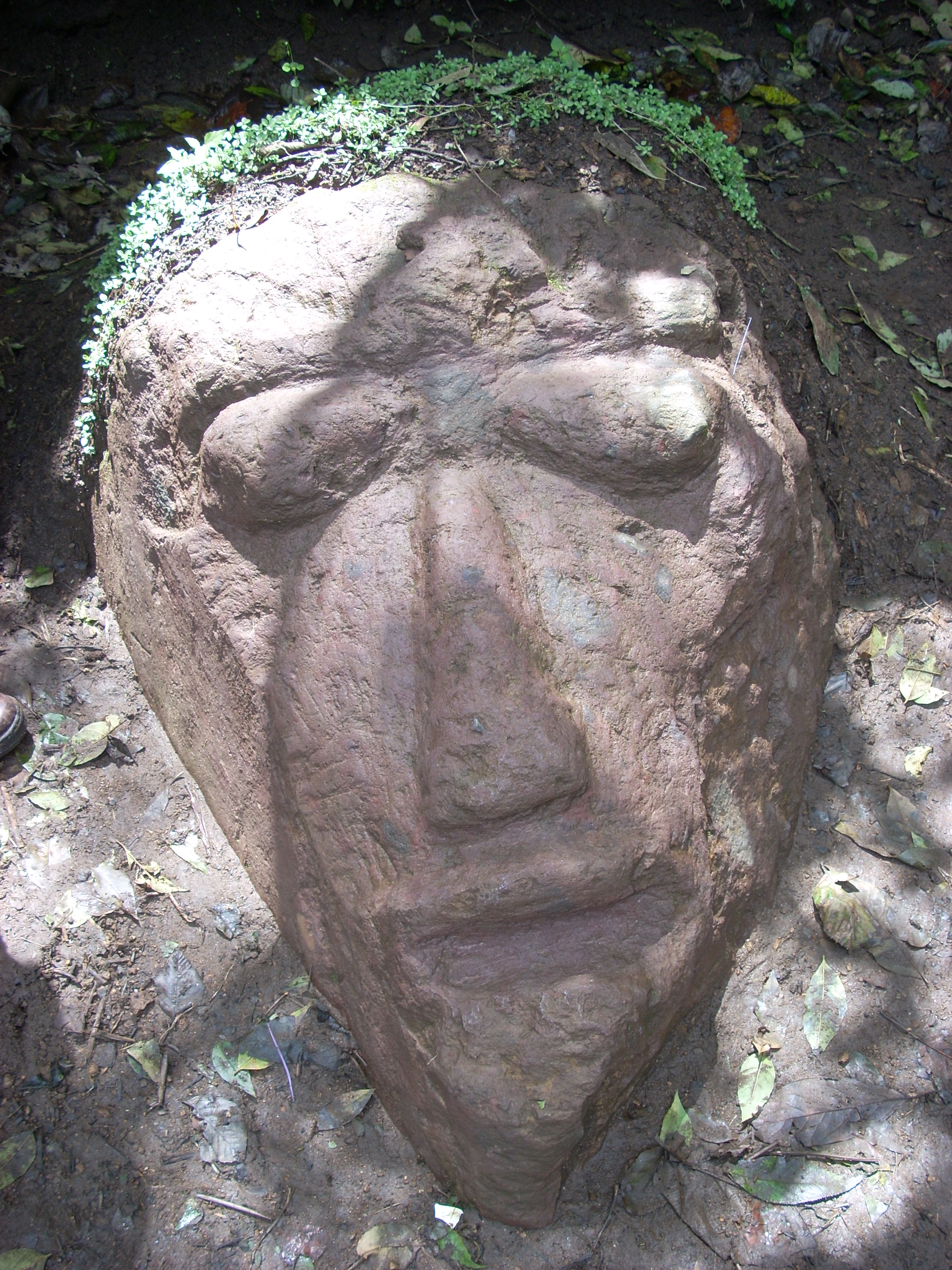
Maya civilization People · Languages · Society Religion · Mythology · Sacrifice Cities · Architecture · Calendar Stelae · Textiles · Trade Pre-Columbian Music · Writing History Preclassic Maya Classic Maya collapse Spanish conquest of Yucatán Spanish conquest of Guatemala As of September 2010 three sculpted stone heads have been found at the site; one of an armadillo, one human and one representing a deity.[9] The heads were discovered when mud was cleared away after a period of heavy rain in 2010.[10] One of the stone heads was found in a cave at the site.[11] Ceramics and bones have also been found, which may represent a ritual offering.[12] In addition to the stone heads, a clay head has also been found.[13] A minor landslide in October 2010 revealed a stone altar under a tree root.[14]
The Armadillo Head measures approximately 15 by 20 centimetres (5.9 by 7.9 in).[15] The Nine-banded Armadillo Dasypus novemcinctus is native to the Cantel region.[16] The Armadillo Head was the first of the three stone heads to have been found by local farmer Sebastián Sam.[17]
The Human Head measures 50 by 50 centimetres (20 by 20 in).[18] It was the second stone head to be discovered at Chojolom.[19]
The Deity Head is the largest sculpture, measuring 1.1 by 1.4 metres (3.6 by 4.6 ft).[20] It was the third stone head to be found at the site.[21]
The Altar measures 25 by 50 centimetres (9.8 by 20 in) and bears designs that include circles, hills, human figures and a deer.[22] The combination of six human figures with the deer has been interpreted as a Maya calendrical date by Guatemalan anthropologist Lina Barrios.[23]
Gallery
-

The Human Head sculpture
-

The Armadillo Head sculpture
Notes
- ^ Rodas 2010-09-18.
- ^ Rodas 2010-09-18.
- ^ Rodas 2010-09-18. Rodríguez Rouanet et al 1992, p.2.
- ^ Anonymous 2010-09-18. Servicio de Información Municipal.
- ^ Inforpressca, p.6.
- ^ Rodas 2010-09-18.
- ^ Rodas 2010-09-18. Christenson, p.46.
- ^ Rodas 2010-09-18.
- ^ Rodas 2010-09-18.
- ^ Rodas 2010-09-18.
- ^ Rodas 2010-09-18.
- ^ Rodas 2010-09-18.
- ^ Rodas 2010-09-18.
- ^ Rodas 2010-10-05.
- ^ Rodas 2010-09-18.
- ^ Rodas 2010-09-18. Corporación Municipal 2001, p.14.
- ^ Anonymous 2010-09-18.
- ^ Rodas 2010-09-18.
- ^ Rodas 2010-09-18.
- ^ Rodas 2010-09-18.
- ^ Rodas 2010-09-18.
- ^ Rodas 2010-10-05.
- ^ Rodas 2010-10-05.
References
-
- Anonymous (2010-09-18). "Editorial: Hallazgos en Cantel deben protegerse [Editorial: Finds in Cantel should be protected]" (in Spanish). El Quetzalteco (Quetzaltenango, Guatemala). http://www.elquetzalteco.com.gt/18.09.2010/?q=opiniones/hallazgos_en_cantel_deben_protegerse. Retrieved 2010-10-19. (Spanish)
- Corporación Municipal (2001). "Plan Estratégico de Desarollo Integral del Municipio de Cantel" (PDF). Cantel, Guatemala. http://www.inforpressca.com/cantelq/plan_estrategico.pdf. Retrieved 2010-10-19. (Spanish)
- Christenson, Allen J. "K’iche’ - English Dictionary and Guide to Pronunciation of the K’iche’-Maya Alphabet" (PDF). Foundation for the Advancement of Mesoamerican Studies, Inc. (FAMSI). http://www.famsi.org/mayawriting/dictionary/christenson/quidic_complete.pdf. Retrieved 2010-10-18.
- Inforpressca. "Diagnostico, Área Urbana Cantel. Quetzaltenango" (PDF). Guatemala: Inforpressca. http://www.inforpressca.com/cantelq/diagnostico_cabecera_municipal.pdf. Retrieved 2010-10-19.
- Rodas, Leonel (2010-09-18). "Descubren piedras antiguas [Ancient stones found]" (in Spanish). El Quetzalteco (Quetzaltenango, Guatemala). http://www.elquetzalteco.com.gt/18.09.2010/?q=breves/descubren_piedras_antiguas. Retrieved 2010-10-18. (Spanish)
- Rodas, Leonel (2010-10-05). "Descubren altar antiguo en Cantel [Ancient altar found in Cantel]" (in Spanish). El Quetzalteco (Quetzaltenango, Guatemala). http://www.elquetzalteco.com.gt/05.10.2010/?q=node/375/print. Retrieved 2010-10-18. (Spanish)
- Rodríguez Rouanet, Francisco; Fernando Seijas and Gerardo Townson Rincón (1992). Quetzaltenango. Monografías de Guatemala, 3. Guatemala: Banco Granai & Townson. OCLC 31406036. (Spanish)
- Servicio de Información Municipal. "Demografía del Municipio de Cantel, Quetzaltenango". Guatemala City: Inforpressca. http://www.inforpressca.com/cantelq/demografia.php. Retrieved 2010-10-19. (Spanish)
External links
Categories:- Maya sites
- Maya sites in Guatemala
- Archaeological sites in Guatemala
- Former populated places in Guatemala
- Quetzaltenango Department
- K'iche'
-

Wikimedia Foundation. 2010.