- Oxkintok
-
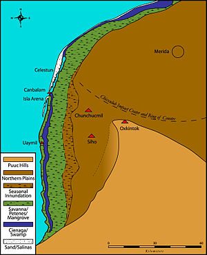
Oxkintok is a pre-Columbian Maya archaeological site on the Yucatán Peninsula, located at the northern tip of the Puuc hills - a few kilometers to the east of the modern town of Maxcanú, Yucatán, Mexico.
Contents
Etymology
In the Maya language, the name "Oxkintok" can be parsed as "Ox" (three) and "Kin" (day/sun), but there are multiple possibilities for "Tok" (if the final letter is a soft /K/ then it may mean "snatch away / defend, lean, fall, or burn", but if the final letter is truly a glottalized /K’/ then it may mean "puncture, let blood, or chert / flint / hard stone"). Different translations, based upon the various meanings of "Tok" are found in the literature.
Chronology
The site has provided evidence of habitation from the Late Preclassic through the Late Postclassic periods of Maya prehistory. However, Oxkintok became a major center between the Early Classic and Terminal Classic periods (including what Carmen Varela terms the "Middle Classic"). It is well known as possessing a very early Long Count date in AD 475 (on the lintel of Structure 6 in the "Canul" group). The latest dated monument at the site records a date in AD 859.
Architecture
The style of architecture is an interesting mix of Early, Late and Terminal Classic techniques. Some of the structures exhibit slab-vaulted masonry (indicative of the Early Classic and early Late Classic periods), while many quadrangles contain structures with veneer masonry (introduced at the end of the Late Classic and elaborated during the Terminal Classic period). The site is used as an example of the transition from traditional Classic Period architecture to Puuc Veneer masonry by George F. Andrews. Oxkintok also exhibits a type of "talud-tablero" architecture, most commonly associated with central Mexican sites such as Teotihuacan, Monte Albán and Cholula (but can also be found among certain Maya sites, such as Tikal, Kaminaljuyu and neighboring Chunchucmil, during the Middle Classic).
The most popular structure at the site is the tzat tun tzat (sometimes written Satunsat, but most commonly called "The Labyrinth"). This relatively small structure has a labyrinth of vaulted tunnels within it.
Sculpture
As already mentioned, Oxkintok is well known for its early Long Count date. However, it is also known for its anthropomorphic columns. These Late to Terminal Classic columns were sculpted to represent elites, warriors and deities – a potential precursor to the “warrior columns” of Chichen Itza and Mayapan. Notes on some of these columns were included in the pioneering work of Tatiana Proskouriakoff (see references, below).
History of research
In 1842, John Lloyd Stephens and Frederick Catherwood explored Oxkintok, including The Labyrinth. In the early 20th century, under the Carnegie project, Edwin M. Shook spent a short time at the site. Since the 1980s a long-term project directed by Miguel Rivera Dorado (of Madrid, Spain) has produced a vast amount of data on Oxkintok. Most recently, Mexico's INAH has invested in excavations and reconstructions at the site (under the direction of Ricardo Velasquez).
Modern site and tourism
The site of Oxkintok is a protected “zona”, open to visitors with an admission fee. It is accessible from the nearby town of Maxcanú, approximately 62 km (38.5mi) south of Mérida on Federal Highway 180. The site lacks facilities, but is attended by guides. Nearby attractions include the Calcehtok caves.
References
Andrews, George F. (1999) Pyramids, Palaces, Monsters and Masks: The Golden Age of Maya Architecture. Labyrinthos Press, Culvert City.
Kelly, Joyce (1993) An Archaeological Guide to Mexico's Yucatán Peninsula. University of Oklahoma Press, Norman.
Proskouriakoff, Tatiana (1950) A Study of Classic Maya Sculpture. Carnegie Institute of Washington Publication No. 593.
Rivera Dorado, Miguel (1994) Notas de arqueología de Oxkintok. In Hidden Among the Hills: Maya Archaeology of the Northwest Yucatán Península. Hanns J. Prem, ed. pp. 44–58 Acta Mesoamericana, 7 Verlag von Flemming, Möckmühl.
Rivera Dorado, Miguel (1999) La emergencia del estado maya de Oxkintok. Mayab 12:71-78 Madrid.
Rivera Dorado, Miguel (2001) Oxkintok (Yucatán, Mexico). In Archaeology of Ancient Mexico and Central America: An Encyclopedia. Susan T. Evans and David L. Webster, eds. pp. 561–562. Garland, New York
Shook, Edwin M. (1940) (English) Exploration in the ruins of Oxkintok, Yucatán. Revista mexicana de estudios antropológicos 4:165-171. Mexico
Shook, Edwin M. (1983) (Spanish) Exploración en las ruinas de Oxkintok, Yucatán. Revista mexicana de estudios antropológicos 29(1):203-210. Mexico
Stephens, John L. (1962) Incidents of Travel in Yucatán (2 vol.). University of Oklahoma Press, Norman
Varela Torrecilla, Carmen (1990) Un nuevo complejo en la secuencia cerámica de Oxkintok: El Clásico Medio. Oxkintok 3:113-126. Madrid
Varela Torrecilla, Carmen (1992) La cerámica de Oxkintok. Mayab 8:39-45. Madrid
Varela Torrecilla, Carmen, and Geoffrey E. Braswell (2003) Teotihuacan and Oxkintok: new perspectives from Yucatán. In The Maya and Teotihuacan: Reinterpreting Early Classic Interaction, edited by G. E. Braswell, pp. 249–272. University of Texas Press, Austin.
Coordinates: 20°33′37″N 89°57′14″W / 20.5603416667°N 89.95385°WCategories:- Maya sites
- Maya sites in Yucatán
- Former populated places in Mexico
Wikimedia Foundation. 2010.


