- Cerros
-
Cerros is the Mayan translation for Hills. It is also an obsolete English name for Cedros Island
Cerros Location Country:  Belize
History Excavation and maintenance Architecture 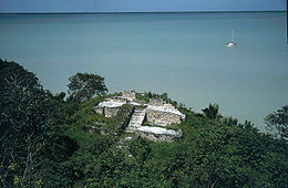

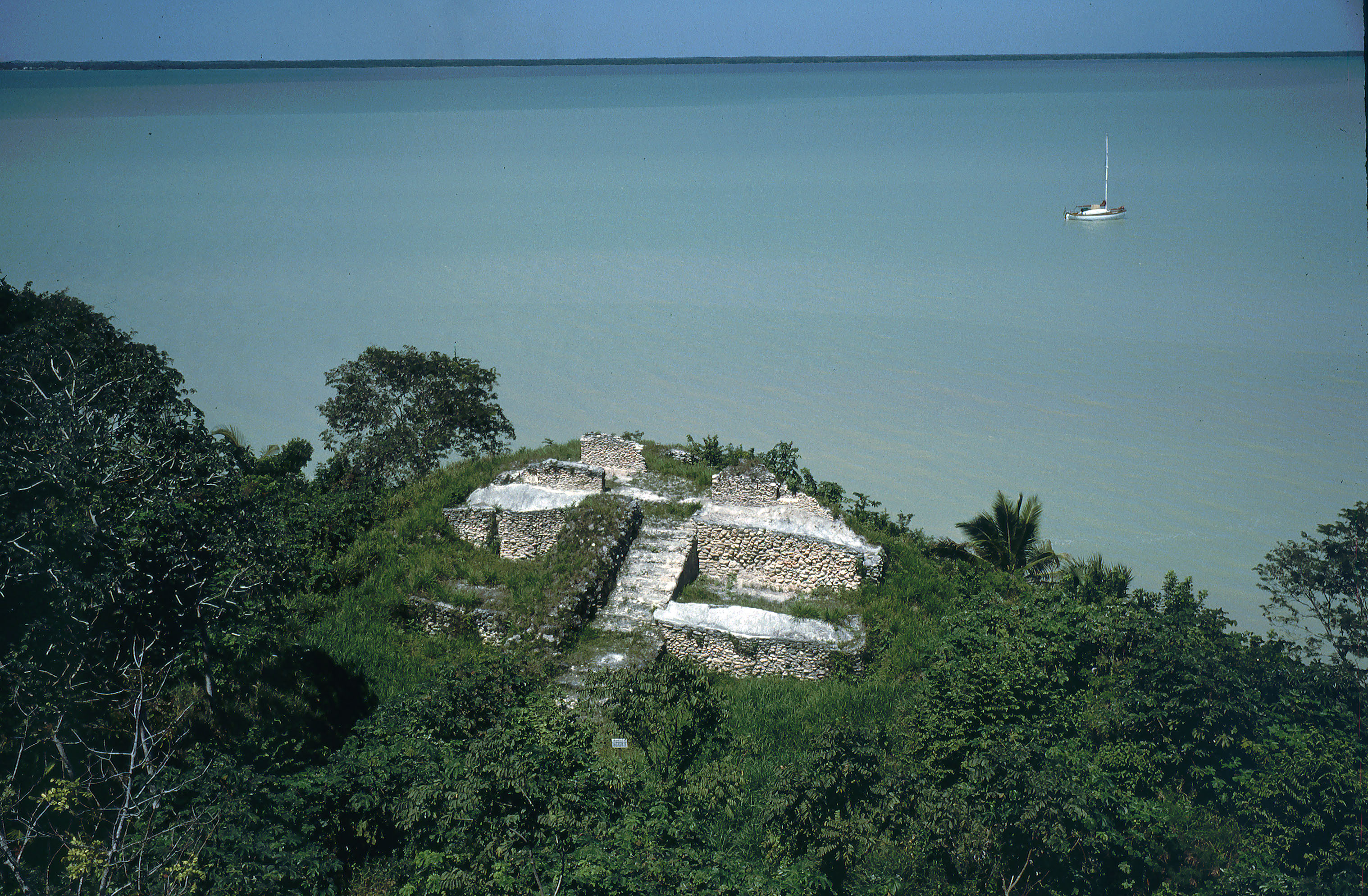
Cerros is a Maya archaeological site in northern Belize that reached its apogee during the Mesoamerican Late Preclassic. At its nadir, it held a population of approximately 1,089 people[1]. The site is strategically located on a peninsula at the mouth of the New River where it empties into Chetumal Bay on the Caribbean coast. As such, the site had access to and served as an intermediary link between the coastal trade route that circumnavigated the Yucatán Peninsula and inland communities. The inhabitants of Cerros constructed an extensive canal system and utilized raised-field agriculture.
Contents
Site organization
The core of the site immediately abuts the bay and consists of several relatively large structures and stepped pyramids, an acropolis complex, and two ballcourts. Bounding the southern side of the site is a crescent-shaped canal network that encloses the central portion of the site and encloses several raised-fields. Residential structures continue outside of the canal, generally radiating southwest and southeast; raised-fields are also present outside of the canal system.[2]
A Brief History
Maya civilization People · Languages · Society Religion · Mythology · Sacrifice Cities · Architecture · Calendar Stelae · Textiles · Trade Pre-Columbian Music · Writing History Preclassic Maya Classic Maya collapse Spanish conquest of Yucatán Spanish conquest of Guatemala From the time of its inception in the Late Preclassic Era, around 400BC, the site of Cerros was a small village of farmers, fishermen and traders [3]. They made use of its fertile soils and easy access to the sea, while producing and trading product amongst the other Maya in the area. Around 50 BC, as their economy grew and they began to experiment with the idea of kingship, the inhabitants of Cerros initiated a great urban renewal program, burying their homes to make way for a group of temples and plazas [4].
The first of the new constructions was the Structure 5C-2nd, which has become the most famous piece of architecture at the site. It marked the northernmost point of the sacred north-south axis of the site, which was complemented by a ballcourt (Str. 50) which lies at the southernmost point. As kings died, others came along and new temples were constructed in their honor. The last of the substantial constructions at the site (Str. 3A-1st) occurred around AD 100, and many of the other structures appear to have been abandoned before then. From then on, any new construction was likely limited to the outer residential area, as the population began to decline severely [5].
Apart from a small occupation at the end of the Late Classic period, Cerros has been abandoned since AD 400. This once glorious site was left for ruin and remained virtually unnoticed until Thomas Gann made reference to "lookout" mounds along the coast in 1900, drawing interest to the site[6].
Archaeology at Cerros
Archaeological work began at Cerros around 1973 when the site was purchased by the Metroplex Corporation of Dallas, who intended to build a tourist resort around the ceremonial center. Fortunately, these plans failed and the site was given to the government of Belize. In 1974, archaeologist David Freidel and his team uncovered evidence that suggested that the site was of the Late Preclassic period. In 1975, when a dedicatory offering cache was uncovered at Structure 6, further evidence was provided that Cerros was indeed a Late Preclassic site[6].
Throughout the 1970s, research was allowed to continue when the National Science Foundation funded further excavations. The original team completed their excavations in 1981.
In the 1990s, Debra Walker and a team of archaeologists began a series of new excavations to investigate the site's demise at the end of the Late Preclassic Era. In addition to the research done at the site, Walker's team also had radiocarbon dates run on newly found artifacts. They also recalibrated several dates from the original research in order to establish a tighter chronological sequence.
Architecture
Monumental Architecture
Structure 5C-2nd
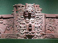
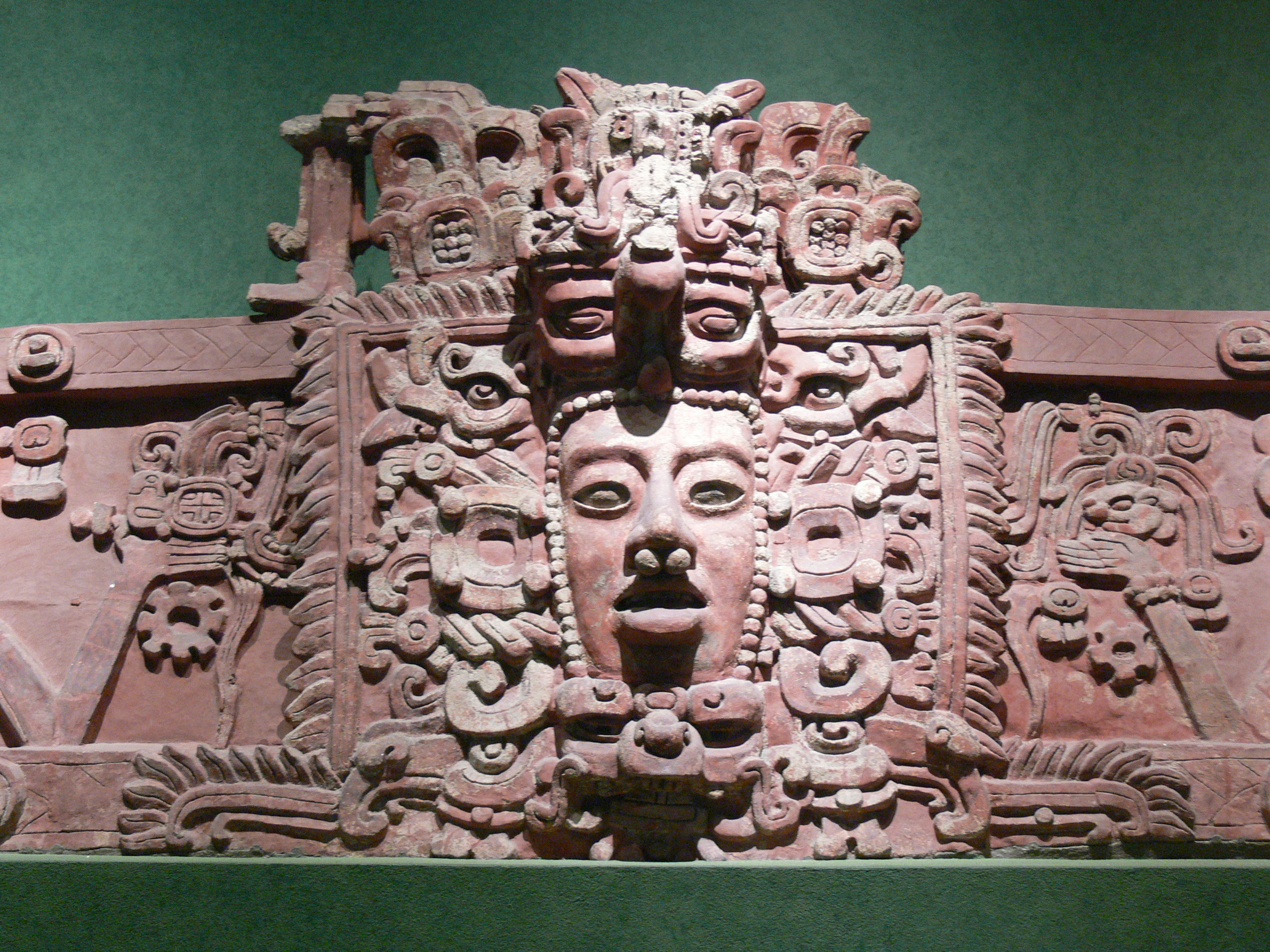
The northernmost structural complex, located adjacent to the waterline, is referred to as Structure 5C-2nd, which contains a modest size temple. Estimated to have been built around 50BC, the organization of Structure 5C–2nd adheres to that of an E-Group. Of importance are four stucco mask reliefs placed against the platform’s stepped walls which flank either side of the stairway leading up the complex’s central pyramid. Linda Schele and David Freidel have identified the two lower masks as representations of The Hero Twins of the Popol Vuh [7].
The four masks have been interpreted as follows[8]:
- The main mask on the lower right panel is a depiction of the rising sun and of Xbalanque, who is identified by a "k'in"(sun) glyph on his cheeks. He is flanked by his objects including his helmet, chin-strip and earflares. He is also identified by a glyph within the decoration surrounding his left ear flare as "yax"(first). In addition:
- The lower mask on the left is Xbalanque as well, but in the position of the setting sun
- The upper mask on the right is a depiction of Hunahpu, aka Venus or the Morningstar
- The upper mask on the left is Hunahpu as well, but in the position of the Eveningstar
Their positions are meant to represent the path that the Sun and Venus follow throughout the sky[8]. In 2005, in his piece The Creation Mountains: Structure 5C-2nd and Late Preclassic Kingship, David Freidel offers yet another interpretation of the masks. He now feels that the lower panels represent the bundled bones and funerary masks of the Maize God and his twin brother. Also in this new interpretation, the upper masks are meant to represent the gods Itzamnaaj, the God of Creation and Chaak, the God of Human Sacrifice. Together, they killed and destroyed the Maize God. It was these gods that the king impersonated when he would perform atop the structure[9].
The structure also contains four large postholes, which once were used for the placing of sacred trees, which were called world trees. The king utilized the rear area of the temple to perform private ceremonies such as fasting, bloodletting and genital perforation[10].
Structure 6
The temple known as Structure 6 is located in front of Structure 5C-2nd on the west side of the north-south axis, and faces south. Construction on this structure began somewhere around 50BC and all additional modifications were completed within 50 to 60 years[11] after. Structure 6 was built upon a large platform and formed part of a triadic pattern. This pattern was completed when two smaller buildings were later added. At 16 meters above the level of the surrounding surface, its height allowed the king more privacy to hold ceremonies, which could only be viewed by a select few. Schele and Freidel[12] postulate that the existence of such a pyramid, with its differentiated viewing spaces, indicates a high degree of social stratification among the people of Cerros.
This temple was likely constructed upon the accession of a new king. This theory is supported by the excavation of a burial cache beneath the structure 6B, which held objects believed to have belonged to the former ruler, including his Jester God diadem[13].
Structure 4
Taking its present form somewhere around AD 1, Structure 4 was built by the same ruler as Structure 6 and was located on the east side of the newly established east-west axis at Cerros. This temple was to become the largest at Cerros. The orientation of this new temple, facing east, identified it with the 2nd ruler. This structure was also meant to be the king's tomb, but was never used for reasons unknown[11].
Structure 29C
This great temple faces westward and was built to the south of the original north precinct. It is a triadic structure with three separate temple platforms on top of a greater pyramid. The small, central platform, which faces west, is adorned with carvings of jaguar heads. The sides of the two remaining temples display long-snouted masks. According to Schele and Freidel, Structure 29C was likely meant to be a war monument and was clearly associated with the north (Str. 61) and south (Str. 50) ballcourts[14].
Structure 3A
Erected around AD 100, this structure is considered to be the final temple at the site of Cerros, and is probably the last of the substantial constructions. This structure was built directly south of Structure 4, returning to the original sacred north-south axis. This temple was shoddily constructed, did not contain a burial cache, and was most likely commissioned by the last of the rulers at Cerros during the Late Preclassic period[11].
The Ballcourts
Structure 61
Structure 61 is considered to be an open ended ballcourt, which is flanked by two parallel buildings (Structure 61B, which faces the west and Structure 61C, which faces east). Both have broad, inclined benches which overlook the raised playing field and rest upon a low substructure (Str. 61A). Unlike most ballcourts, there is no upper playing wall on either building, so it is likely that the bench area was considered to be within fair play [15].
Structure 50
The Structure 50 ballcourt is considered to be identical to Structure 61 with a few exceptions [15]:
- The playing area of Structure 50 is in a sunken court, which has defined playing areas, as opposed to the open ended design of Structure 61
- Both side buildings, Structures 50C and 50E, have upper summit platforms that were probably included in the field of play
- There are two large end-zone buildings that are most likely well outside the field of play and probably served as stands for viewing the game
Residential Structures
By 1991, various areas and mounds throughout the site had been excavated; however, there were still many more that had not. The number of excavated residential areas inside the core was 18 and the number of mounds, 20. The number of excavations outside of the core area were fewer, with only 6 areas and 12 mounds. There were a total of 157 presumed areas and mounds inside and outside the core that were left untouched[16].
Subsistence at Cerros
Agriculture and Wild Plant Utilization
The Maya of Cerros made use of several raised and channeled fields around the site. One such field lies west of the Structure 50 ballcourt and was located just inside the boundary of the main canal, which surrounded the community. Inhabitants made use of the main canal, which was constructed during the C'oh Phase (200-50 BC) for crop irrigation year round. During the dry season, the canal and its branches were ponded and used for pot irrigation. During the wet season, they were used along with drainage ditches to irrigate the crops[17]. The "typical triad" of crops (maize, beans and squash) was grown at the site. According to Crane, maize cupules and/or kernels were present in approximately 75% of the samples that were taken at the site. A small number of remains of beans and squash pollen were also found[18].
Arboriculture was another important part of the Maya diet. Nance tree (Byrsonima crassifolia) seeds were found in about 40% of the samples taken. Cocoyol palm (Acrocomia mexicana) fruit seeds, Ziricote (Cordia dodecandra) and Huano (Sabal spp.) seeds were common as well[18].
Faunal Remains
A substantial amount of faunal remains have been recovered throughout the site, including various types of marine life, amphibians, reptiles, birds and mammals (both wild and domesticated). The location of the bones of these animals points to the social stratification that was present among the inhabitants of the site. In the areas attributed as residential places for commoners, faunal remains were few, and were almost uniformly of smaller animals. Conversely, the quantity and size of animal remains, in areas attributed to the elite, varied widely. Meats were more accessible to the elites of Cerros[19].
Various forms of animal procurement took place in and around the site. Marine faunal procurement was most likely the primary focus and took place in a variety of habitats. Dogs were bred for meat and were likely eaten during the winter "nortes," and during the months in which a great amount of agricultural work was done. Deer and other animals, such as peccary, pumas, jaguars and smaller mammals were hunted as well[19].
Burials and Caches
A 1979 excavation of burial groups throughout the site uncovered 26 individuals in 20 interments. The archaeologists found that both sexes were represented and that the age of the individuals ranged from infancy to mature adulthood. Also included in these burials were pottery vessels, metate fragments and chert tools[20].
A variety of artifacts were found within caches throughout the site. Structure 6B contained a dedicatory cache with a large number of offerings, including 28 jade artifacts, a few ceramic vessels, spondylus shells, mirror fragments made from specular hematite and a variety of white shell disks. Assorted smashed termination offerings were also found at Structures 2A and 5C-2nd [21].
Present-day conditions
Much of the site remains unexcavated. It is now possible to travel to Cerros over a gravel road from Corozal Town. There is an archaeological information officer on site.
Notes
- ^ Scarborough 1991:176
- ^ Sharer 1994:118-122.
- ^ Schele & Freidel 1990:98
- ^ Sharer 2005:265
- ^ Sharer 2005:267
- ^ a b Freidel 1986:xv
- ^ Freidel & Schele 1988:550
- ^ a b Freidel & Schele 1988:552
- ^ Fields, Virginia M., Dorie Reents-Budet et al. 2005:52
- ^ Schele & Freidel 1990:110
- ^ a b c Walker 2005.
- ^ Schele & Freidel 1990:118
- ^ Schele & Freidel 1990:121
- ^ Schele & Freidel 1990:125
- ^ a b Scarborough, Mitchum et al.:27
- ^ Scarborough 1991:148
- ^ Scarborough 1983:725
- ^ a b Crane 1986:148
- ^ a b Carr 1985:129
- ^ Freidel 1979:41
- ^ Garber 1983: 802
References
-
- Carr, Helen S. (1985) Subsistence and Ceremony: Faunal Utilization in a Late Preclassic Community at Cerros, Belize. Papers of the Peabody Museum of Archaeology and Ethnology, Harvard University, 77(117), pp. 115-132.
- Fields, Virginia M.; and Dorie Reents-Budet et al. (2005). Lords of Creation : The Origins of Sacred Maya Kingship. Los Angeles: Scala Publishers. ISBN 1-85759-386-3.
- Freidel, David A. (1979) Culture Areas and Interaction Spheres: Contrasting Approaches to the Emergence of Civilization in the Maya Lowlands. American Antiquity, 44(1), pp. 36-54.
- Freidel, David A. & Linda Schele (1988) Kingship in the Late Preclassic Maya Lowlands: The Instruments and Places of Ritual Power. American Anthropologist, 90(3), pp. 547-567.
- Garber, James F. (1983) Patterns of Jade Consumption and Disposal at Cerros, Northern Belize. American Antiquity, 48(4), pp. 800-807.
- Robertson, Robin A.; and David A. Freidel et al. (1986). Archaeology at Cerros Belize, Central America Vol.I, An Interim Report. Dallas, TX: Southern Methodist University Press. ISBN 0-87074-214-0 (v.1).
- Scarborough, Vernon L. (1983) A Preclassic Maya Water System. American Antiquity, 48(4), pp. 720-744.
- Scarborough, Vernon L. et al. (1982) Two Late Preclassic Ballcourts at the Lowland Maya Cetner of Cerros, Northern Belize. Journal of Field Archaeology, 9(1), pp. 21-34.
- Scarborough, Vernon L.; and David A. Freidel et al. (1991). Archaeology at Cerros Belize, Central America Vol. III, The Settlement System in a Late Preclassic System in a Late Preclassic Maya Community. 3. Dallas, TX: Southern Methodist University Press. ISBN 0-87074-307-4.
- Schele, Linda; and David Freidel (1990). A Forest of Kings: The Untold Story of the Ancient Maya. New York: William Morrow. ISBN 0-688-07456-1. OCLC 21295769.
- Sharer, Robert J.; and Loa P. Traxler (2005). The Ancient Maya 6th Edition. Palo Alto, CA: Stanford University Press. ISBN 0-80474-816-0.
- Walker, Debra S. (2005) Sampling Cerros' Demise: A Radiometric Check on the Elusive Protoclassic. FAMSI.
Coordinates: 18°21′30″N 88°21′07″W / 18.35833°N 88.35194°W
Categories:- Maya sites
- Maya sites in Belize
- Former populated places in Belize
Wikimedia Foundation. 2010.