- Cotzumalhuapa
-
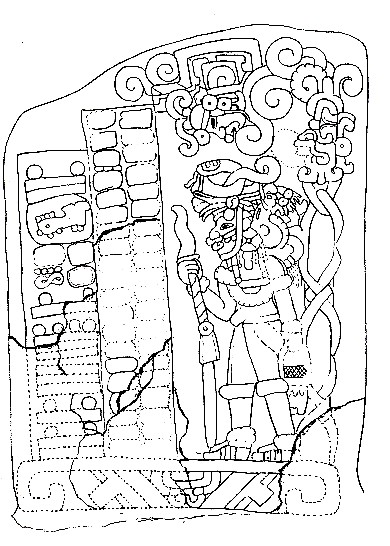
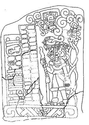 Stela 1, from El Baúl, with the Mesoamerican Long Count calendar date of 7.19.15.7.12.
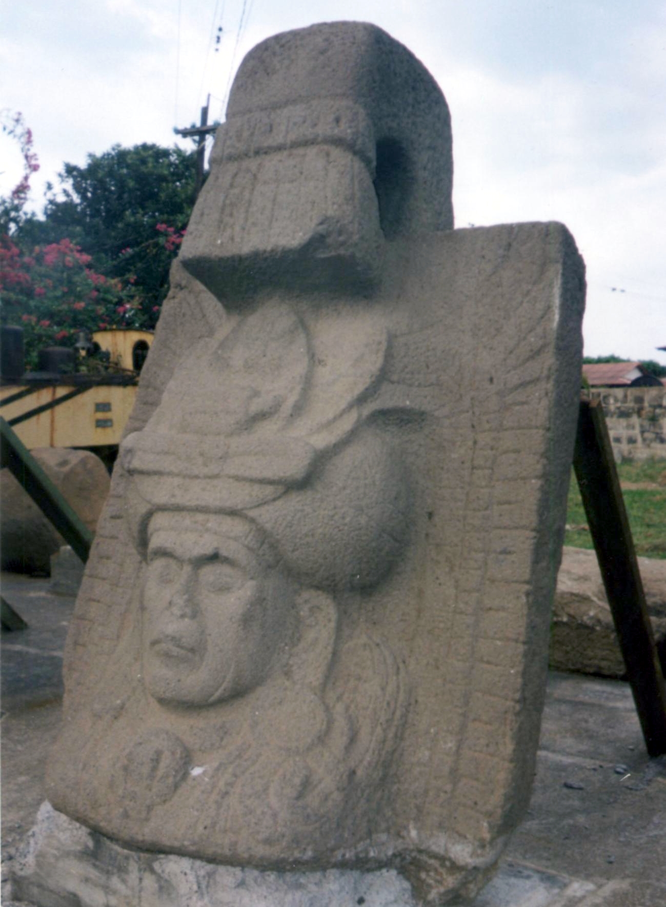
 A sculpture from El Baúl
Santa Lucía Cotzumalhuapa (or Cotzumalguapa) is the name of a pre-Columbian Maya archaeological zone dating mainly to the Late Classic period in Mesoamerican chronology, although it was occupied since the Middle Preclassic period and there is evidence of a major development during the Late Preclassic period. The famous Stela 1 from El Baúl has one of the earliest inscriptions in Mesoamerica, with the earliest legible hieroglyphic Long Count date in Guatemala: AD 37.
Cotzumalhuapa is located on the Pacific piedmont of southern Guatemala, in the department of Escuintla, on the outskirts of the modern city. During the Late Classic period, Cotzumalhuapa was a major city that extended more than ten square kilometers, encompassing three major compounds, known as El Baul, Bilbao, and El Castillo, with extensive settlements between and around them. A corpus of more than 200 monumental sculptures are known from the city and from neighboring sites that include Palo Verde, Aguna, Palo Gordo, and others. Examples of the Cotzumalhuapa sculptural style are found across the Pacific Coast and highlands of Guatemala, and into El Salvador, where Cara Sucia marks the southeastern limit of the Cotzumalhuapa zone.[1]
Contents
Location
The Cotzumalhuapa Zone is 10 km², containing not only the 3 main sites, but the minor site of Golón as well as connecting stone-paved causeways and bridges. Its main structures were made of earthen filling and carefully chosen stones. There have been found more than 200 structures and 187 sculptured monuments here dating from Pre-Classic (see Stela 1, to right, dated at 37 CE) to the Late Classic (600-1000 CE). In the Late Classic phase, El Baúl was one of the most important Pacific coast sites.
Culture
The inhabitants of Cotzumalhuapa developed an original artistic style and a writing system of their own, which found expression in a large corpus of monumental sculptures. These include rock carvings, stelae, altars, colossal heads, and sculptures, both free-standing and as a component of the architecture (e. g. carved stairs, pillars, and pavement stones). There are also numerous portable sculptures. Characteristic of the Cotzumalguapa style is an extraordinary degree of realism in the representation of human figures, which in many cases may be considered as individual portraits, possibly representing kings and nobles. In many cases, these individuals participate in complex scenes, where they interact with other human characters or with supernatural beings. Sacrificial scenes are frequent. Distinctive elements of the Cotzumalguapa style include speech scrolls shaped as vines with a variety of flowers and fruits. Hieroglyphic signs usually are inscribed in circular cartouches, but they may also acquire complex animated forms.
Influence
Cotzumalhuapa was most likely the seat of a powerful state, which exerted political control over a vast region of the Pacific coast. The diffusion of the sculptural style provides a measure of the geographic extension of Cotzumalguapa influence. The style is found along a 200 kilometer stretch of the Pacific coast, from the modern border between Guatemala and El Salvador to the department of Suchitepéquez. It also had strong presence in some regions of the Central and Eastern Highlands, particularly in the region of Antigua Guatemala. Some elements of the style are perceptible in sculptures from various sites located in Chimaltenango in the Central Highlands, the western Pacific Coastal area, and the Motagua River valley.
Footnotes
- ^ Guthrie Hingston (1989, 2003), p. 135. "Cara Sucia / El Imposible". UNESCO. http://whc.unesco.org/en/tentativelists/207/. Retrieved 13 September 2010.
References
- Chinchilla Mazariegos, Oswaldo (2000), "Cotzumalhuapa style" in Evans, Susan , Archaeology of Ancient Mexico and Central America, Taylor & Francis.
- Parsons, Lee 1969 "The Pacific Coast Cotzumalhuapa Region and Middle American Culture History" In: Verhandlungen des XXXVIII: internationalen Amerikanistenkongresses, München: K. Renner.
- Website of the Cotzumalhuapa Archaeology Project
Coordinates: 14°22′53″N 91°01′07″W / 14.38139°N 91.01861°WCategories:- Maya sites
- Maya sites in Guatemala
- Archaeological sites in Guatemala
- Former populated places in Guatemala
- Escuintla Department
- Formative period in the Americas
Wikimedia Foundation. 2010.