- Escuintla
Infobox Settlement
official_name = PAGENAME
other_name =
native_name =
nickname =
settlement_type = Municipality
motto =
imagesize =250px
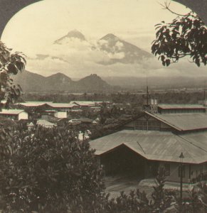
image_caption = Esquintla c.1902
flag_size =
image_
seal_size =
image_shield =
shield_size =
image_blank_emblem =
blank_emblem_type =
blank_emblem_size =
mapsize =
map_caption =
mapsize1 =
map_caption1 =
image_dot_
dot_mapsize =
dot_map_caption =
dot_x = |dot_y =
pushpin_
pushpin_label_position =bottom
pushpin_map_caption =Location in Guatemala
subdivision_type = Country
subdivision_name =
subdivision_type1 = Department
subdivision_name1 = Escuintla
subdivision_type2 =Municipality
subdivision_name2 = Escuintla
subdivision_type3 =
subdivision_name3 =
subdivision_type4 =
subdivision_name4 =
government_footnotes =
government_type = Municipal
leader_title = Mayor
leader_name = Julio Melgar
leader_title1 =
leader_name1 =
leader_title2 =
leader_name2 =
leader_title3 =
leader_name3 =
leader_title4 =
leader_name4 =
established_title =
established_date =
established_title2 =
established_date2 =
established_title3 =
established_date3 =
area_magnitude =
unit_pref =
area_footnotes =
area_total_km2 =
area_land_km2 =
area_water_km2 =
area_total_sq_mi =
area_land_sq_mi =
area_water_sq_mi =
area_water_percent =
area_urban_km2 =
area_urban_sq_mi =
area_metro_km2 =
area_metro_sq_mi =
area_blank1_title =
area_blank1_km2 =
area_blank1_sq_mi =
population_as_of =census 2002
population_footnotes = [cite web |url=http://www.ine.gob.gt/index.php?view=article&catid=42%3Ademografiaypoblacion&id=75%3Acenso2002&option=com_content&Itemid=69 |title=XI Censo Nacional de Poblacion y VI de Habitación (Censo 2002) |accessmonthday= |accessyear= |last= |first= |date=2002 |work= |publisher=Insituto Nacional de Estadística (INE) ]
population_note =
population_total =119897
population_density_km2 =
population_density_sq_mi =
population_metro =
population_density_metro_km2 =
population_density_metro_sq_mi =
population_urban =86678
population_density_urban_km2 =
population_density_urban_sq_mi =
population_blank1_title =Ethnicities
population_blank1 =
population_blank2_title =Religions
population_blank2 =Roman Catholicism ,Evangelicalism
population_density_blank1_km2 =
population_density_blank1_sq_mi =
timezone =
utc_offset =
timezone_DST =
utc_offset_DST =
latd=14 |latm=17 |lats=52 |latNS=N
longd=90|longm=47 |longs=13 |longEW=W
elevation_footnotes =
elevation_m =
elevation_ft =
postal_code_type =
postal_code =
area_code =
blank_name =
blank_info =
blank1_name =
blank1_info =
website =
footnotes =Escuintla (sometimes spelled Esquintla) is a city in south central
Guatemala . It is the capital of the Department of Escuintla and the administrative seat of Escuintla municipality.In
2003 the city had a population of about 68,000 people. It is on the border of the central highlands and the Pacific coastal plain.Economy
The city is among the more industrialized areas of the country. One of the most important agricultural products of the region is
sugar cane . Other products aretobacco ,seafood , andcattle .Transportation
Escuintla used to be an important stop for trains going to
Puerto San José until 2007. Today, the CA-2 and CA-9highways cross here.Attractions
*
Auto Safari Chapin
* Beaches
* RodeosReferences
External links
* [http://www.viajeaguatemala.com/english/Escuintla/1051016311050.htm Escuintla on prensalibre.com]
Wikimedia Foundation. 2010.

