- Upper Hutt
-
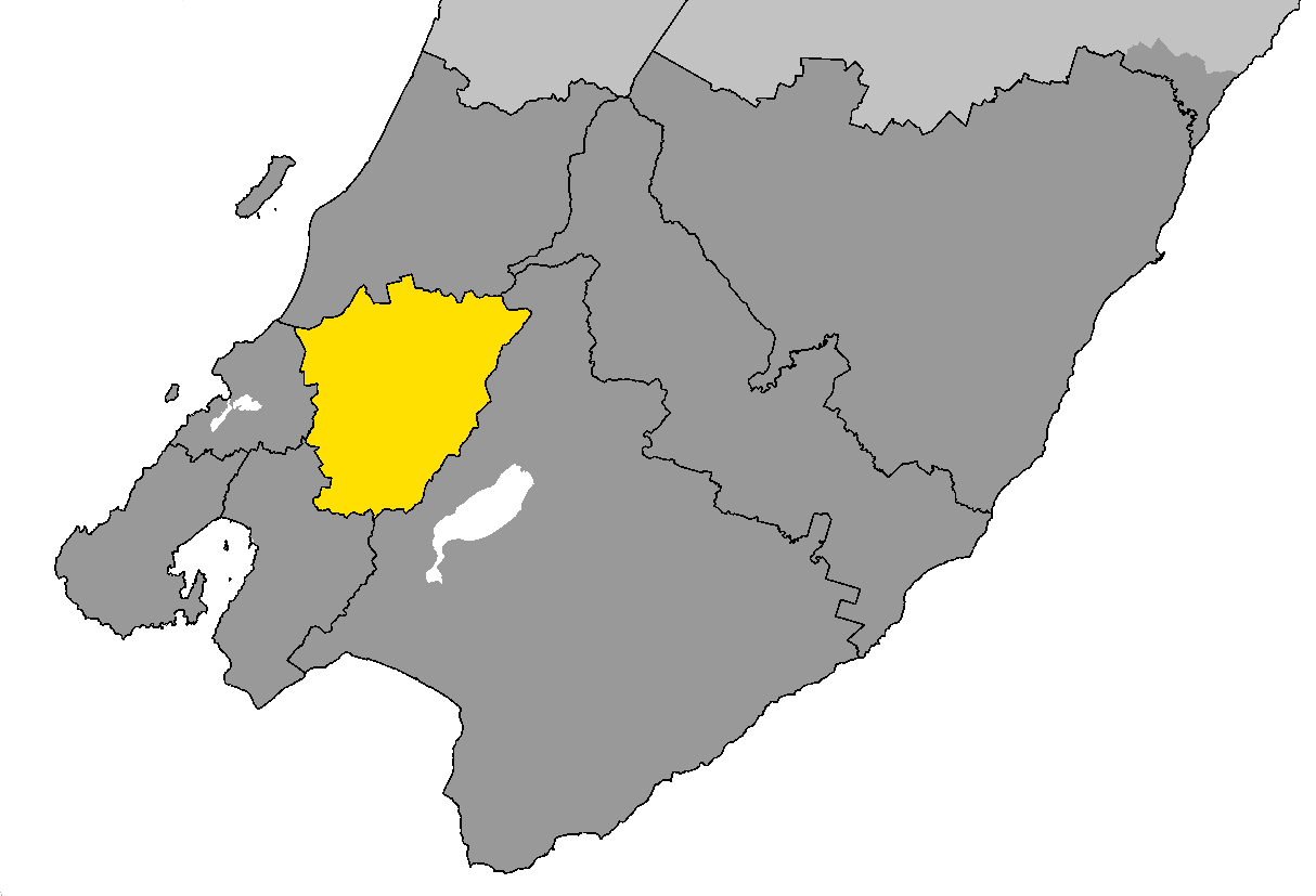
Upper Hutt — City — The location of Upper Hutt City within Wellington Region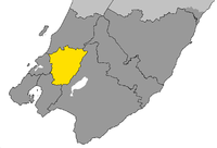
Country  New Zealand
Region Wellington Territorial Authoritiy Upper Hutt City Suburbs Te Marua, Akatarawa, Rimutaka, Parkdale, Emerald Hill, Birchville, Timberlea, Brown Owl, Kaitoke, Maoribank, Upper Hutt Central, Clouston Park, Mangaroa, Maymorn, Whitemans Valley, Totara Park, Kingsley Heights, Elderslea, Wallaceville, Trentham, Heretaunga, Silverstream, Pinehaven Government – Mayor Wayne Guppy Area – Land 540 km2 (208.5 sq mi) Population (June 2010 estimate)[1] – Territorial 41,100 – Urban 38,800 Time zone NZST (UTC+12) – Summer (DST) NZDT (UTC+13) Postcode 50xx, 53xx Area code(s) 04 Website http://www.upperhuttcity.com/ Upper Hutt (Māori: Orongomai) is a satellite city of Wellington. It is New Zealand's smallest city by population, the second largest by land area. It is in Greater Wellington.
Contents
Geography
Upper Hutt is 30 km north-east of Wellington. While the main areas of development lie along the Hutt River valley floor, the city extends to the top of the Rimutaka saddle to the north-east and into the Akatarawa Valley and rough hill-country of the Akatarawa ranges to the north and north-west, almost reaching the Kapiti Coast close to Paekakariki. Centred on the upper (northern) valley of the Hutt River, which flows north-east to south-west on its way to Wellington harbour, it widens briefly into a 2500-m-wide floodplain between the Rimutaka and Akatarawa Ranges before constricting nine kilometres further downstream at the Taita Gorge, which separates Upper Hutt from its neighbour, Lower Hutt. The city's main urban area is on this plain. A smaller flood plain lies upstream, above the Kaitoke Gorge, but there is little development on it.
Government
Upper Hutt City Council administers the city with its surrounding rural areas, parks and reserves. Its area is 540 km², the second-largest area of city council in New Zealand, after Dunedin. New Zealand local authorities with a large land area are usually termed districts, but Upper Hutt maintains its status as a city largely because of its high degree of urbanisation.
Upper Hutt was originally administered by the Hutt County Council, which was constituted in 1877. The Town Board was proclaimed on 24 April 1908. Upper Hutt became a Borough on 26 February 1926 and a City on 2 May 1966. On 1 April 1973, the Rimutaka Riding of Hutt County was added to the city. When the Hutt County Council was abolished on 1 November 1988, the city took over administration of the Heretaunga/Pinehaven ward, which was incorporated into the city on 1 November 1989 when the Heretaunga/Pinehaven Community Council was abolished.[2]
People
The main urban area of the city has a population of 38,800 (June 2010 estimate),[1] including people who live in the sparsely-populated regions beyond the upper Hutt Valley plain.
Suburbs
The main suburbs of Upper Hutt, from north-east to south-west, include:
- Te Marua, Akatarawa, Rimutaka, Parkdale, Emerald Hill, Birchville, Timberlea, Brown Owl, Kaitoke, Maoribank, Ebdentown, Upper Hutt Central, Clouston Park, Mangaroa, Maymorn, Whitemans Valley, Totara Park, Kingsley Heights, Elderslea, Wallaceville, Trentham, Heretaunga, Silverstream and Pinehaven.
Developments in the area include Mount Marua, Marua Downs, Waitoka Estate, and Riverstone Terraces. A development called The Lanes was proposed but never completed.
History
Upper Hutt is in an area originally known as Orongomai, and that of the river was Heretaunga (today the name of a suburb of Upper Hutt). The first residents of the area were Māori of the Ngai Tara iwi. Various other iwi controlled the area in the years before 1840, and by the time the first colonial settlers arrived the area was part of the Te Atiawa rohe. Orongomai Marae is to the south of the modern city centre.
Richard Barton, who settled at Trentham in 1841 in the area now known as Barton's Bush, was the first European resident. Barton subsequently subdivided his land and set aside a large area that was turned into parkland. James Brown settled in the area that became the Upper Hutt town in 1848.
The railway line from Wellington reached Upper Hutt on 1 February 1876. The line was extended to Kaitoke at the top end of the valley, reaching there on 1 January 1878. The line continued over the Rimutaka Ranges to Featherston in the Wairarapa as a Fell railway, opening on 12 October 1878.
For many years Upper Hutt was a rural service town supporting the surrounding rural farming and forestry community. Serious urbanisation of the upper Hutt Valley only started around the 1920s but from the late 1940s onwards Upper Hutt's population exploded as people moved from the crowded hustle and bustle of inner city Wellington into a more secluded yet sprawling Hutt Valley. In 1950 Trentham Memorial Park was created with an area of almost 50 hectares. Upper Hutt continued to grow in population and became a city within the Wellington metropolitan area on 2 May 1966.
Residential subdivision in areas such as Clouston Park, Maoribank, Totara Park and Kingsley Heights continued into the 1980's.
Towards the end of the 1980s significant travel delays were being experienced with road access to Upper Hutt. With central government reluctant to fund any road improvements in the area, Upper Hutt City Council commissioned the construction of a high-speed bypass that became known as the River Road. The road promptly ran at full capacity and, after several serious accidents that were a legacy of its origins, it was enlarged and re-engineered to cope with the growing traffic volume. As the name implies, River Road runs alongside the river from Taita Gorge in the south to Māoribank in the North.
Upper Hutt is in the bed of an ancient river flood plain and as such was prone to flooding. In the 1970s and 1980s, a stop bank was built alongside the eastern side of the river from northern Upper Hutt to the mouth of the Hutt River in Lower Hutt to prevent further flooding.
Railway
- Main articles: Hutt Valley Line, Wairarapa Line.
Upper Hutt is on the Hutt Valley railway line, with half-hourly daytime Metlink electric trains operated by Tranz Metro, which reach Waterloo in around 20 minutes and Wellington in around 45 minutes. Many commuters, however, still use their cars.
The railway continues beyond Upper Hutt to Masterton, becoming the Wairarapa Line, not electrified. Masterton is about an hour away by morning and afternoon trains. There are services five times a day each way Monday to Thursday, six on Friday, and twice a day each way on Saturday, Sunday, and public holidays. A notable feature of this section of railway is the Rimutaka Tunnel, the second-longest railway tunnel in New Zealand, which replaced the Rimutaka Incline.
Rimutaka Incline
- Main article: Rimutaka Incline
To assist with the 1 in 15 grade of the Rimutaka Incline on the Featherston side of the range, Fell engines that used a raised centre rail to haul trains up the steep grade were employed. The less steep 1 in 40 grades between Upper Hutt and the small settlement and shunting yard at Summit could be managed by ordinary steam locomotives. The only other rolling stock able to traverse the incline unaided were small bus-like Wairarapa railcars, colloquially known as "Tin Hares".
By the 1950s the Fell system had become too expensive to operate and was closed on 29 October 1955. To replace it, the Rimutaka Tunnel had been constructed, opening on 3 November 1955. In conjunction with the tunnel, the laying of a new route, new bridges and substantial realignment and double-tracking of the rest of the line from Wellington to Trentham station had occurred by 26 June 1955.
The course of the incline is open to the public as part of the Rimutaka Rail Trail.
2011 Winter Blast
14 August 2011 - A cold front from the Antarctic swept way up into New Zealand and affected most areas of the country including Upper Hutt. In Upper Hutt, snow started to fall at 5:15 pm on Sunday 14 August 2011, depositing a thin layer. On 15 August 2011 the snow turned for the worse and delivered four short blizzards in one day. Schools remained open but most high school, college and primary students took the day off to play in the snow in Upper Hutt. The winter blast was the second one that saw snow 3 cm thick in the Upper Hutt CBD. In Totara Park, the snow was 15 cm deep at 8 pm on 15 August 2011. All the roads became deserted by 7:45 pm. Another more severe blizzard began in the early afternoon of the next day, 16 August 2011. By 5.20pm that day, usually the height of evening rush hour, an eery silence descended over the city. Some residents said that they could yell and hear their own voices echo at that time because of the eery silence created by the blizzard. The winter blast of 14-16 August was the longest and worst blizzard Upper Hutt has seen in living memory.
Sports and recreation

Walking and mountain-biking is popular along the Hutt River and on the tracks in many parks, including Karapoti (focal point of the annual Karapoti Classic), Kaitoke, Cannons Point, Tunnel Gully and the Rimutaka Rail Trail. Popular team sports include Cricket, Netball, Rugby, Rugby league, Soccer, and Valley Gridiron American football.
Arts have traditionally struggled in Upper Hutt, with 'Expressions' art centre combating declining interest since opening. Homespun crafts and landscape painting are reliable drawcards however.
Upper Hutt is home to the biggest junior football club in New Zealand. The club was formed when Tararua Sports Club Inc and Upper Hutt City Soccer merged to create one club. The club now carries both of the old clubs names. The club primarily plays its home games at Awakairangi but also plays at Harcourt Park and Trentham Memorial Park.
Popular recreation sites include:
- Royal Wellington Golf Club at Heretaunga
- Te Marua Golf Club at Te Marua
- Wellington Family Speedway at Te Marua
- Kartsport Wellington Raceway at Kaitoke
- Wellington Racing Club at Trentham
- Trentham Memorial Park at Trentham
- Upper Hutt Rugby Football Club at Maidstone Park, Upper Hutt
- Rimutaka Rugby Football Club at Maoribank, Upper Hutt
- Upper Hutt City Soccer Club at Harcourt Park, Upper Hutt
- Harcourt Park diskgolf couse at Harcourt Park, Upper Hutt
- Upper Hutt Roller Skating Club at Upper Hutt
- Wellington Model Aeroplane Club Inc at Trentham, Upper Hutt
Secondary schools
- Heretaunga College
- Hutt International Boys' School, Trentham
- St. Patrick's College, Silverstream
- Upper Hutt College
Sister-city relationships
 Mesa, Arizona, United States
References
- ^ a b "Subnational population estimates at 30 June 2010 (boundaries at 1 November 2010)". Statistics New Zealand. 26 October 2010. http://www.stats.govt.nz/~/media/Statistics/Methods%20and%20Services/Tables/Subnational%20population%20estimates/subpopest2001-10.ashx. Retrieved 7 March 2011.
- ^ History of our city: Local Government in Upper Hutt. Retrieved from Upper Hutt City Council website, 12 January 2011.
External links
Categories:- Main urban areas in New Zealand
- Wellington Region
Wikimedia Foundation. 2010.