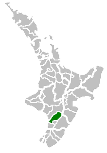
- Manawatu District
-
Manawatu District Country: New Zealand Population: 29,700
(territorial)
(June 2010 estimate)[1]Main town: Feilding Other towns: Sanson, Bunnythorpe, Hiwinui, Awahuri, Colyton, Pohangina, Rangiwahia, Ruahine, Himatangi, Longburn, Rongotea, Tangimoana Territorial Authority Name: Manawatu District Mayor: Ian McKelvie Deputy Mayor: Matt Bell Extent: Himatangi to Rangiwahia;Rangitikei River to Ruahine Ranges Land Area: 2,624.115 km² (1,013.176 sq mi) Website: www.MDC.govt.nz See also: Palmerston North, Horowhenua Regional Council Name: Manawatu-Wanganui (Horizons Regional Council) Website: www.Horizons.govt.nz Regional Tourism Name: Destination Manawatu Website: www.ManawatuNZ.co.nz The Manawatu District is a district in the Manawatu-Wanganui Region in the North Island of New Zealand.
Contents
Location
"The Manawatu", as it is usually called, is located in the southwest of the island, close to the river which shares its name. Located north of Wellington, the district stretches from slightly north of the settlement of Himatangi in the south to just south of Mangaweka in the north, and from the Rangitikei River to the summit of the Tararua Ranges. The southern boundary follows the Manawatu River, and the district excludes the area around the city of Palmerston North (including Ashhurst). The district has an area of 2,624 km².
Population
The population of the district is 29,700 (June 2010 estimate).[1] The main town and seat of the district council is Feilding, which has a population of 14,500. Towns in the district include Halcombe, Himatangi, Bainesse, Bunnythorpe, Waituna West, Kimbolton, Apiti, Rangiwahia, Longburn, Rongotea, Pohangina, Tangimoana, Himatangi Beach and Sanson.
Schools in Manawatu District
Secondary
- Feilding High School - Feilding
- Longburn Adventist College - Longburn
- Hato Paora College - Cheltenham
Intermediate
- Feilding Intermediate School - Feilding
Primary
- Manchester Street School - Feilding
- Lytton Street School
- North Street School
- St Joseph's School
Local government
Manawatu District was formed through the amalgamation of the former Manawatu, Oroua, Kiwitea, Pohangina and part of Kairanga counties.
The current mayor of the district is Ian McKelvie
There are three wards, each ward is represented on the council by three councillors.
The three wards are:
- Feilding
- Kairanga
- Kiwitea-Pohangina
Other uses
The term Manawatu (often the Manawatu) is also used to refer to a somewhat larger geographical region centred on the floodplain of the Manawatu River, with Palmerston North as its principal city. Like several other geographical regions, such as Wairarapa and the King Country, the Manawatu in this sense never had precisely defined borders, its extents determined largely by custom and preference. Usually included were Palmerston North City and all or most of today's Manawatu and Horowhenua Districts. Parts of the Rangitikei and/or Tararua districts could also be included.
References
- ^ a b "Subnational population estimates at 30 June 2010 (boundaries at 1 November 2010)". Statistics New Zealand. 26 October 2010. http://www.stats.govt.nz/~/media/Statistics/Methods%20and%20Services/Tables/Subnational%20population%20estimates/subpopest2001-10.ashx. Retrieved 7 March 2011.
External links
Categories:- Manawatu District
- Manawatu-Wanganui Region geography stubs
Wikimedia Foundation. 2010.

