- Manawatu River
-

Mouth Tasman Sea Basin countries New Zealand Length 180 km Mouth elevation sea level Avg. discharge 102 cubic metres per second  The Manawatu Gorge
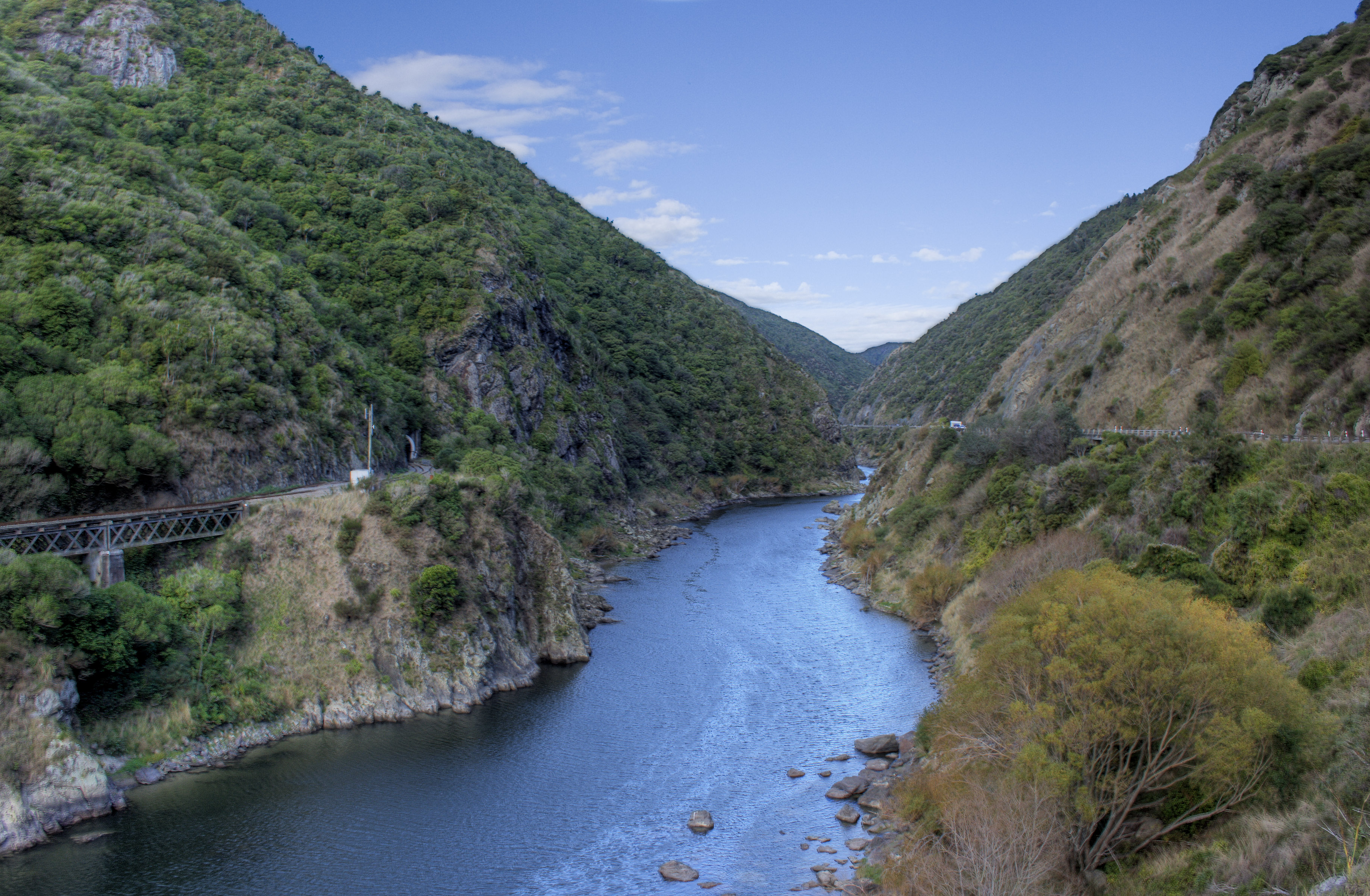
The Manawatu River is a major river of the southern North Island of New Zealand.
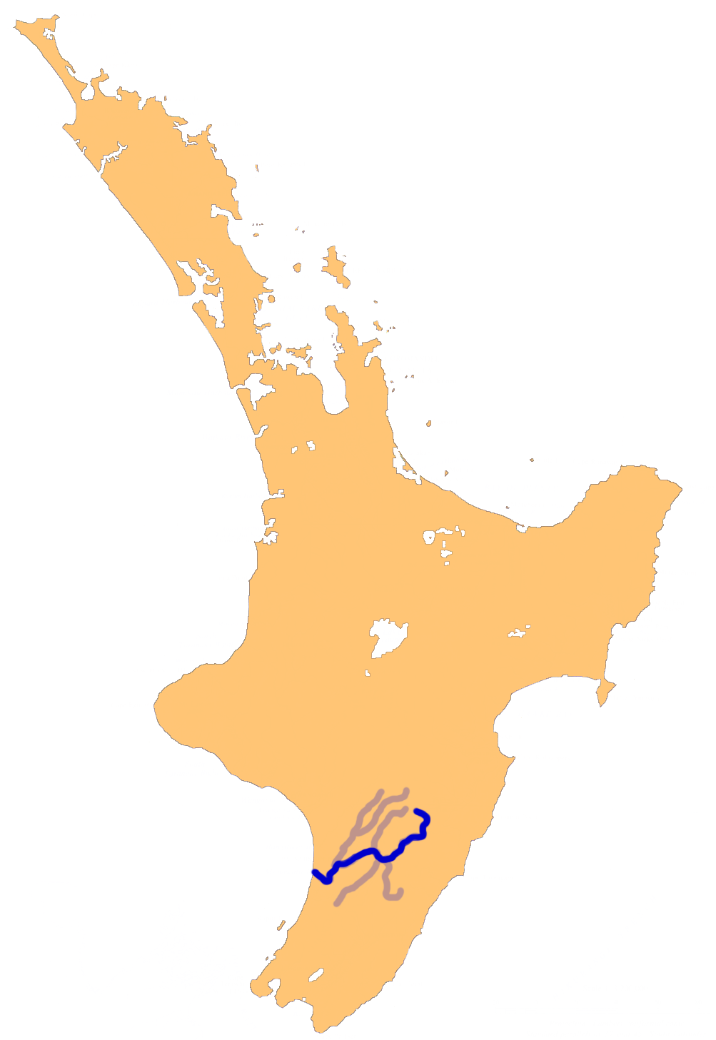
The river has its headwaters to the northwest of Norsewood in the Ruahine Ranges of southern Hawke's Bay. It flows initially eastward before turning south-west near Ormondville, flowing 40 km before turning north-west near Woodville. At this point the river enters the Manawatu Gorge. Beyond the gorge it again turns south-west, flowing through the city of Palmerston North before entering the Tasman Sea at Foxton Beach.
The river, along with the more northern Whanganui River, gives its name to the Manawatu-Wanganui region. The river's name comes from the Māori words manawa (heart, spirit) and tū (stand still, or depressed), therefore heart standing still with fear, or depressed spirit. Haunui was in pursuit of his wife and arrived at this river clutching his chest when he named this river.[1]
Contents
Physical environment
The river is unique among New Zealand rivers, starting on the east side of the main dividing range and having its outflow to the west. The explanation for this is the uplift of the central ranges. The ranges moved upwards at the same time as the gorge was eroded by the river, instead of the more usual erosion of an already existing range. This suggests that the river is an old one, as it must have existed before the Ruahine and Tararua Ranges.
Major tributaries of the river include the Makakahi, Mangahao, Pohangina and Oroua Rivers. The Manawatu's total length is 180 km, making it only the 12th-longest in the country, but at 102 m³/s it is one of the country's greatest rivers in terms of flow, and second only to the Waikato River among North Island rivers.
The Manawatu River flooded in February 2004, displacing over 2000 people (primarily from Marton and Feilding) and damaging over 1000 Manawatu farms. The cost of the flood in terms of insurance payouts was NZ$122 million. Further damage was prevented by the opening of the Moutoa floodgates, which intercept the river between Foxton and Shannon.
Water quality
The river is heavily polluted with industrial waste, treated sewage, and, most particularly, nutrient land runoff from dairy farms. In 2006 Fonterra were criticised for an application to discharge 8500 m3 of wastewater into the Manawatu River.[2] In 2009, the Cawthron Institute found that the river had the highest gross primary production (GPP) compared to 300 rivers and streams in the Western world.[3] High GPP rates are an indication of poor ecological health and can lead to various environmental issues. A report by the Ministry for the Environment ranked 76 New Zealand sites for water clarity and E. coli levels. Using those measures, they found four other New Zealand rivers rate worse than the Manawatu (the Waitara, Whanganui, Waipa and Rangitikei).[4]
References
- ^ Reed, A.W. (1996) The Reed Dictionary of Māori Place Names, Te Papakupu Ingoa Wāhi Māori a Reed (3rd Ed) Reed Publishing: Auckland, New Zealand
- ^ "Forest & Bird calls on Fonterra to clean up its act on the Manawatu River" (Press release). Royal Forest and Bird Protection Society of New Zealand. 9 August 2006. http://www.forestandbird.org.nz/mediarelease/2006/0809_fonterramanawaturiver.asp. Retrieved 13 March 2008.
- ^ Young, Roger. "Ecosystem metabolism in the Manawatu River". Cawthron Institute. http://www.cawthron.org.nz/news/downloads/manawatu-river-ecosystem-metabolism.pdf. Retrieved 15 May 2011.
- ^ "Recreational river water quality league table: water clarity and Escherichia coli bacteria levels". Ministry for the Environment. http://www.mfe.govt.nz/environmental-reporting/freshwater/river/league-table/clarity-ecoli.html. Retrieved 26 November 2009.
External links
- State of New Zealand's Environment 1997 - Chapter 7: Nature of NZ's water environment [Ministry for the Environment]
- Palmerston North Accommodation
- Morgan, Jon; Burns, Kelly (2007-11-26). "Manawatu River 'among worst in the West'". The Dominion Post. Archived from the original on 2010-08-15. http://www.webcitation.org/5s03qZw4F. Retrieved 2010-08-15.
Coordinates: 40°28′S 175°13′E / 40.467°S 175.217°E
Manawatu River Source: Ruahine Range — Flows into: South Taranaki Bight Administrative areas Hawke's Bay Region · Manawatu-Wanganui Region · Central Hawke's Bay District · Tararua District · Manawatu District · Palmerston North City · Horowhenua DistrictTowns and settlements (upstream to downstream) Norsewood · Ormondville · Dannevirke · Kumeroa · Woodville · Ashhurst · Palmerston North · Tokomaru · Shannon · Foxton · Foxton BeachMajor tributaries (upstream to downstream by confluence) Other features (upstream to downstream) Longest New Zealand rivers 1: Waikato · 2: Clutha · 3: Whanganui · 4: Taieri · 5: Rangitikei · 6: Mataura · 7: Waiau (Southland) · 8: Clarence · 9: Waitaki · 10: OretiCategories:- Ramsar sites in New Zealand
- Rivers of the Manawatu-Wanganui Region
Wikimedia Foundation. 2010.