Norsewood

Norsewood
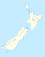
Norsewood is located in New Zealand
{{{alt}}}
Norsewood

Norsewood is a small rural town in the Manawatu - Wanganui region of New Zealand's North Island. It is situated in the Tararua District. Its population is 330.

The town is situated east of the Ruahine Mountain range and is located 20 kilometres northeast of Dannevirke. Norsewood was founded by Scandinavian settlers in 1872 as a loggers settlement [1] and was subsequently destroyed in a fire in 1888 [2].

A fishing boat, the Bindalsfareing, is displayed in a glassed boat-house in the town. It was a gift from the Norwegian government.

External links

References

  1. ^ "Kingdom of Denmark Bilateral Relations". New Zealand Ministry of Foreign Affairs and Trade. http://www.mfat.govt.nz/Countries/Europe/Denmark.php. Retrieved 2009-12-07. "There is a small Danish community in this country, descended from a group of early settlers who came out to clear thick North Island bush in the middle years of last century and stayed on to found settlements like Dannevirke and Norsewood. In fact, a former Prime Minister and high-ranking churchman from Denmark, Bishop Ditlev Gothard Monrad, established a community in Longburn, Manawatu and set up the first dairy plant in the region. He returned to Denmark after three years, but members of his family stayed behind, as well as a substantial art collection now held by Te Papa." 
  2. ^ "Norsewood Travel Guide". Jasons Travel Media. http://www.jasons.co.nz/norsewood. 

Coordinates: 40°04′S 176°13′E / 40.067°S 176.217°E / -40.067; 176.217


Wikimedia Foundation. 2010.

Игры ⚽ Нужна курсовая?

Look at other dictionaries:

  • Norwegian New Zealander — Norsknewzealender …   Wikipedia

  • Manawatu River — Mouth Tasman Sea Basin countries New Zealand Length 180 km Mouth elevation sea level Av …   Wikipedia

  • Denmark–New Zealand relations — Danish New Zealand relations New Zealand …   Wikipedia

  • Mangatewainui River — Mouth Manawatu River Basin countries New Zealand Length 27 kilometres (17 mi) The Mangatewainui River is a river of the Manawatu Wanganui Region of New Zealand s North Island. An upper tributary of the …   Wikipedia

  • New Zealand–Norway relations — New Zealand Norway relations New Zealand …   Wikipedia

  • Dannevirke — For other uses, see Dannevirke (disambiguation). Dannevirke Tāmaki nui a Rua (Māori) …   Wikipedia

  • Manawatu-Wanganui — is a region situated in the lower half of the North Island of New Zealand, around the city of Palmerston North and the central city of Wanganui.GeographyAdministrationThe region is comprised by all or parts of ten separate Districts. Five of… …   Wikipedia

  • Tararua District — The Tararua District lies near the south east corner of New Zealand s North Island. Created in 1989, it was named after the Tararua Range, which forms much of its western boundary. Its population (2006) is 17,634, and it has an area of 4,360.56… …   Wikipedia

  • Manawatu Gorge — viewed from a lookout on the Manawatu Gorge Track The Manawatu Gorge (in Maori Te Apiti, meaning The Narrow Passage ) runs between the Ruahine and Tararua Ranges of the North Island of New Zealand, linking the Manawatu and Hawke s Bay regions. It …   Wikipedia

  • Manawatu Plains — Location of the Manawatu Plains Some of the most fertile land in the southwestern North Island of New Zealand is located on the floodplains of the Manawatu and Rangitikei Rivers, in an area known as the Manawatu Plains. Stretching from the… …   Wikipedia

Share the article and excerpts

Direct link
Do a right-click on the link above
and select “Copy Link”