- Cocodrie, Louisiana
-
Cocodrie Unincorporated community 
Country United States State Louisiana Parish Terrebonne Elevation 3 ft (0.9 m) Coordinates 29°14′49″N 90°39′41″W / 29.24694°N 90.66139°W Timezone CST (UTC-6) - summer (DST) CDT (UTC-5) Area code 985 
 Location of Cocodrie in Louisiana
 Location of Louisiana in the United States
Cocodrie is an unincorporated fishing, shrimping and crabbing village in Terrebonne Parish, Louisiana, United States, ten miles south of Chauvin, due south of the larger town of Houma.[1] It is part of the Houma–Bayou Cane–Thibodaux Metropolitan Statistical Area. The Acadian settlement is known for being very near the landfall location for Tropical Storm Matthew on October 10, 2004, and Hurricane Gustav on September 1, 2008.[2]
Cocodrie is a waterfront town, located due west of Grand Isle, on an inlet of another bay blocked by several barrier islands along the Gulf of Mexico.[1] Cocodrie is connected to the larger town of Houma, due north, along Louisiana state highway 56.[1]
Contents
Impact from Hurricane Gustav
On September 1, 2008, Hurricane Gustav, coming from Cuba, made a technical landfall near Cocodrie, around 9:30 a.m. CDT.[2] When Hurricane Gustav came from the southeast, the hurricane force winds (up to 115 mph, 180 km/h) extended for 70 miles from the eye center,[2] impacting the area with north-to-south winds for over 5 hours before making landfall.[2]
Media
Cocodrie, Louisiana was featured in the Insomniac Games Playstation 3 game Resistance 2 between the Holar Tower and Chicxulub Crater levels. The level consists of a plantation style environment surrounded by swamp and marshlands and also includes a large bridge later on into the level which highly resembles a single span of the Crescent City Connection which is located in New Orleans, LA approximately 85 miles northeast of Cocodrie.
See also
- Buras-Triumph, Louisiana - a landfall site of Hurricane Katrina (2nd of 3 USA landfalls)
- Pearlington, Mississippi - a landfall site of Hurricane Katrina (3rd of 3 USA landfalls)
Notes
- ^ a b c Louisiana map, Louisiana-Map.org, 2007, webpage: LaMap-Louisiana-road-map (shows town/lake names).
- ^ a b c d "Hurricane Gustav Public Advisory Number 32", National Hurricane Center, 1 September 2008, 10 a.m., webpage: NHC-Adv-32.
References
- Cocodrie, Louisiana's Inside & Offshore Fishing Information
- Gustav lands on U.S. state, making landfall
- Hurricane Gustav Public Advisory Number 32, National Hurricane Center, 1 September 2008, 10 a.m. CDT.
- Louisiana-Map.org, webpage: LaMap-Louisiana-road-map (shows town/lake names).
Municipalities and communities of Terrebonne Parish, Louisiana City 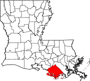
CDPs Unincorporated
communitiesCategories:- Unincorporated communities in Louisiana
- Populated places in Terrebonne Parish, Louisiana
- Houma – Bayou Cane – Thibodaux metropolitan area


Wikimedia Foundation. 2010.