- Summerhaven, Arizona
-

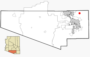
Summerhaven is a small Census-designated place on Mount Lemmon in the Santa Catalina Mountains north of Tucson in Pima County, Arizona, United States. Summerhaven sits at an elevation of approximately 8,200 feet. Summerhaven is accessed via the Catalina Highway from suburban northeast Tucson, and it is about 24.5 miles from the base of the mountain to Summerhaven.
Summerhaven is a popular tourist destination. Several small shops in Summerhaven attract visitors, including the Mount Lemmon General Store and The Cookie Cabin, which offers homemade cookies and pizzas. In the winter, residents from lower elevations travel to Summerhaven, when the Catalina Highway is open, to enjoy the snow. Also during the summer, the same residents will frequent the area to get away from the heat. Because of the elevation difference between the Tucson area (5-6000 feet), the temperature in Summerhaven will be anywhere from 15-30 degrees cooler depending on weather patterns, which usually makes it a very comfortable place to be compared to the hot desert heat in the summer time.
The Summerhaven area was originally used by the U.S. Army at Fort Lowell in Tucson as a military camp in its campaign against the Apache people in the 1870s and 1880s.
The Aspen wildfire struck Summerhaven in the summer of 2003, which resulted in the destruction of more than 250 of the 700 homes in the community. Arizona Governor Janet Napolitano assessed the damage, and both federal and county officials surveyed the extensive loss. In the months that followed, Tucson residents organized "Lemmon Aid" to help rebuild Summerhaven. Summerhaven continues to recover from the wildfire.
The Mount Lemmon Ski Valley located outside Summerhaven is the southernmost ski location in the continental United States.
A wind storm hit the mountain in May 2010 and caused extensive damage to the forest. Some trails were severely damaged, however repair efforts are underway.
October 2010 saw the inaugural running of the Mount Lemmon Marathon which saw nearly 800 participants finish the race from near the start of the Catalina Highway up to Summerhaven.[1]
Geography
Summerhaven is located at 32°29′10″N 110°46′35″W / 32.48611°N 110.77639°W (32.4415965, -110.7766004). According to the 2010 Census, the Summerhaven census designated place had a total area of 4.6 square miles (11.8 km²), of which, 4.6 square miles (11.8 km²) of it is land and 0.00 square miles (0.00 km²) of it (0.00%) is water. It's permanent population is 40.[2]
Summerhaven has the ZIP Code of 85619; in 2000, the population of the 85619 ZCTA was 73[3]. Note that this includes only people who were living in Summerhaven on the day of the census, thus excluding many part-time or seasonal residents.
There is a general store and several food venues, but no gasoline or automotive services. The Mount Lemmon Fire Department maintains a station near Summerhaven, providing fire and EMS services.
External links
 Media related to Summerhaven, Arizona at Wikimedia Commons
References
- ^ Marc Lacey (17 October 2010). "A Finish Line With a Real High: 8,000 Feet". New York Times. http://www.nytimes.com/2010/10/18/sports/18tucson.html. Retrieved 28 October 2010.
- ^ http://factfinder2.census.gov/faces/tableservices/jsf/pages/productview.xhtml?pid=DEC_10_SF1_G001&prodType=table
- ^ http://factfinder.census.gov/servlet/SAFFPopulation?_event=Search&_zip=85619
Coordinates: 32°26′19″N 110°45′33″W / 32.43861°N 110.75917°W
Municipalities and communities of Pima County, Arizona Cities 
Towns CDPs Ajo | Avra Valley | Casas Adobes | Catalina | Catalina Foothills | Corona de Tucson | Drexel-Alvernon | Drexel Heights | East Sahuarita | Flowing Wells | Green Valley | Littletown | Picture Rocks | Pisinemo | Rincon Valley | Santa Rosa | Sells | Summit | Tanque Verde | Three Points | Tortolita | Tucson Estates | Vail | Valencia West
Unincorporated
communitiesIndian reservations Ghost towns Allen | Cerro Colorado | Helvetia | Kentucky Camp | Redington | Total Wreck
Categories:- Santa Catalina Mountains
- Populated places in the Sonoran Desert
- Unincorporated communities in Pima County, Arizona


Wikimedia Foundation. 2010.