- Tortolita, Arizona
Infobox Settlement
official_name = Tortolita, Arizona
settlement_type = CDP
imagesize =
image_caption =
imagesize =
image_caption =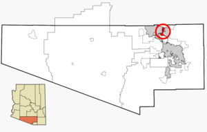
mapsize = 250px
map_caption = Location in Pima County and the state ofArizona
mapsize1 =
map_caption1 =
subdivision_type = Country
subdivision_type1 = State
subdivision_type2 = County
subdivision_name =United States
subdivision_name1 =Arizona
subdivision_name2 = Pima
government_type =
leader_title =
leader_name =
established_title =
established_date =
area_magnitude =
area_total_km2 = 30.8
area_total_sq_mi = 11.9
area_land_km2 = 30.7
area_land_sq_mi = 11.86
area_water_km2 = 0.1
area_water_sq_mi = 0.04
elevation_ft = 2690
elevation_m = 820
population_as_of = 2000
population_footnotes =
population_total = 3740
population_metro =
population_density_km2 = 121.4
population_density_sq_mi = 314.3
timezone = MST (no DST)
utc_offset = -7
latd = 32 |latm = 24 |lats = 16 |latNS = N
longd = 111 |longm = 2 |longs = 56 |longEW = W
website =
timezone_DST =
utc_offset_DST =
postal_code_type =
postal_code =
area_code =
blank_name = FIPS code
blank_info = 04-74975
blank1_name = GNIS feature ID
blank1_info = 1777314
footnotes =Tortolita is a
census-designated place (CDP) in Pima County,Arizona ,United States . The population was 3,740 at the 2000 census. Tortolita is situated between the booming towns of Oro Valley and Marana. These two incorporated communities continue to annex the community of Tortolita. Eventually, the community of Tortolita will become part of western Oro Valley and eastern Marana.Geography
Tortolita is located at coor dms|32|24|16|N|111|2|56|W|city (32.404322, -111.049006)GR|1.
According to the
United States Census Bureau , the CDP has a total area of 11.9square mile s (30.8km² ), of which, 11.9 square miles (30.8 km²) of it is land and 0.04 square miles (0.1 km²) of it (0.34%) is water.Demographics
As of the
census GR|2 of 2000, there were 3,740 people, 1,332 households, and 1,057 families residing in the CDP. Thepopulation density was 314.9 people per square mile (121.6/km²). There were 1,408 housing units at an average density of 118.6/sq mi (45.8/km²). The racial makeup of the CDP was 92.51% White, 0.75% Black or African American, 0.80% Native American, 0.75% Asian, 2.65% from other races, and 2.54% from two or more races. 12.30% of the population were Hispanic or Latino of any race.There were 1,332 households out of which 38.4% had children under the age of 18 living with them, 68.2% were married couples living together, 8.0% had a female householder with no husband present, and 20.6% were non-families. 15.4% of all households were made up of individuals and 4.0% had someone living alone who was 65 years of age or older. The average household size was 2.81 and the average family size was 3.15.
In the CDP the population was spread out with 27.6% under the age of 18, 6.9% from 18 to 24, 27.6% from 25 to 44, 29.7% from 45 to 64, and 8.3% who were 65 years of age or older. The median age was 39 years. For every 100 females there were 99.7 males. For every 100 females age 18 and over, there were 95.9 males.
The median income for a household in the CDP was $57,136, and the median income for a family was $64,573. Males had a median income of $44,886 versus $24,271 for females. The
per capita income for the CDP was $25,550. About 5.7% of families and 5.2% of the population were below thepoverty line , including 5.0% of those under age 18 and 7.8% of those age 65 or over.References
External links
Wikimedia Foundation. 2010.