- Sahuarita, Arizona
Infobox Settlement
official_name = Town of Sahuarita, Arizona
imagesize =
image_caption =
image_
seal_size = 170px
settlement_type =Town 
imagesize = 250px
image_caption = View of Sahuarita Town Hall (2008)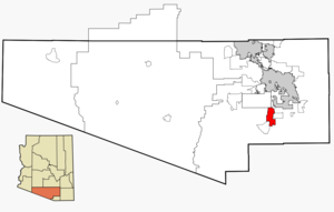
mapsize = 250px
map_caption = Location in Pima County and the state ofArizona
mapsize1 =
map_caption1 =
subdivision_type = Country
subdivision_type1 = State
subdivision_type2 = County
subdivision_name =United States
subdivision_name1 =Arizona
subdivision_name2 = Pima
established_title =
established_date =
established_title2 =
established_date2 =
government_type =
leader_title =Mayor
leader_name =Lynn Skelton
area_magnitude = 1 E8
area_total_km2 = 80
area_total_sq_mi = 30
area_land_km2 = 80
area_land_sq_mi = 30
area_water_km2 = 0.0
area_water_sq_mi = 0.0
elevation_ft = 2,844
elevation_m = 824
population_as_of = 2007
population_footnotes = |population_footnotes =cite web|url=http://www.census.gov/popest/cities/tables/SUB-EST2007-04-04.csv|title=Annual Estimates of the Population for Incorporated Places in Arizona|publisher=United States Census Bureau |date=2008-07-10|accessdate=2008-07-14] cite web | date =June 21 2006 | url = http://www.census.gov/popest/cities/tables/SUB-EST2005-04-04.csv | title = Annual Estimates of the Population for All Incorporated Places in Arizona | format = CSV | work = 2005 Population Estimates | publisher = U.S. Census Bureau, Population Division | accessmonthday = November 15 | accessyear = 2006]
population_total = 16153
population_metro =
population_density_km2 = 60
population_density_sq_mi = 160
timezone = MST (no DST)
utc_offset = -7
latd = 31 |latm = 55 |lats = 45 |latNS = N
longd = 110 |longm = 58 |longs = 56 |longEW = W
website = http://www.ci.sahuarita.az.us/
timezone_DST =
utc_offset_DST =
postal_code_type =ZIP code
postal_code = 85629
area_code = 520
GNIS_id = 33948
blank_name = FIPS code
blank_info = 04-62140
blank1_name =
blank1_info =
footnotes =Sahuarita (Saw wah ree ta) is a town in Pima County,
Arizona ,United States . Sahuarita is located south of theTohono O'odham Nation and north of Green Valley, 15 miles (24 km) south of Tucson. The population was 3,242 at the 2000 census; in 2007, it was estimated at 16,153. [ [http://factfinder.census.gov/servlet/DTTable?_bm=y&-context=dt&-ds_name=PEP_2007_EST&-CONTEXT=dt&-mt_name=PEP_2007_EST_G2007_T001&-tree_id=807&-redoLog=true&-all_geo_types=N&-_caller=geoselect&-geo_id=16000US0462140&-search_results=04000US04&-format=&-_lang=en Arizona by Place 2007 Population Estimates] ,United States Census Bureau , 2008. Accessed2008-09-7 .]History
Sahuarita was founded in 1911 and incorporated in 1994.cite web | date =
October 22 2007 | url = http://www.ci.sahuarita.az.us/PDFs/At_a_Glance.pdf | title = Sahuarita at a Glance | format =PDF | work = Town Facts & Figures | publisher = Town of Sahuarita | accessmonthday = October 22 | accessyear = 2007]Hohokam (200 to 1450)
The first known human inhabitants of the Sahuarita region were the
Hohokam people, which may be the ancestors of the modern day Tohono O'odham nation. The Hohokam were known for their highly innovative and extensive use of irrigation. The Hohokam were a very peaceful people, they had extensive trade routes extending to mesoamerica, and showed many cultural influences from their southern neighbors.Henry, P.; Bufkin, D: "Historical Atlas of Arizona". University of Oklahoma Press © 1979]Sobaipuri (1400 - 1900)
The
Sobaipuri were possibly related to the Hohokam, and occupied the Southern portion of the Santa Cruz, with the Pima to their North and South. While Coronado passed just East of Sahuarita in 1521, it wasn't untilEusebio Kino 's 1691 journey along the Santa Cruz River that he met the leaders of the Sobaipuri people. Kino was a true champion of the indigenous Indians, opposing forced labor in mines by Spanish overseers. Kino would later go on to found theMission San Xavier del Bac in 1699, just north of Sahuarita. In 1775, Fransico Garcés would follow the same path, laying the groundwork for the founding of Tucson.Spanish & Mexican control (1775 - 1853)
In 1775, after building a series of missions in the region, the Spanish established a colony in Tucson, just north of Sahuarita, effectively placing the region under Spanish control. After the
Mexican War of Independence in 1821, the region came under Mexican control.Incorporation into the U.S. (1854 -1874 )
In 1854, following the
Gadsden Purchase , Sahuarita would become a part of the Territory of Arizona, in the United States of America. In the same year, Andrew B. Gray would travel the region on behalf of the Texas Western Railroad, in order to run a preliminary survey of the region. Meanwhile, the Native American peoples of the region were being pushed onto each other's land through American expansionism. In 1857, the Sobaipuri, who had acted as a buffer between the hostile Spaniards to the South and Apache to the North, finally collapsed under the pressure and vacated the area, generally moving Westward to Papago territory. In 1867, Fort Crittenden was created between Sonoita and Patagonia in order to support the establishment of European settlements in the Santa Cruz Valley. In 1874, the San Xavier reservation was created, presently called the Tohono O'odham Reservation, and Native Americans were forcibly relocated to the reservation.Sahuarita on the map (1870 - 1925)
An 1870 map of Arizona shows an "Indian Village" just north of Sahuarita.cite web | year = 1870 | url = http://www.davidrumsey.com/detail?id=1-1-30415-1140454&name=Arizona,+New+Mexico. | title = Arizona, New Mexico | format =
HTML | work = by Mitchell, Samuel Augustus | publisher = David Rumsey Map Collection | accessmonthday = October 23 | accessyear = 2007] The earliest known reference to the town can be found on a German map from 1875, which labels the town "Sahuarito".cite web | year = 1875 | url = http://www.davidrumsey.com/detail?id=1-1-2475-250030&name=Die+Vereinigten+Staaten+Von+Nord-Amerika+In+6+Blattern. | title = Die Vereinigten Staaten Von Nord-Amerika In 6 Blattern | format =HTML | work = The United States in 6 sheets, by Stieler, Adolf | publisher = David Rumsey Map Collection | accessmonthday = October 23 | accessyear = 2007] The first known US map to list the town came in 1879, by the US Department of Interior, calling the town "Saurita".cite web | year = 1879 | url = http://www.davidrumsey.com/detail?id=1-1-1598-200048&name=Territory+Of+Arizona. | title = Territory of Arizona | format =HTML | work = U.S. General Land Office | publisher = David Rumsey Map Collection | accessmonthday = October 23 | accessyear = 2007] The Saurita town name would continue to be found on successive maps of 1880cite web | year = 1880 | url = http://www.davidrumsey.com/detail?id=1-1-1807-170060&name=Official+Map+Of+The+Territory+Of+Arizona. | title = Official Map Of The Territory Of Arizona. | format =HTML | work = Eckhoff, E.A. ; Riecker, P. | publisher = David Rumsey Map Collection | accessmonthday = October 23 | accessyear = 2007] and 1890.cite web | year = 1890 | url = http://www.davidrumsey.com/detail?id=1-1-30595-1140122&name=Arizona,+New+Mexico. | title = Arizona, New Mexico. | format =HTML | work = Mitchell, Samuel Augustus | publisher = David Rumsey Map Collection | accessmonthday = October 23 | accessyear = 2007] Finally, a 1925 map of "Auto Trails" (e.g. roadways) of Arizona and New Mexico lists "Continental" instead of Sahuarita. The roadway at the time was an "improved road", one step inferior to a "paved road", laying the route to what today is called the Old Nogales Highway.cite web | year = 1925 | url = http://www.davidrumsey.com/detail?id=1-1-2164-200083&name=Rand+McNally+Official+1925+Auto+Trails+Map+Arizona+New+Mexico. | title = Rand McNally Official 1925 Auto Trails Map Arizona New Mexico. | format =HTML | publisher = David Rumsey Map Collection | accessmonthday = October 23 | accessyear = 2007]Sahuarita Ranch (1879 - 1886)
In 1879 Sahuarita Ranch was created by James Kilroy Brown. Brown choose the name Sahuarita due to the preponderance of
saguaro s in the area. The ranch was used as a staging area between Tucson, Arivaca, and Quijotoa. A small community developed in the area named Sahuarito, while the railroad laid tracks through the area (which remain to this day) and established a station and post office. Although originally surveyed by the Texas Western Railroad, the route would soon be run by theSouthern Pacific Railroad up until the late 20th century. Brown sold his ranch in 1886 which caused the region to stagnate for three decades.cite web | date =October 22 2007 | url = http://jeff.scott.tripod.com/sahuarita.html | title = History and Information about Sahuarita | format =HTML | work = Arizona's names: X marks the place | publisher = Falconer Pub. Co. | accessmonthday = October 22 | accessyear = 2007]During this time, the hub of Sahuarita commerce was at the intersection of Sahuarita Road and Nogales Highway, in the form of the One Stop Market and Sahuarita Bar and Grill.cite book
last = Goorian
first = Philip
title = Green Valley, Arizona
publisher = Arcadia Publishing
year = 2002
pages = 51-70
isbn = 0738520721 ] These 130-year-old buildings remain intact, but they are scheduled to be demolished for a road expansion: "While some have said the 1 Stop and the shuttered Sahuarita Bar on the north side of Sahuarita Road were long-time fixtures that might deserve historic recognition, the longest-serving council member, Charles Oldham, and the council member who lives closest, Marty Moreno, both said the convenience store should make way for badly needed road improvements. Oldham said, “It’s in the way”."cite web | date =October 25 2007 | url = http://www.sahuaritasun.com/ | title = Sahuarita Sun | format =HTML | accessmonthday = January 8 | accessyear = 2008]Continental Farm (1915 - present)
The Continental Farm of Sahuarita plays a central role in town history. In 1915, worried about the possibility of a German blockade of rubber imports,
Bernard Baruch ,Joseph Kennedy andJ.P. Morgan founded the farm along the Santa Cruz River with hopes of growing guayule: plants that provide rubber. The project was abandoned after the end of World War I, and in 1922, was sold to Queen Wilhelmina of the Netherlands. The Queen rented the land to cotton farmers, in what would be the primary crop for the following four decades. In 1948, R. Keith Walden relocated the Farmers Investment Co. (FICO) from California to Arizona, buying the Continental Farm lands from the Queen. In 1965, over fears of a fall in demand for cotton resulting from the advent of synthetic fibers, Walden switched his crop to pecans. Today, the FICO pecan orchard is the largest in the world, with over convert|6000|acre|km2 and 106,000 trees.cite web | date =October 22 2007 | url = http://www.pecanstore.com/Aboutus.asp | title = The Pecan Store | format =HTML | work = Company History | publisher = FICO | accessmonthday = October 22 | accessyear = 2007]Sahuarita Bombing & Gunnery Range (1942 - 1978)
The Army Air Corp from
Davis-Monthan Air Force Base first used this convert|27046|acre|km2|sing=on range in April, 1942 for practice bombing runs. The Sahuarita Flight Strip was completed in 1943, with a convert|5540|ft|m|sing=on paved runway, and the bombing runs ceased shortly thereafter. The site included 12 buildings in addition to the airstrip, and four observational towers. In 1950, bomber crews operating out of Carswell AFB, TX, restarted bombing runs on the range, which would last until 1962, with the airway strip remaining in use as an emergency landing strip thereafter. The Federal government soon released the land to the State of Arizona in 1978, who in turn leased the land to a cattle rancher. Presently, the former airstrip has been converted into a roadway that leads to "Sahuarita Park", while the remaining land remains in use for cattle grazing. TheU.S. Army Corps of Engineers is continuing its longstanding efforts of identitifying remaining munitions, preventing environmental containmentation, and protecting several endangered species in the area, including jaguars, spotted owls, among others.cite web | year = 2004 | url = http://www.airfields-freeman.com/AZ/Airfields_AZ_Tuscon_SE.html#sahuarita | title = Abandoned & Little Known Airfields | format =HTML | work = Sahuarita AF Flight Strip, Sahuarita, AZ | publisher = Paul Freeman | accessmonthday = October 22 | accessyear = 2007] cite web | month = August | year = 2006 | url = http://www.tucsonaz.gov/ets/SSAFR.pdf | title = Sahuarita Air Force Range | format =PDF | work = Site Inspection Report | publisher = U.S. Army Corps of Engineers | accessmonthday = October 22 | accessyear = 2007]World War II (1944 - 1945)
During World War II, Sahuarita was home to Camp Continental, a labor camp for German prisoners of war. The location of the camp was around what is now Continental Ranch, West of the Nogales Highway and the Quail Crossing Boulevard intersection. It was established around November, 1944, as one of 21 "branch" POW camps established throughout the state. The population of 250 prisoners primarily worked in agriculture, tending to cotton and vegetable crops.cite web | date =
May 25 2006 | url = http://www.azstarnet.net/allheadlines/130608 | title = Sahuarita once had POW camp | format =HTML | work = Many residents surprised to learn German Prisoners of War were housed in area as no traces of facility remain | publisher = Arizona Daily Star | accessmonthday = October 22 | accessyear = 2007]Population
The population of the town was 1,629 in 1990, while in 2000, the population rose to 3,242. The U.S. Census Bureau estimated that it had a population of 13,027 in 2006. [ [http://factfinder.census.gov/servlet/GCTTable?_bm=y&-geo_id=04000US04&-_box_head_nbr=GCT-T1&-ds_name=PEP_2006_EST&-_lang=en&-format=ST-9&-_sse=on Arizona by Place 2006 Population Estimates] ,
United States Census Bureau , 2007. Accessed2007-10-22 .]In contrast to federal census data, in 2006 the Arizona Department of Economic Security assessed the town population at 18,035.cite web | date =
October 22 2007 | url = http://www.azcommerce.com/doclib/COMMUNE/sahuarita.pdf | title = Community Profile for Sahuarita | format =PDF | work = Community Profile for Sahuarita | publisher = Arizona Department of Commerce | accessmonthday = October 22 | accessyear = 2007] The town has guessed that its 2008 population was around 24,000.cite web | date =October 22 2007 | url = http://www.ci.sahuarita.az.us/communityprofile/communityprofile.cfm | title = Sahuarita Town Profile | format =HTML | work = Population Estimates | publisher = Town of Sahuarita | accessmonthday = October 22 | accessyear = 2007]Geography
Sahuarita is located at coor dms|31|55|45|N|110|58|56|W|city (31.929245, -110.982241).GR|1 According to the
United States Census Bureau , the town has a total area of 15.2 square miles (39.4 km²), all of it land. Since the most recent census was taken in 2000, the town has annexed more land; its area is presently about 30 sq mi (80 km²). TheSanta Cruz River runs through the town, flowing north during the monsoons.ahuarita Lake
Sahuarita Lake is an artificial lake that was completed on June 22, 2001, by Rancho Sahuarita. The lake surface area is 435,600 square feet (10 acres), with a convert|1|mi|km|sing=on long perimeter and maximum depth of convert|10|ft|m, holding approximately 70 acre feet of water (22.8 million gallons).cite web | date =
June 22 2001 | url = http://www.ci.sahuarita.az.us/Docs/Rancho%20Sahuarita%20-%20Lake%20Manual%20-%202001.pdf | title = Lake Manual | format =PDF | work = prepared for Rancho Sahuarita | publisher = J. Harlan Glenn, P.E. | accessmonthday = December 12 | accessyear = 2007] This reflects a water amount equivalent to less than one tenth of one percent (< 0.1%) of the convert|76000|acre feet of water used by all of Sahuarita and Green Valley in 2006.The lake is a "managed lake", which means that natural ecological changes within the lake that do "not fit within the parameters set by man", are cause for remedial action to return to the goals of the management plan. Air compressors located at various points under the lake continually inject air through diffusers which aids the movement of water in a process called vertical mixing. This system of continual aeration enables the circulation of all water in the lake on a daily basis, and therefore creates an ecological balance and uniform appearance. The lake also contains fish and frogs, the former of which are regularly stocked by the Arizona State Department of Game and Fish, and is an attraction to ducks and various kinds of birds.The lake consumes water to the extent that all the water in the lake must be replenished every year. Regarding water evaporation, lake documents state that according to the USDA Water Conservation Laboratory in Phoenix, the mean annual evaporation rate for Sahuarita is convert|69|in|mm per year. This results in a mean water loss of 57.5 acre feet per year. Regarding water loss due to seepage, initial estimates indicated an annual loss of 10 acre feet of water, or 17% of total capacity per year. The J. Harlan Glenn Engineers that provided this estimate indicated that this equates to an "extremely low seepage rate". On average, 65 gpm (gallons of water per minute) must be pumped into the lake to maintain its current level. A nearby well site that draws on the shared Upper Santa Cruz Valley aquifer is used to refill the lake. In 2006, convert|105.3|acre feet of water was used for the entire Sahuarita lake park, which includes water for the convert|5|acre|m2 of grass and restroom facilities.
Demographics
2000 census
As of the
census GR|2 of 2000, there were 3,242 people, 1,155 households, and 927 families residing in the town. Thepopulation density was 213.2 people per square mile (82.3/km²). There were 1,247 housing units at an average density of 82.0/sq mi (31.7/km²). The racial makeup of the town was 87.85% White, 0.59% Black or African American, 1.08% Native American, 0.99% Asian, 7.40% from other races, and 2.10% from two or more races. 24.18% of the population were Hispanic or Latino of any race.There were 1,155 households out of which 33.4% had children under the age of 18 living with them, 70.6% were married couples living together, 6.8% had a female householder with no husband present, and 19.7% were non-families. 15.3% of all households were made up of individuals and 5.1% had someone living alone who was 65 years of age or older. The average household size was 2.78 and the average family size was 3.09.
In the town the population was spread out with 25.6% under the age of 18, 7.2% from 18 to 24, 27.1% from 25 to 44, 24.7% from 45 to 64, and 15.4% who were 65 years of age or older. The median age was 38 years. For every 100 females there were 96.7 males. For every 100 females age 18 and over, there were 98.4 males.
The median income for a household in the town was $53,194, and the median income for a family was $55,338. Males had a median income of $42,258 versus $26,174 for females. The
per capita income for the town was $22,075. About 4.0% of families and 5.7% of the population were below thepoverty line , including 6.6% of those under age 18 and 7.0% of those age 65 or over.2007 workforce survey
In April 2007, the
Eller College of Management conducted an assessment survey of Sahuarita residents due to the town's 529% growth since the 2000 Census, because data from that census "on workforce and community characteristics is no longer applicable." The survey was mailed to 7,805 households and was weighted by area to ensure a representative sampling.cite web | month = May | year = 2007 | url = http://www.ci.sahuarita.az.us/PDFs/News/Sahuarita_Survey_final.pdf | title = Town of Sahuarita Workforce Survey | format =PDF | publisher = Town of Sahuarita & University of Arizona | accessmonthday = October 23 | accessyear = 2007]The survey reported that in educational attainment 19.7% of residents are high school graduates; 32.4% have an Associates Degree or some college; 26.9% have a Bachelor's degree, and 14.6% have a Master's degree, and 3.3% have a Doctoral degree. These statistics lead to the finding that "demonstrates significantly higher concentrations in associate’s, bachelor’s and graduate/professional degrees than the county as a whole, or the state."
For places of work, 57% of residents reported working in Tucson, with 16.6% working in Sahuarita, and 12.7% in Green Valley. It found that local workers specialized more than workers elsewhere in Pima County, being most concentrated in the following occupations:
*Management
*Business and financial
*Computer and mathematics
*Architecture and engineering
*Healthcare practitioner and technical
*Protective serviceLaw and Government
The Town of Sahuarita operates under the
council-manager form of government. The Sahuarita town council is responsible for the policy matters of the town, and the management of a town manager to oversee staff and carry out the day to day functions of the town.Sahuarita is administered by the seven member town council, which includes a Mayor and Vice Mayor. The Mayor and Vice Mayor are not elected into those positions, but are instead chosen among elected council members. The town council oversees all issues pertaining to Sahuarita, including residential and commercial development and natural preservation. cite web | date =October 25 2006 | url = http://www.ci.sahuarita.az.us/index.php?option=com_content&task=view&id=20&Itemid=43&parent_id=43 | title = Sahuarita Mayor and Council | format =HTML | publisher = Town of Sahuarita | accessmonthday = March 17 | accessyear = 2008]The Town of Sahuarita is a general law town, and does not have a town charter. As a result, Sahuarita operates fully under Title 9: Cities and Towns, of the Arizona Revised Statues. cite web | year = 2007 | url = http://www.azleg.state.az.us/ArizonaRevisedStatutes.asp?Title=9 | title = Arizona Revised Statutes | work = Cities and Towns | format =
HTML | publisher = State of Arizona | accessmonthday = March 17 | accessyear = 2008]Neighborhoods
Sahuarita contains the master planned communities of Rancho Sahuarita & Resort (north), Quail Creek (southeast) and Madera Highlands (south) in addition to the residential neighborhoods of La Joya (southwest), Los Colonias and Los Arroyos (west). The town has 92 acres of public and private parks and recreation facilities, with approximately 125 additional acres currently proposed.cite web | date =
October 22 | work = Public and Private Recreation Facilities | publisher = Town of Sahuarita | accessmonthday = October 22 | accessyear = 2007]Town Zoning
Since 2002, 30% of the land in the town is zoned for residential use, the majority of which (22%) is classed as medium density residential, defined as a single family suburban environment. Employment, commercial, institutional, and industrial land comprises 6.5% of town land, while mixed use zoning occupies 9% of land. The town has set aside 7% of land for resource conservation/open space, while 25% of land is designated flood plain.cite web | date =
December 9 2002 | url = http://www.ci.sahuarita.az.us/PDFs/Final%20general%20plan%208-8-3.pdf | title = General Plan | format =PDF | publisher = Town of Sahuarita | accessmonthday = October 23 | accessyear = 2007]Sites of Interest
Sahuarita contains the
Titan Missile Museum , which is the only Titan Missile site in the world accessible to the public. The actual Titan II missile, the most powerful nuclear missile on standby in the US, remains in the silo for visitors to see.cite web | date =January 7 2007 | url = http://travel.nytimes.com/2007/01/05/travel/escapes/05atomic.html | title = Strange Love | format =HTML | publisher = New York Times | accessmonthday = October 24 | accessyear = 2007]Just convert|11|mi|km southeast of Sahuarita is
Madera Canyon , rising above the town at convert|5500|ft|m. Visiting the canyon offers residents a way to escape the summer heat (about 15 degrees cooler than Tucson), and travel the extensive trail system or experience the world-renowned bird watching opportunities.cite web | date =October 24 2007 | url = http://www.friendsofmaderacanyon.org/ | title = Friends of Madera Canyon | format =HTML | publisher = Friends of Madera Canyon | accessmonthday = October 24 | accessyear = 2007] cite web | date =November 29 2006 | url = http://www.fs.fed.us/r3/coronado/forest/recreation/camping/sites/madera.shtml | title = Coronado National Forest | format =HTML | publisher = Madera Canyon | accessmonthday = October 24 | accessyear = 2007]Water sustainability
In the desert southwest, water sustainability is a major concern. According to a 2007 report by Pima County, convert|76000|acre feet of water was pumped from the aquifer in the Upper Santa Cruz Valley in 2006 [in the report referred to as the Green Valley area, which includes Sahuarita] , with 85 percent of that water being used for mining and agriculture. The remaining 15 percent was split between water used for golf courses and residential/commercial water use. The report explains that "The Green Valley area does not have a sustainable water supply given current groundwater pumping rates... the water table in Green Valley has been declining in past years, and is expected to decline even faster as water demands [continue to increase] ...". The report concludes that "Water supplies will become critical within the next ten years."cite web | date =
October 2 2007 | url = http://www.pima.gov/pdf/Long-Term%20Green%20Valley%20Water%20Supply%20.pdf | title = Long Term Green Valley Water Supply | format =PDF | work = Long Term Green Valley Water Supply | publisher = Pima County | accessmonthday = November 30 | accessyear = 2007]The Upper Santa Cruz Valley has several "major water users", all pumping water out of the same aquifer. None of these are owned by Pima County, the town of Sahuarita, nor Green Valley. The major water users are all private companies: ASARCO-Mission Mine, Phelps Dodge Sierrita Mine; Farmers Water Company; Sahuarita Water Company, Las Quintas Serenas Water Company, Quail Creek Water Company, Community Water Company of Green Valley, and the Green Valley Water District. The proliferation of water companies can be partially explained by the fact that the actual water in the aquifer is not owned by anyone, thus any amount of water can be pumped out, with costs limited only to drilling, pumping, distribution, etc.cite web | year = 2007 | url = http://www.g-a-l.info/ | title = Groundwater Awareness League | format =
HTML | work = Representing the voice of the people... about their water supply | publisher = GAL | accessmonthday = November 30 | accessyear = 2007]References
External links
* [http://www.ci.sahuarita.az.us/ Town of Sahuarita]
* [http://www.ranchosahuarita.com/ Rancho Sahuarita neighborhood]
* [http://www.sahuarita.k12.az.us/ Sahuarita Unified School District]
* [http://www.sahuaritasun.com/ "The Sahuarita Sun" - Local News]

Wikimedia Foundation. 2010.