- Catalina Foothills, Arizona
Infobox Settlement
official_name = Catalina Foothills, Arizona
settlement_type = CDP
imagesize =
image_caption =
imagesize =
image_caption =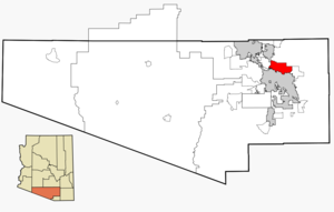
mapsize = 250px
map_caption = Location in Pima County and the state ofArizona
mapsize1 =
map_caption1 =
subdivision_type = Country
subdivision_type1 = State
subdivision_type2 = County
subdivision_name =United States
subdivision_name1 =Arizona
subdivision_name2 = Pima
government_type =
leader_title =
leader_name =
established_title =
established_date =
area_magnitude =
area_total_km2 = 115.5
area_total_sq_mi = 44.6
area_land_km2 = 115.2
area_land_sq_mi = 44.5
area_water_km2 = 0.3
area_water_sq_mi = 0.1
elevation_ft = 2575
elevation_m = 785
population_as_of = 2000
population_footnotes =
population_total = 53794
population_metro =
population_density_km2 = 465.7
population_density_sq_mi = 1210.2
timezone = MST (no DST)
utc_offset = -7
latd = 32 |latm = 17 |lats = 38 |latNS = N
longd = 110 |longm = 53 |longs = 2 |longEW = W
website =
timezone_DST =
utc_offset_DST =
postal_code_type =
postal_code =
area_code =
blank_name = FIPS code
blank_info = 04-11230
blank1_name = GNIS feature ID
blank1_info = 0037214
footnotes =Catalina Foothills is a
census-designated place (CDP) located north of Tucson in Pima County,Arizona ,United States . Situated in the southern foothills of theSanta Catalina Mountains , Catalina Foothills had a population of 53,794 at the 2000 census. Catalina Foothills is among the most wealthy communities inArizona , with the 5th highest per capita income.Geography
Catalina Foothills is located at coor dms|32|17|38|N|110|53|2|W|city (32.293990, -110.883872)GR|1.
According to the
United States Census Bureau , the CDP has a total area of 44.6square mile s (115.5km² ), of which, 44.5 square miles (115.2 km²) of it is land and 0.1 square miles (0.3 km²) of it (0.27%) is water.Demographics
As of the
census GR|2 of 2000, there were 53,794 people, 23,948 households, and 15,590 families residing in the CDP. Thepopulation density was 1,209.5 people per square mile (467.1/km²). There were 26,372 housing units at an average density of 593.0/sq mi (229.0/km²). The racial makeup of the CDP was 91.35% White, 1.21% Black or African American, 0.49% Native American, 3.24% Asian, 0.09% Pacific Islander, 1.73% from other races, and 1.88% from two or more races. 7.55% of the population were Hispanic or Latino of any race.There were 23,948 households out of which 24.6% had children under the age of 18 living with them, 57.3% were married couples living together, 5.6% had a female householder with no husband present, and 34.9% were non-families. 28.8% of all households were made up of individuals and 9.2% had someone living alone who was 65 years of age or older. The average household size was 2.23 and the average family size was 2.76.
In the CDP the population was spread out with 19.9% under the age of 18, 6.4% from 18 to 24, 23.0% from 25 to 44, 31.8% from 45 to 64, and 19.0% who were 65 years of age or older. The median age was 45 years. For every 100 females there were 93.4 males. For every 100 females age 18 and over, there were 91.0 males.
The median income for a household in the CDP was $65,657, and the median income for a family was $82,675. Males had a median income of $61,697 versus $37,077 for females. The
per capita income for the CDP was $42,006. About 2.4% of families and 4.3% of the population were below thepoverty line , including 3.8% of those under age 18 and 3.2% of those age 65 or over.Education
The Catalina Foothills community is served by three public
school districts :
*Catalina Foothills School District serves the upper Catalina Foothills.
*Amphitheater Public Schools serves small neighborhoods in the western Catalina Foothills, namely Pima Canyon Estates, Cobblestone Estates, and the Via Entrada neighborhood.
*Tucson Unified School District serves the lower and northeastern neighborhoods of the Catalina Foothills community.References
External links
Wikimedia Foundation. 2010.