- Vail, Arizona
Infobox Settlement
official_name = Vail, Arizona
settlement_type = CDP
imagesize =
image_caption =
imagesize =
image_caption =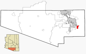
mapsize = 250x250px
map_caption = Location in Pima County and the state ofArizona
mapsize1 =
map_caption1 =
subdivision_type = Country
subdivision_type1 = State
subdivision_type2 = County
subdivision_name =United States
subdivision_name1 =Arizona
subdivision_name2 = Pima
government_type =
leader_title =
leader_name =
established_title =
established_date =
area_magnitude =
area_total_km2 = 47.2
area_total_sq_mi = 18.2
area_land_km2 = 47.2
area_land_sq_mi = 18.2
area_water_km2 = 0.0
area_water_sq_mi = 0.0
elevation_ft = 3235
elevation_m = 986
population_as_of = 2000
population_footnotes =
population_total = 2484
population_metro =
population_density_km2 = 52.6
population_density_sq_mi = 136.5
timezone = MST (no DST)
utc_offset = -7
latd = 32 |latm = 0 |lats = 7 |latNS = N
longd = 110 |longm = 42 |longs = 1 |longEW = W
website = http://vailaz.com/
timezone_DST =
utc_offset_DST =
postal_code_type =ZIP code
postal_code = 85641
area_code = 520
blank_name = FIPS code
blank_info = 04-78540
blank1_name = GNIS feature ID
blank1_info = 0013150
footnotes =Vail is a
census-designated place (CDP) in Pima County,Arizona ,United States . The population was 2,484 at the 2000 census. The area is known for the nearby Colossal Cave, a small cave system and tourism spot.Geography
Vail is located at coor dms|32|0|7|N|110|42|1|W|city (32.001939, -110.700286)GR|1.
According to the
United States Census Bureau , the CDP has a total area of 18.2square mile s (47.2km² ), all of it land.Demographics
As of the
census GR|2 of 2000, there were 2,484 people, 842 households, and 675 families residing in the CDP. Thepopulation density was 136.4 people per square mile (52.7/km²). There were 906 housing units at an average density of 49.8/sq mi (19.2/km²). The racial makeup of the CDP was 87.16% White, 0.64% Black or African American, 0.52% Native American, 0.48% Asian, 0.04% Pacific Islander, 7.45% from other races, and 3.70% from two or more races. 16.63% of the population were Hispanic or Latino of any race.There were 842 households out of which 43.2% had children under the age of 18 living with them, 69.2% were married couples living together, 6.8% had a female householder with no husband present, and 19.8% were non-families. 14.0% of all households were made up of individuals and 1.8% had someone living alone who was 65 years of age or older. The average household size was 2.95 and the average family size was 3.25.
In the CDP the population was spread out with 31.8% under the age of 18, 5.6% from 18 to 24, 33.3% from 25 to 44, 23.6% from 45 to 64, and 5.8% who were 65 years of age or older. The median age was 35 years. For every 100 females there were 101.1 males. For every 100 females age 18 and over, there were 101.3 males.
The median income for a household in the CDP was $46,202, and the median income for a family was $53,958. Males had a median income of $37,418 versus $28,594 for females. The
per capita income for the CDP was $19,892. About 6.1% of families and 6.3% of the population were below thepoverty line , including 6.5% of those under age 18 and 7.5% of those age 65 or over.References
External links
Vail Arizona community web site: http://vailaz.com
Wikimedia Foundation. 2010.