- Meriden Linear Trail
-
The Meriden Linear Trail is a rail trail that follows the original route of the Meriden, Waterbury, and Connecticut River Railroad through the city of Meriden, Connecticut. Currently, the trail follows 1.3 miles (2.1 km) of the former railroad right-of-way through the Quinnipiac River Gorge, starting at Red Bridge (41°31′21″N 72°50′20″W / 41.5225°N 72.8390°W) and ending near the Meriden/Cheshire town line (41°31′41″N 72°51′28″W / 41.5281°N 72.8579°W). This portion of the Linear Trail system is named The Quinnipiac River Gorge Trail.
Contents
History
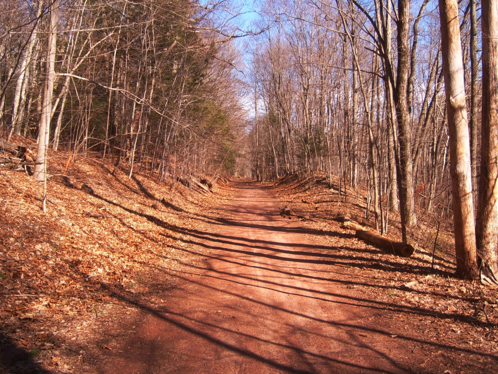
 The former MW&CR Railroad right of way prior to construction of the linear trail.
Construction of the Meriden and Waterbury Railroad commenced in 1887 and finished the following year, when the M&W Railroad merged with the Meriden and Cromwell Railroad to form the Meriden, Waterbury, and Connecticut River Railroad. The line never saw high traffic, and by 1924 the section of the railroad from West Main Street in Meriden to East Farms in Waterbury was abandoned.
For decades, the old right-of-way sat unused. Through the Quinnipiac Gorge, no development occurred over the former right-of-way due to its remote nature; throughout the rest of Meriden, most of the railroad remained active until 1966 as an industrial spur to Ragazzino's on West Main Street and the Suzio York Hill Quarry in East Meriden. Since little new development has occurred since then along the right-of-way (with the notable exception of the Mid-State Medical Center), much remains intact with the railroad tracks still in place.
Along the Quinnipiac River Gorge in South Meriden, the former right-of-way began to be used more and more by fishermen looking to access some of the more remote parts of the gorge. Eventually more and more people began to use the trail, including a lot of dirt bike and all terrain vehicle owners.
Looking to preserve the trail from being torn up by these vehicles (as well as from the increasing problem of illegal dumping along the trail), talks commenced in the late 1990s to create a paved rail trail along the old right-of-way of the MW&CRRR through the city, with a side trail connecting southward to connect to the new Quinnipiac River Linear Trail being proposed in Wallingford.
Current
Due to funding issues, land acquisition, and community concerns, planning for the linear trail was slow, and often sporadic for the next decade. However, in late 2005 and 2006, the final stages of land and funding acquisition fell into place for the first phase of the trail, the 1.3-mile (2.1 km) stretch through the Quinnipiac Gorge, starting near Red Bridge and ending near the Cheshire border. Construction began in spring 2006, and was mostly completed by December 2006. Additional work, including new landscaping, fences, and informational kiosks was completed throughout 2007. The trail was formally dedicated on 3 November 2007.
The community reaction to the new trail has been very welcoming, and it has become a very popular recreation spot for area residents.
Initially after the trail opening, there was a problem with vandalism of the informational kiosks along the trail; in response the Meriden Police Department used their two all terrain vehicles to randomly patrol the trail. This, along with a large increase in the number of people using the trail, has nearly eliminated vandalism and illegal dumping along the trail.
Future expansion
Long-term goals are to eventually convert the entire former right-of-way of the MW&CR Railroad - from the Cheshire to Middletown town lines - into a paved linear trail. A side trail from Hanover Pond, following the Quinnipiac River to the Wallingford town line to the south has also been proposed, to connect with their linear trail.
References
- Meriden Linear Trail official website
- Andrew Perlot, "Residents seek answers on master plan". Meriden Record-Journal, June 25, 2008.
Hiking Trails in Connecticut Airline State Park Trail • Alain and May White Trails • American Legion • Appalachian Trail • Aspetuck Valley • Bigelow Hollow • Case Mountain • Charter Oak Greenway • Chatfield • Cockaponset • East Coast Greenway • Falls Brook • Farmington Canal Heritage Trail • Gay City • Hancock Brook • Hop River State Park Trail • Housatonic Range • Jericho • Kettletown • Lillinonah • Lone Pine • Macedonia Brook • Mattabesett • Mattatuck • McLean Game Refuge • Menunkatuck • Metacomet • Mohawk • Moosup Valley State Park Trail • Muir • Narragansett • Natchaug • Naugatuck • Nayantaquit • Nehantic • New England National Scenic Trail • Nipmuck • Old Furnace • Patchaug • Paugussett • Peoples • Pequot • Pine Knob • Pomperaug • Quinebaug • Quinnipiac • Ragged Mountain • Regicides • Salmon River • Saugatuck • Shenipsit • Sleeping Giant • Sleeping Giant State Park • Stony Creek Quarry • Sunny Valley Preserve • Tunxis • Washington–Rochambeau Revolutionary Route • Westwoods • Whitestone Cliffs • Wolcott Trail • Zoar

Protected areas of Connecticut National Park Service National Wildlife Refuges Silvio O. Conte • Stewart B. McKinney National Wildlife Refuge
National Trails State Parks Airline • Beckley Iron Furnace Industrial Monument • Bigelow Hollow • Black Rock • Bluff Point • Burr Pond • Camp Columbia • Campbell Falls • Chatfield Hollow • Collis P. Huntington • Connecticut Valley Railroad • Day Pond • Dennis Hill • Devil's Hopyard • Dinosaur • Fort Griswold Battlefield • Fort Trumbull • Gardner Lake • Gay City • George W. Seymour • Gillette Castle • Haddam Meadows • Haley Farm • Hammonasset Beach • Hampton Beach • Harkness Memorial • Haystack Mountain • Hop River State Park Trail • Hopeville Pond • Housatonic Meadows • Hurd • Indian Well • John A. Minetto • Kent Falls • Kettletown • Lake Waramaug • Larkin State Park Trail • Levy • Lovers Leap • Macedonia Brook • Mansfield Hollow • Mashamoquet Brook • Millers Pond • Mohawk Mountain • Moosup Valley State Park Trail • Mount Tom • Old Furnace • Osbornedale • Penwood • Putnam Memorial • Quaddick • Quinnipiac River • River Highlands • Rocky Neck • Selden Neck • Seth Low Pierrepont • Sherwood Island • Silver Sands • Sleeping Giant • Southford Falls • Squantz Pond • Stratton Brook • Talcott Mountain • Wadsworth Falls • West Rock Ridge • Wharton Brook • Windsor Locks Canal State Park Trail
State Forests Algonquin • American Legion • Centennial Watershed • Cockaponset • Enders • James L. Goodwin • Housatonic • Massacoe • Mattatuck • Meshomasic • Mohawk • Mohegan • Nassahegon • Natchaug • Nathan Hale • Nehantic • Nepaug • Nipmuck • Nye-Holman • Pachaug • Paugnut • People's • Pootatuck • Quaddick • Salmon River • Shenipsit • Topsmead • Tunxis • Wyantenock
Connecticut Department of Environmental Protection (web)Categories:- Rail trails in Connecticut
- Protected areas of New Haven County, Connecticut
- Meriden, Connecticut

Wikimedia Foundation. 2010.