- Tacheng
-
Tacheng
چۆچەك
شاۋەشەك
塔城— County-level city — "Ruins in Chuguchak" by Vasily Vereshchagin (1869)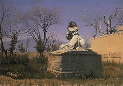 Location within China
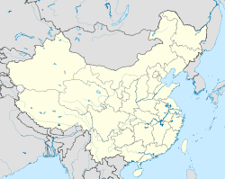
 Tacheng
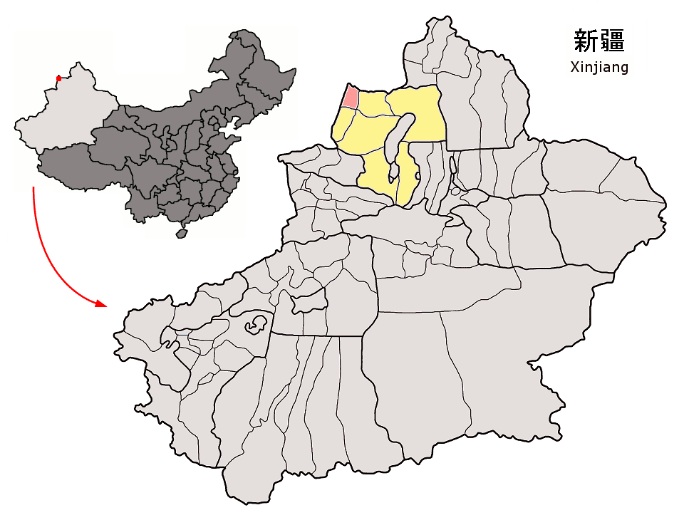
Coordinates: 46°45′N 82°59′E / 46.75°N 82.983°ECoordinates: 46°45′N 82°59′E / 46.75°N 82.983°E Country China Province Xinjiang Prefecture Tacheng Prefecture Area - Total 4,007 km2 (1,547.1 sq mi) Population (2003) - Total 160,000 - Density 39.9/km2 (103.4/sq mi) Postal code Uyghur name kona yezik̡ (UEY): چۆچەك شەھىرى yengi yezik̡ (UPNY): Qɵqək Xəh̡ri Cyrillic (USY): Чөчәк шәһири official PRC transcription: Qoqek Chinese name simplified characters: 塔城市 Pinyin: Tǎchéng Shì 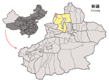 Location of Tacheng County-level City of Tacheng Prefecture within Xinjiang (China)
Tacheng (Uyghur: چۆچەك, ULY: Chöchek; Kazakh: شاۋەشەك / Шәуешек / Şәweşek) is a county-level city (1994 est. pop. 56,400) and the capital of Tacheng Prefecture, in northern Ili Kazakh Autonomous Prefecture, Xinjiang, China.
The city was sometimes called Tarbaghatay or Tarbagatai (Mongolian: 'having marmots') and was once known in European languages as Chuguchak (based on its name in Turkic languages).
It is located in the Dzungarian basin, some 10 km from the Kazakhstan border. Long a major center for trade with Central Asia, it is an agricultural hub. Its industries include food processing, textiles, and utilities.
The city suffered much destruction in 1865, during the fighting between the Qing forces and the Dungan and Uyghur rebels.
Contents
Border crossing
The Bakhtu border crossing into Kazakhstan is located 17km from Tacheng. The checkpoint on the Kazakh side of the border is also known as Bakhty and is located 60km from Makanchi in East Kazakhstan Province.
Climate
Climate data for Tacheng (1971−2000) Month Jan Feb Mar Apr May Jun Jul Aug Sep Oct Nov Dec Year Average high °C (°F) −4.1
(24.6)−2.3
(27.9)4.1
(39.4)17.0
(62.6)23.4
(74.1)28.4
(83.1)30.8
(87.4)29.9
(85.8)24.1
(75.4)15.0
(59.0)4.3
(39.7)−2
(28.4)14.05
(57.29)Average low °C (°F) −15.6
(3.9)−14.1
(6.6)−7
(19.4)3.6
(38.5)9.2
(48.6)13.6
(56.5)15.7
(60.3)14.1
(57.4)8.5
(47.3)1.9
(35.4)−5.6
(21.9)−12
(10)1.03
(33.85)Precipitation mm (inches) 16.5
(0.65)14.4
(0.567)15.6
(0.614)32.4
(1.276)31.7
(1.248)24.5
(0.965)29.8
(1.173)16.3
(0.642)14.0
(0.551)26.9
(1.059)34.3
(1.35)25.9
(1.02)282.3
(11.114)Avg. precipitation days (≥ 0.1 mm) 8.9 8.5 9.3 8.2 9.4 7.9 8.4 6.3 6.0 7.5 10.0 9.7 100.1 Source: Weather China References
- Khālidī, Qurbanʻali, Allen J. Frank, and Mirkasym Abdulakhatovich Usmanov. An Islamic Biographical Dictionary of the Eastern Kazakh Steppe, 1770-1912. Brill's Inner Asian library, v. 12. Leiden: Brill, 2004.
- Light, Nathan. "Qazaqs in the People's Republic of China: The Local Processes of History". Bloomington, Indiana: Indiana Center on Global Change and World Peace, Occasional Paper No. 22, June 1994. ISBN 1-881157-24-5.
- Light, Nathan. "Kazakhs of the Tarbaghatai: Ethno-History Through a Novel". The Turkish Studies Association Bulletin, 17/2 (1993): 91-102.
- Saguchi Toru. "Kazak Pastoralists on the Tarbaghatai Frontier under the Ch'ing." In: Proceedings of the International Conference on China Border Area Studies. Lin En-hsien [Lin Enxian], ed. Taipei: National Chengchi University, 1985, pp. 953-996.
- Wiens, Herold J. "Change in the Ethnography and Land Use of the Ili Valley and Region, Chinese Turkestan". Annals of the Association of American Geographers, Vol. 59, No. 4. (Dec., 1969), pp. 753-775.
External links
- Map of the City of Tacheng (Chinese)
- Webpage on the Bakktu border crossing in Xinjiang's Land Ports and Border Trade website
Xinjiang Uyghur Autonomous Region county-level divisions Ürümqi (capital)  Xinjiang in China
Ürümqi: Tianshan District · Saybagh District · Xinshi District · Shuimogou District · Toutunhe District · Dabancheng District · Midong District · Ürümqi County
Ili: Yining City · Kuytun City · Yining County · Huocheng County · Tokkuztara County · Künes County · Zhaosu County · Tekes County · Nilka County · Qapqal Autonomous County
Tacheng1: Tacheng City · Wusu City · Emin County · Yumin County · Shawan County · Toli County · Hoboksar Autonomous County
Altay1: Altay City · Qinggil County · Jeminay County · Fuyun County · Burqin County · Fuhai County · Habahe CountyKaramay: Karamay District · Dushanzi District · Baijiantan District · Urho District
Turpan: Turpan City · Toksun County · Piqan County
Kumul: Kumul City · Yiwu County · Barkol Autonomous County
Hotan2: Hotan City · Hotan County · Lop County · Minfeng County · Pishan County · Qira County · Keriya County · Karakax County
Aksu: Aksu City · Wensu County · Xayar County · Baicheng County · Awat County · Kuqa County · Kalpin County · Toksu County · Uqturpan County
Kashgar: Kashgar City · Maralbishi County · Poskam County · Peyziwat County · Kargilik County · Yopurga County · Shule County · Mekit County
Yengisar County · Yarkent County · Shufu County · Tashkurgan Autonomous CountyKizilsu: Artux City · Akqi County · Ulugqat County · Akto County
Bayin'gholin: Korla City · Hejing County · Yuli County · Hoxud County · Qiemo County · Bohu County · Luntai County · Ruoqiang County
Yanqi Autonomous CountyBortala: Bortala City · Jinghe County · Wenquan County
Changji: Changji · Fukang · Qitai County · Manas County · Jimsar County · Hutubi County · Mori Autonomous County
Shihezi: (no intermediate County-level divisions, see Administration of Shihezi)
Aral: (no intermediate County-level divisions, see Administration of Aral)
Tumxuk: (no intermediate County-level divisions, see Administration of Tumxuk)
Wujiaqu: (no intermediate County-level divisions, see Administration of Wujiaqu)■ = Sub-provincial autonomous prefecture ■ = Prefecture-level city ■ = Prefecture ■ = Autonomous prefectures ■ = Sub-prefecture-level city of the Xinjiang Production and Construction Corps
2 Aksai Chin is administered by the PRC as part of Hotan, but claimed by India.
1 Tacheng and Altay are prefectures within and under the administration of the Ili Kazakh Autonomous Prefecture.Categories:- Populated places in Xinjiang
- Prefecture-level divisions of Xinjiang
- China–Kazakhstan border crossings
- Xinjiang geography stubs


Wikimedia Foundation. 2010.