- Magallanes, Agusan del Norte
-
Municipality of Magallanes
Baug
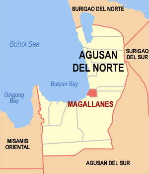
Lungsod ng MagallanesMap of Agusan del Norte showing the location of Magallanes.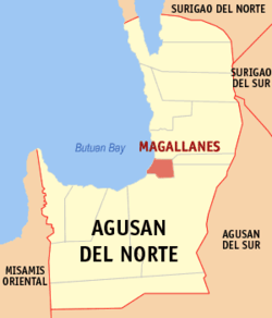
Country Philippines Region Northern Mindanao CARAGA (Region XIII) Province Agusan del Norte District 2nd District of Agusan del Norte Barangays 8 Income Class 4th class municipality Incorporated (town) Government - Mayor Carlito C. Cumba Lakas-CMD) - Vice Mayor Meriam G. Pagaran Lakas-CMD) Population (2000) - Total 19,895 Time zone PST (UTC+8) ZIP code 8604 Area code(s) 85 Website www.magallanesadn.gov.ph Magallanes is a 4th class municipality in the province of Agusan del Norte, Philippines. According to the 2000 census, it has a population of 19,895 people in 3,640 households.
Magallanes is a Spanish name of the Portuguese maritime explorer Ferdinand Magellan. The town has two plywood manufacturing firms: EMCO (Brgy. Sto. Rosario) and PSPI (Brgy. Marcos), and one safety matches manufacturing firm: JAKA Equities Corp (Brgy. Marcos). The three manufacturing plants are all on the main street and operating near the Baug River and Agusan River.Contents
Geography
Topography
Swamps characterize much of the landscape of this place that is situated at the mouth of the two major rivers in the province, the Agusan and Baug Rivers. The elevation of most of lands is two (2) feet below sea level. This gradually rises towards the northwest where the 99 meter above sea level barangay Taod-oy and the 162 meter Mount Panaytayon.
Around 2,834.89 hectares of Magallanes lands have slope of 0 to 03 percent, 399.28 hectares have 8 to 18 percent, 1,497.30 18 to 30 percent and 250.53 hectares 30 to 50 percent.
Barangays
Magallanes is politically subdivided into 8 barangays. Of these, 6 are mainland 2 are across the river barangays. There are 7 coastal barangays located near the Baug River in the South, Mouth of Agusan River, in the West and in the North running Eastward lies Butuan Bay, of which 1 is a mountain barangay.
- Buhang
- Caloc-an
- Guiasan
- Marcos
- Poblacion
- Santo Niño
- Santo Rosario
- Taod-oy
Natural Features
Surface Drainage
Lying two feet below sea level, Magallanes is natural depository of water from both the rivers and the sea. The delta where the town center lies has to be kept protected by dikes.
Land Forms
Flat and rolling, surrounded by mountains: - Mt. Taod-oy (99 m) - Mt. Panaytayon (162 m)
Oldest Tree in the Philippines
The Departnment of Environment and Natural Resources (DENR) awarded Magallanes, Agusan Del Norte as the place that host the Oldest Tree (500 years old) in the Philippines called Bitaug.
Landuse
Existing Land Use
Using 1990 records, the national land use authorities have delineated a total of 4,991 has. as Magallanes land area. Of this size 4,109 has. classified as alienable and disposable. The other 882 has. are forestlands.
2,000 Hectares of Prawn/Shrimp Farm
With the existing 2,000 hectares, more or less, of prawn/shrimp farm, Magallanes used to be the Philippines' top exporter of first class prawn/shrimp to Japan, until the entire farm was hit by a white spot disease in 2001 leading to the collapse of the industry.
General Land Use
In actual use, however, the place is devoting 149.95 has. or 3percent for built-up, 92.26 has. of that for social facilities and the other 59.69 has. for roads. Around 3,210.72 has. or 64.33 percent of its lands are utilized for africulture, the other 1,630.33 hectares or 33.20 percent, for forest use. Four hectares are also being utilized for tourism in special use. Within the agricultural area, 1,727.63 hectares are under CARP coverage.
Climate and Soil
Magallanes is generally is outside the "typhoon belt". Its climate is, by Philippine classification, Type II. There is no definite dry season in the area. Maximum rain is from November to January. Lying within the eastern coast, the place is within the pathway northeast monsoons, trade winds and storms.
Hydrosol, San Miguel Loam, San Miguel Clay Loam, Malalag Silt Loam and Butuan Loam are its soil types.
Upper Miocene, Cretaceous-Paleogene and recent sedimentary materials are the rock elements that make up Magallanes lands.
Transportation
Municipality of Magallanes can be reached through the Mindanao gateways:
Air
Bancasi Airport of Butuan and Lumbia Airport of Cagayan de Oro.
PAL and Cebu Pacific have daily flights from Manila to Butuan and v.v. Cebu-Butuan-Cebu flights via Cebu Pacific scheduled Mondays, Wednesdays and Saturdays, and PAL.Sea
Nasipit Port of Nasipit, Surigao Port of Surigao, and Macabalan Port of Cagayan de Oro.
There are several major shipping lines serving the Manila and Cebu routes namely: Superferry, Cebu Ferries, Carlos A. Gothong shipping lines, and Sulpicio lines. A 45 minutes boat ride from Butuan to Magallanes navigating the Agusan River.Land
Bachelor Express and PhilTranCo is the dominant public land transport from Manila and Tacloban passing Surigao, Cabadbaran and Butuan to Cagayan de Oro and Davao. The public mode of transportation within the municipality is by motorcabs and pedicabs. Passenger vans commonly known as V-Hire are also available for Butuan routes.
Highlights
Lisagan Festival
Magallanes celebrates its annual fiesta every third Saturday of October in honor of patroness Nuestra Señora del Rosario, Our Lady of the Rosary, which includes thanksgiving mass, parades and more.
The 'Lisagan Festival' held on Sunday after the fiesta includes street dancing similar to Sinulog Festival and fluvial procession at the Agusan River and Baug River.
The town parish doesn't allow major public gathering like disco, live bands and other similar events the night before the fiesta.VIVAMagellan Shrine
Located at Poblacion near the Municipal Hall, the shrine was the site of the 'first' Catholic mass in Mindanao on April 8, 1521. It was believed that the Magellan's Cross in Cebu was also erected here by the explorer Ferdinand Magellan and his men before they sail North. Evidence showed church ruins near the Agusan River.
Agusan River
Agusan River is the widest and navigable river in Mindanao.
Telecommunications
Cell Sites available: Smart Communications and Globe Telecoms/Touch Mobile
Landlines: BayanTel
Internet Service Providers: BayanTel DSL and Smart BroadbandExternal links
Municipalities Buenavista • Carmen • Jabonga • Kitcharao • Las Nieves • Magallanes • Nasipit • Remedios T. Romualdez • Santiago • TubayComponent city CabadbaranHighly urbanized city Butuan
(Administratively independent from the province, but grouped under Agusan del Norte by the National Statistics Office)Categories:- Municipalities of Agusan del Norte
Wikimedia Foundation. 2010.