- Nasipit, Agusan del Norte
-
Municipality of Nasipit
Lungsod sa Nasipit
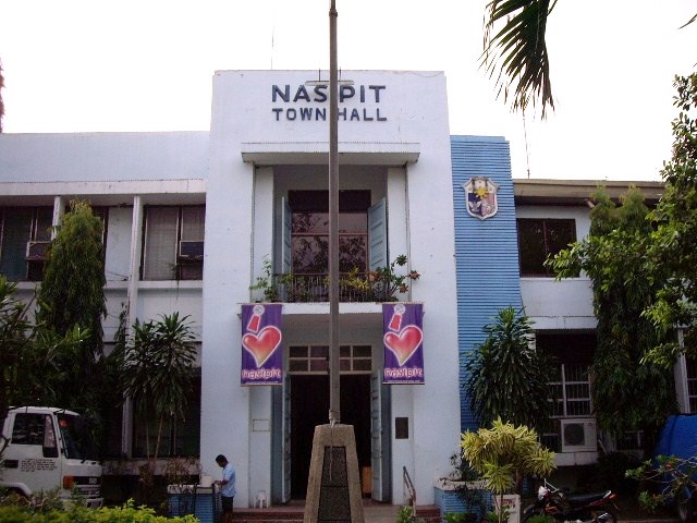
Bayan ng NasipitTown hall

SealNickname(s): The Gateway to Agusan del Norte, Ang Tuboran sa bahandi ug Kusog Motto: I Love Nasipit! 
Coordinates: 8°57′N 125°32′E / 8.95°N 125.533°E Country Philippines Region Region XIII (CARAGA) Province Agusan del Norte Districts Second District of Agusan del Norte Barangays 19 Official Languages Cebuano Widely Spoken, Filipino, English Incorporated (town) August 1, 1929 Government – Mayor Roscoe Democrito B. Plaza (2010-2013) – Vice Mayor Ronald N. Timogan (2010-2013) Area – Total 236.36 km2 (91.3 sq mi) Population (August 2007)[1] – Total 38,096 Time zone PST (UTC+8) ZIP code 8602 Area code(s) 85 Patron Saint Saint Michael, the Archangel The Municipality of Nasipit (Cebuano: Lungsod sa Nasipit ; Filipino: Bayan ng Nasipit) is a 3rd class municipality in the province of Agusan del Norte, Philippines. The town has the major seaport in the province, the Nasipit International Port or Port of Nasipit. According to the 2007 latest census, it has a population of 38,096 people in 7,010 households.
Contents
History
The recorded history of Nasipit can be traced to as early as 1880 when it was declared a pueblo by the Spanish colonizers. According to townsfolk, its name may be attributed to an incident where a native, just after being bitten by a crab, was asked the name of the place by an immigrant. Misunderstanding the question, the native answered “na-si-pit” meaning bitten by a crab. Since then, the town became known as Nasipit.
Nasipit was officially separated from the municipality of Butuan on August 1, 1929. It became a municipality by virtue of Executive Order No. 181 issued by Acting Governor General Eugene Gilmore of the U.S. Army. A proposal to change its name to Aurora was initiated by former Governor Teofisto Guingona Sr. but due to strong opposition from townsfolk, the name Nasipit was retained.
In 1949 the barrios of Carmen, Tagcatong, Cahayagan and San Agustin, formerly part of this municipality, became the town of Carmen by virtue of Republic Act No. 380 which was approved on June 15, 1949.[2]
Barangays
Nasipit is politically subdivided into 19 barangays. Of these, 7 are urban and 12 are rural. There are 9 coastal barangays namely: Cubi-Cubi, Ata-Atahon, Punta, Brgy. 1 Apagan (Pob.), Talisay (where the seaport is situated), Sta. Ana, Camagong, Amontay and Aclan
- Aclan
- Amontay
- Ata-atahon
- Camagong
- Cubi-cubi
- Culit
- Jaguimitan
- Kinabjangan
- Barangay 1 - Apagan (Pob.)
- Barangay 2 - Apagan (Pob.)
- Barangay 3 (Pob.)
- Barangay 4 (Pob.)
- Barangay 5 (Pob.)
- Barangay 6 (Pob.)
- Barangay 7 (Pob.)
- Punta
- Santa Ana
- Talisay
- Triangulo
Geographical Location
Nasipit lies in the northwestern part of the province and is located 8059’ north latitude and 125 degrees 24 minutes to 125 degrees 15 minutes east longitude. It is bounded in the east and south by the municipality of Buenavista, in the west by the municipality of Carmen, and in the north by Butuan Bay.
It is 24 kilometers west of Butuan City and is 175 kilometers northeast of Cagayan de Oro City. It is accessible by sea through the inter-island vessels docking in the Nasipit International Seaport, to destinations such as Manila, Cebu, Bohol, and Cagayan de Oro.
Education
Elementary Schools
- West Nasipit Central Elementary School
- Saint Michael College of Caraga
- Northwestern Agusan Colleges
- Punta Elementary School
- Talisay Elementary School
- Camagong Elementary School
- East Central - Kinabjangan Elementary School
- Aclan Elementary School
- Ata-Atahon Elementary School
- Jaguimitan Elementary School
- Sta. Ana Elementary School
- Triangulo Elementary School
- Cubi-Cubi Elementary School
- Amontay Elementary School
- Culit Elementary School
High Schools and Colleges
- Nasipit Institute of Technology (NIT)
- Jaguimitan National High School
- Culit National High School
- Liceo de Agusan
- Nasipit National High School (NNHS/IS)
- Nasipit National Vocational School
- Northwestern Agusan Colleges
- Nasipit Institute
- Pacifican Institute of Agusan
- Saint Michael College of Caraga
- Virginia Institute of Technology
Economic
The municipality of Nasipit, one of the 11 municipalities of Agusan del Norte, was identified by the Caraga Regional Development Council (Caraga RDC) through Resolution Number 44 Series of 1996, as the Regional Agri-Industrial Growth Center (RAGC) of the Caraga Region. The municipality's identification as the RAGC and its inclusion in the Agusan Norte Special Economic Zone (ANSEZ) can be attributed to the establishment of the Nasipit, Agusan del Norte Industrial Estate (NANIE). Covering a total of 296.9 hectares and located within Barangays Camagong and Talisay, the proposed estate is envisaged to be an industrial nucleus or manufacturing center in the province where industrial plants, bonded warehouses, container yards and other industrial facilities will be located and made available to investors.
Population
The population statistics was based on the National Statistics Office' census on 2007.
Barangay Population Aclan 2,053 Amontay 1,806 Ata-Atahon 1,443 Camagong 4,235 Cubi-Cubi 1,191 Culit 2,671 Jaguimitan 1,027 Kinabjangan 3,272 Barangay 1 Poblacion 1,180 Barangay 2 Poblacion 1166 Barangay 3 Poblacion 895 Barangay 4 Poblacion 727 Barangay 5 Poblacion 1328 Barangay 6 Poblacion 1505 Barangay 7 Poblacion 1645 Punta 3729 Santa Ana 1879 Talisay 3740 Triangulo 2604 Transportation
Municipality of Nasipit can be access through the Mindanao PAN Philippine highway.
Air
Bancasi Airport of Butuan and Lumbia Airport of Cagayan de Oro. PAL and Cebu Pacific have daily flights from Manila to Butuan and v.v. Cebu-Butuan-Cebu flights via Cebu Pacific scheduled Mondays, Wednesdays and Saturdays, and PAL.
Sea
Through the Port of Nasipit. There are several major shipping lines serving the Manila and Cebu routes namely: Superferry, Cebu Ferries, Carlos A. Gothong shipping lines, and Sulpicio lines.
Land
Nasipit can be reached by riding jeepney, van, multicabs and buses from Butuan within 45 minutes. The public mode of transportation in Nasipit is by tricycle similar in Butuan City.
Highlights
Town's Fiesta Celebration
 The old inside shot of Saint Michael Parish in Nasipit now it is repainted into yellow color.
Nasipit celebrates its annual fiesta every 29th of September in honor to the town’s patron saint St. Michael the archangel, which includes thanksgiving mass, parade and week before the day of fiesta activities.
Araw ng Nasipit
Araw ng Nasipit (Day of Nasipit), the day celebrated the anniversary of the townhood of Nasipit from 1929 after it was a barrio of Butuan.
Saint Michael the Archangel Parish Church
Located at the heart of the town, it was built by the Dominican priests who serve in the church during 60’s. Nowadays, the church was renovated and makes it as good as it is. Recently the altar of the church was constructed on its new image. When, Rev. Fr. Gaby Avelino took the helm as the Parish Priest there were many developments one of this is the new look of the altar.
Telecommunications
- Cell sites in Nasipit: Smart Communications, Globe Telecommunications and Sun Cellular.
- Landlines: BayanTel, Smart Broadband Inc. (formerly CruzTelCo) and the DOTC Government owned telephone company.
- Internet service Provider: Bayantel DSL, Smart Broadband, Inc., and PLDT Vibe.
Radio Station(s)
- DXRR NASIPIT HOT FM - Nasipit
References
- ^ 2007 Census of population: Caraga region, Philippine Government: National Statistics Office, http://www.census.gov.ph/data/census2007/index.html, retrieved 2009-02-24
- ^ "Act creating the municipality of Carmen in the province of Agusan". LawPH.com. http://lawph.com/statutes/ra380.html. Retrieved 2011-04-09.
External links
Municipalities Component city - Cabadbaran
Highly urbanized city - Butuan
Categories:- Municipalities of Agusan del Norte


Wikimedia Foundation. 2010.