- Conchalí
-
Conchalí — City and Commune — 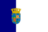
Flag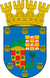
Coat of armsMap of Conchalí commune within Greater Santiago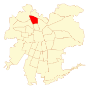 Location in Chile
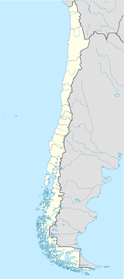
 Conchalí
Coordinates (city): 33°23′00″S 70°40′30″W / 33.3833333°S 70.675°WCoordinates: 33°23′00″S 70°40′30″W / 33.3833333°S 70.675°W Country Chile Region Santiago Metro. Province Santiago Founded 30 December 1927 Government[1] [2] – Type Municipality – Alcalde Rubén Malvoa Hernández (RN) Area[3] – Total 70.7 km2 (27.3 sq mi) Population (2002 Census)[3] – Total 133,256 – Density 1,884.8/km2 (4,881.6/sq mi) – Urban 133,256 – Rural 0 Demonym Conchalino Sex[3] – Men 64,973 – Women 68,283 Time zone CLT [4] (UTC-4) – Summer (DST) CLST [5] (UTC-3) Area code(s) 56 + Website Municipality of Conchali Conchalí is a commune of Chile located in Santiago Province, Santiago Metropolitan Region. It is a northwestern suburb of Santiago.
Contents
Demographics
According to the 2002 census of the National Statistics Institute, Conchalí spans an area of 70.7 km2 (27 sq mi) and has 133,256 inhabitants (64,973 men and 68,283 women), making the commune an entirely urban area. The population fell by 12.9% (19663 persons) between the 1992 and 2002 censuses.[3] Its 2006 population was projected at 120,151 persons.[6][dead link]
Stats
- Average annual household income: US$17,396 (PPP, 2006)[6][dead link]
- Population below poverty line: 8.0% (2006)[7][dead link]
- Regional quality of life index: 78.61, mid-high, 16 out of 52 (2005)[citation needed]
- Human Development Index: 0.707, 118 out of 341 (2003)[8]
Administration
As a commune, Conchalí is a third-level administrative division of Chile administered by a municipal council, headed by an alcalde who is directly elected every four years. The 2008-2012 alcalde is Rubén Malvoa Hernández (RN).[1][2]
Within the electoral divisions of Chile, Conchalí is represented in the Chamber of Deputies by Karla Rubilar (RN) and María Antonieta Saa (PPD) as part of the 17th electoral district, (together with Renca and Huechuraba). The commune is represented in the Senate by Guido Girardi Lavín (PPD) and Jovino Novoa Vásquez (UDI) as part of the 7th senatorial constituency (Santiago-West).
References
- ^ a b (Spanish) "Asociación Chilena de Municipalidades". http://www.conchali.cl. Retrieved 27 January 2011.
- ^ a b (Spanish) "Municipality of Conchalí". http://www.conchali.cl. Retrieved 27 January 2011.
- ^ a b c d (Spanish) "National Statistics Institute". http://www.ine.cl/canales/chile_estadistico/censos_poblacion_vivienda/censo_pobl_vivi.php. Retrieved 13 December 2010.
- ^ "Chile Time". WorldTimeZones.org. http://www.world-time-zones.org/zones/chile-time.htm. Retrieved 13 September 2010.
- ^ "Chile Summer Time". WorldTimeZones.org. http://www.world-time-zones.org/zones/chile-summer-time.htm. Retrieved 13 September 2010.
- ^ a b "System of Regional Information". Ministry of Planning of Chile. http://sir.mideplan.cl/. Retrieved 13 September 2010.
- ^ Poverty in the Santiago Metropolitan Region, Ministry of Planning of Chile.
- ^ (Spanish) "The Trajectories of Human Development in the Communes of Chile (1994-2003)" (PDF). Government of Chile, Mideplán. UNDP,. http://www.desarrollohumano.cl/otraspub/pub12/IDHC%20con%20portada.pdf. Retrieved 13 September 2010.
External links
- (Spanish) Municipality of Conchalí
< Communes and municipalities in Santiago Metropolitan Region > Santiago Province Santiago · Cerrillos · Cerro Navia · Conchalí · El Bosque · Estación Central · Huechuraba · Independencia · La Cisterna · La Florida · San Ramón · La Granja · La Pintana · La Reina · Las Condes · Lo Barnechea · Lo Espejo · Lo Prado · Macul · Maipú · Ñuñoa · Pedro Aguirre Cerda · Peñalolén · Providencia · Pudahuel · Quilicura · Quinta Normal · Recoleta · Renca · San Joaquín · San Miguel · Vitacura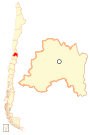
Chacabuco Province Cordillera Province Maipo Province Melipilla Province Talagante Province Categories:- Populated places in Santiago Province
- Communes of Chile
- Santiago, Chile
- Populated places established in 1927


Wikimedia Foundation. 2010.