McKinley Heights, St. Louis
- McKinley Heights, St. Louis
-
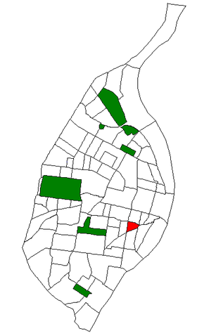
The McKinley Heights Neighborhood is an historic conservation district located in the near South Side of the City of St. Louis. The neighborhood is bounded by I-44 to the north, Jefferson Avenue to the west, and I-55 and Gravois Boulevard to the east and south. There are restaurants and entertainment in the adjacent Soulard and Lafayette Square neighborhoods. Three bus routes provide a commute downtown or throughout the City. There are three churches, the top Junior High School in the St. Louis region[citation needed], and several neighborhood businesses.
References
- ^ Census Summary By Neighborhoods
Coordinates: 38°36′35″N 90°13′06″W / 38.6098°N 90.2183°W / 38.6098; -90.2183
Categories: - Neighborhoods in St. Louis, Missouri
- Saint Louis City, Missouri geography stubs
Wikimedia Foundation.
2010.
Look at other dictionaries:
Clifton Heights, St. Louis — Clifton Heights Neighborhoods of St. Louis, Missouri Clifton Heights Lake. Government Country United States State Missouri … Wikipedia
Compton Heights, St. Louis — Compton Heights Neighborhoods of St. Louis, Missouri The Compton Water Tower, located on the northwest corner of Compton Heights, is a local landmark since it can be seen from miles away. Although it is commonly referred to as a water tower, it… … Wikipedia
Botanical Heights, St. Louis — Botanical Heights Neighborhoods of St. Louis, Missouri Government Country United States State Missouri City St. Louis Wards 17 Statistics Total area … Wikipedia
Neighborhoods of St. Louis, Missouri — Stately French houses in Lafayette Square Grand … Wikipedia
St. Louis, Missouri — St. Louis redirects here. For saints named Louis and other uses, see Saint Louis. City of St. Louis Independent City From top left: Forest Park Jewel Box … Wikipedia
Downtown St. Louis — Downtown Neighborhoods of St. Louis, Missouri The Gateway Arch from Laclede s Landing. Government Country United States State … Wikipedia
Old North St. Louis — Neighborhoods of St. Louis, Missouri Terraced Houses in Old North St. Louis. Government Country United States State Missouri … Wikipedia
Midtown St. Louis — Midtown Neighborhoods of St. Louis, Missouri Government Country United States State Missouri City St. Louis Wards 6, 17, 19 Statistics Total area … Wikipedia
College Hill, St. Louis — College Hill Neighborhoods of St. Louis, Missouri The new Bissell Water Tower (left) and the old Grand Avenue Wat … Wikipedia
Tiffany, St. Louis — Tiffany Neighborhoods of St. Louis, Missouri Skyline of the Tiffany Neighborhood, from South Grand Blvd. Government Country United States State … Wikipedia

