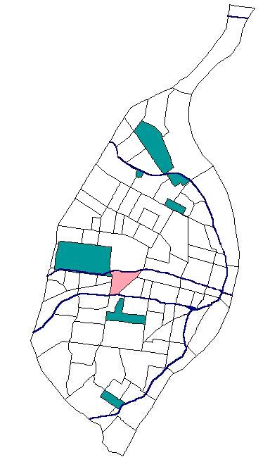
Forest Park Southeast, St. Louis
- Forest Park Southeast, St. Louis
Infobox Settlement
official_name = Forest Park Southeast
nickname =
motto =
image_

map_caption = Location in St. Louis, Missouri
subdivision_type = Neighborhood
subdivision_name = Forest Park Southeast
established_title =
established_date =
government_type =
leader_title =
leader_name =
unit_pref = imperial
area_magnitude =
area_total_sq_mi = 0.64
area_total_km2 =
area_land_sq_mi =
area_land_km2 =
area_water_sq_mi =
area_water_km2 =
population_as_of = 2000
population_footnotes = [cite web|url=http://stlouis.missouri.org/census/|title=St. Louis Census 2000|publisher=U.S. Census Bureau|accessdate=2008-05-30] ]
population_total = 3704
population_density_sq_mi = 5752.4
population_density_km2 =
website = http://stlouis.missouri.org/forestparksoutheast/
footnotes =
Forest Park Southeast is a neighborhood of St. Louis, Missouri.
References
* National Register of Historic Places - Nomination Forms
** cite web|url=http://www.dnr.mo.gov/shpo/nps-nr/01001360.pdf|title=Forest Park Southeast Historic District|publisher=Missouri Department of Natural Resources|accessdate=2008-05-31
** cite web|url=http://www.dnr.mo.gov/shpo/docs/ForestParkSEincrease.pdf|title=Forest Park Southeast Historic District - Boundary Increase #1 (map)|publisher=Missouri Department of Natural Resources|accessdate=2008-05-31
** cite web|url=http://www.dnr.mo.gov/shpo/docs/FPSE_B-Increase2.pdf|title=Forest Park Southeast Historic District - Boundary Increase #2 (map)|publisher=Missouri Department of Natural Resources|accessdate=2008-05-31
External links
* [http://stlouis.missouri.org/forestparksoutheast/ Forest Park Southeast] neighborhood website
Wikimedia Foundation.
2010.
Look at other dictionaries:
Forest Park (St. Louis) — Infobox park park=Forest Park image size=250px caption=The Jewel box in Forest park type=Municipal (St. Louis Parks Department) location=St. Louis size=1,293 acres (5.2 km²) opened=1876 operator=St. Louis Parks Department annual visitors=12… … Wikipedia
List of Registered Historic Places in St. Louis, Missouri — NOTOC List of Registered Historic Places in St. Louis and St. Louis County, Missouri.:: Missouri NRHP date for lists =St. Louis County= *Affton ** Joseph Sappington House ** Louis Auguste Benoist House ** New Mount Sinai Cemetery *Bellefontaine… … Wikipedia
Streets of St. Louis, Missouri — The streets of St. Louis, Missouri, USA, and the surrounding area of Greater St. Louis are under the jurisdiction of the City of St. Louis Street Department [1]. According to the Streets Division, there are 1,000 mile (1,600 km) of streets… … Wikipedia
National Register of Historic Places listings in St. Louis (city, A–L), Missouri — This is a list of properties and historic districts in the independent city of St. Louis that are listed on the National Register of Historic Places. Listings from A to L appear here, M Z are in National Register of Historic Places listings in St … Wikipedia
Neighborhoods of St. Louis, Missouri — Stately French houses in Lafayette Square Grand … Wikipedia
St. Louis, Missouri — St. Louis redirects here. For saints named Louis and other uses, see Saint Louis. City of St. Louis Independent City From top left: Forest Park Jewel Box … Wikipedia
Clayton/Tamm, St. Louis — Clayton/Tamm ( Dogtown ) Neighborhoods of St. Louis, Missouri Clayton Tamm is home to the popular Ancient Order of Hibernians Parade in Dogtown. Government Country … Wikipedia
Saint-Louis (Missouri) — Pour les articles homonymes, voir Saint Louis. 38° 38′ 53″ N 90° 12′ 44″ W … Wikipédia en Français
Geography of St. Louis, Missouri — St. Louis is located at coor dms|38|38|53|N|90|12|44|W|region:GR (38.648056, 90.212222).GR|1The city is built primarily on bluffs and terraces that rise 100 200 feet above the western banks of the Mississippi River, just south of the Missouri… … Wikipedia
Cheltenham, St. Louis — Cheltenham Neighborhoods of St. Louis, Missouri Government Country United States State Missouri City St. Louis Wards 17, 24 Statistics Total area … Wikipedia

